- North Uist
-
North Uist Location 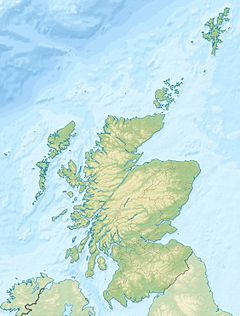
 North Uist
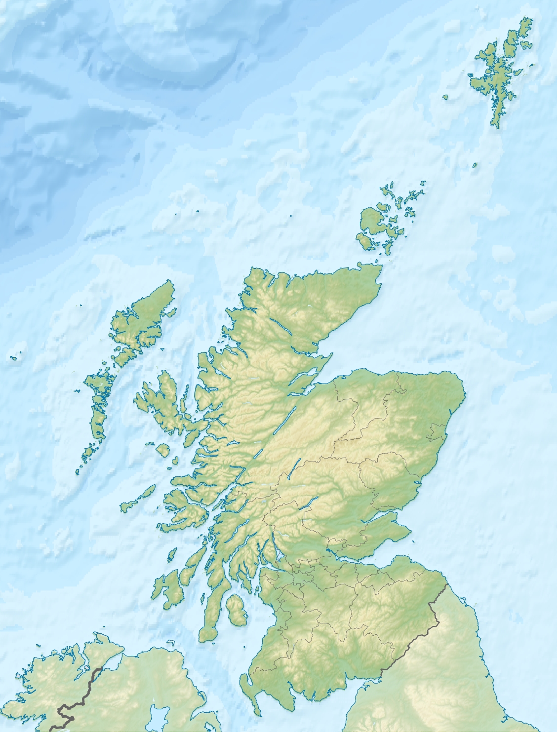
North Uist shown within Scotland OS grid reference NF835697 Names Gaelic name  Uibhist a Tuath (help·info)
Meaning of name From "inni-vist", Old Norse for "dwelling" Area and summit Area 30,305 hectares (117 sq mi) Area rank 10 Highest elevation Eaval 1,138 ft (347 m) Population Population 1,271 Population rank 11 out of 97 Main settlement Lochmaddy Groupings Island group Uists and Barra Local Authority Na h-Eileanan Siar 

References [1][2][3][4][5] If shown, area and population ranks are for all Scottish islands and all inhabited Scottish islands respectively. Population data is from 2001 census. North Uist (Scottish Gaelic: Uibhist a Tuath pronounced [ˈɯ.ɪʃtʲ ə t̪ʰuə]) is an island and community in the Outer Hebrides of Scotland.
Contents
Geography
North Uist is the tenth largest Scottish island[6] and the thirteenth largest island surrounding Great Britain.[7] It has an area of 117 square miles (303 km2),[2] slightly smaller than South Uist. North Uist is connected by causeways to Benbecula via Grimsay, to Berneray, and to Baleshare. With the exception of the south east, the island is very flat, and covered with a patchwork of peat bogs, low hills and lochans, with more than half the land being covered by water. Some of the lochs contain a mixture of fresh and tidal salt water, giving rise to some complex and unusual habitats. Loch Sgadabhagh, about which it has been said "there is probably no other loch in Britain which approaches Loch Scadavay in irregularity and complexity of outline", is the largest loch by area on North Uist although Loch Obisary has about twice the volume of water.[8] The northern part of the island is part of the South Lewis, Harris and North Uist National Scenic Area, one of 40 in Scotland.[9]
Settlements
 Causeway from Benbecula (foreground) to North Uist
The main settlement on the island is Lochmaddy, a fishing port and home to a museum, an arts centre and a camera obscura. Caledonian MacBrayne ferries sail from the village to Uig on Skye, as well as from the island of Berneray (which is connected to North Uist by road causeway), to Leverburgh in Harris. Lochmaddy also has Taigh Chearsabhagh - a museum and arts centre with a cafe, small shop and post office service. Nearby is the Uist Outdoor Centre.
The island's main villages are Sollas, Hosta, Tigharry, Hougharry, Paible, Grimsay and Cladach Kirkibost. Other settlements include Clachan Carinish, Knockquien, Port nan Long, Greinetobht and Scolpaig, home to the nineteenth century Scolpaig Tower folly.
According to the 2001 census North Uist had a population of 1,271 (1,320 including Baleshare).[10]
Places of interest
North Uist has many prehistoric structures, including the Barpa Langass chambered cairn, the Pobull Fhinn stone circle, the Fir Bhreige standing stones, the islet of Eilean Dòmhnuill (which may be the earliest crannog site in Scotland),[11] and the Baile Sear roundhouses, which were exposed by storms in January, 2005.[12]
The island is known for its birdlife, including corncrakes, arctic terns, gannets, corn buntings and Manx shearwaters. The RSPB has a nature reserve at Balranald.[13]
Despite limited facilities, the island's athletics club (North Uist Amateur Athletics Club) has performed well at local, regional and national athletics competitions.[citation needed]
Etymology
In Donald Munro's A Description of the Western Isles of Scotland Called Hybrides of 1549, North Uist, Benbecula and South Uist are described as one island of Ywst (Uist). Starting in the south of this 'island', he described the division between South Uist and Benbecula where "the end heirof the sea enters, and cuts the countrey be ebbing and flowing through it".[14] Further north of Benbecula he described North Uist as "this countrey is called Kenehnache of Ywst, that is in Englishe, the north head of Ywst".[14]
Some have given the etymology of Uist from Old Norse meaning "west",[2] much like Westray in the Orkney Islands.[15] Another speculated derivation from Old Norse is Ivist,[4] derived from vist meaning "an abode, dwelling, domicile".[16] "Ívist" was the name used for Uist in the Old Norse sagas.[citation needed] A Gaelic etymology is also possible, with I-fheirste meaning "Crossings-island" or "Fords-island", derived from I meaning "island" and fearsad meaning "estuary, sand-bank, passage across at ebb-tide".[15][17] Place-names derived from fearsad include Fersit, and Belfast.[17]
In a paper of 1988, Richard Coates compares the placename Uist with the Balearic island name Ibiza.[18]
Population
In the eighteenth century the total population of the combined Uists rose dramatically, before the population crash of the Highland Clearances. In 1755, there was an estimated combined population on the Uists, of 4,118; by 1794 it rose to 6,668; and in 1821 to 11,009.[2]
North Uist
The pre-clearance population of North Uist was about 5,000 and it has dwindled to about 1,300 people in 2001.pre 1820s[19] 1841 1881 1891 1931 1961 1971 1981 1991 2001[10] abt 5,000 3,870 3,398 3,250 2,349 1,622 1,469 1,454 1,404 1,271 From Haswell-Smith (2004)[2] except as stated.
History
After the Norse occupation of the Western Isles the MacRuairidhs controlled the island.[2] North Uist was granted to Macdonald of Sleat in 1495,[20] and remained in possession of the Macdonalds of Sleat until 1855, when it was sold to Sir John Powlett Ord.[19] Today the island is owned by the Granville family through the North Uist Trust.[19]
The force-fire was last made in North Uist in about 1829.[citation needed]
North Uist and the Clearances
See also: Highland ClearancesNorth Uist was hit hard during the Highland Clearances, and there was large scale emigration from the island to Cape Breton, Nova Scotia, Canada.[21] The pre-clearance population of North Uist had been almost 5,000,[19] though by 1841 it had fallen to 3,870,[20] and has further dwindled to about 1,300 people today. The clearances occurred later on North Uist, which was predominately Presbyterian, than on South Uist which was mostly Roman Catholic.[21]
The main reason for the massive scale of emigration was the failure of the island's kelp industry. Since the French Revolutionary Wars the kelp industry had been North Uist's main source of income.[21] Though with the collapse of their main source of income the crofters of North Uist could not afford the high rents.[21] Even as the landlords reduced the rents, such as in 1827 when the rents were reduced by 20%, many crofters were forced to emigrate.[21]
The first real clearances on North Uist occurred in the 1820s.[21] In 1826 the villages of Kyles Berneray, Baile Mhic Phail and Baile mhic Conon, located on the north-east corner of North Uist, were cleared of their inhabitants. Although some moved further east to Loch Portain, most of those affected moved to Cape Breton, Nova Scotia.[21] The effect of this is shown in the rental roll of 1827, which states that over fifty families had "Gone to America", meaning Cape Breton.[21] As the economic conditions worsened and with reports of islanders succeeding overseas, the numbers of families emigrating from Scotland to North America greatly increased.[21] In 1838 1,300 people from North Uist were recorded as being cleared. It is misconception that most families involved in the clearances were "cleared" from their holdings, though in 1849 there was rioting as 603 inhabitants from Sollas were forcefully cleared by Lord (the 4th Baron) Macdonald.[22] In the incident the women of Sollas took large part in the rioting.[23] As a detachment of Glasgow police officers advanced on the protesters, the Sollas men were said to have stood aside, but the women of Sollas stood up to the authorities, and pelted the police with rocks. The police then descended upon the Sollas folk and attacked them with their truncheons.[24] In fact a Hebredian settlement in Cape Breton County, Nova Scotia was originally called Sollas (now Woodbine).[25][26] North Uist surnames affected during the clearances were the MacAulays, MacCodrums, MacCuishs, and MacDonalds.[21]
Famous residents
- The Scottish Gaelic poet Dòmhnall Ruadh Chorùna (1887–1967) was born on North Uist and lived his life there. Due to his vivid descriptions of his experiences in the First World War, he is often referred to as "The Voice of the Trenches."
- Erskine Beveridge, LL.D., FRSE (1851–1920), a textile manufacturer and antiquary and sometime resident of Vallay, completed important archaeological excavations in the Hebrides.
- Julie Fowlis (born 1979), a singer and instrumentalist who sings primarily in Scottish Gaelic, was born and raised on North Uist.
- Alasdair Morrison (born 1968), former Member of the Scottish Parliament for the Western Isles, lived on North Uist and was educated at Paible School.
- Flight Lieutenant John Morrison, 2nd Viscount Dunrossil, CMG, JP (1926–2000), diplomat and Governor of Bermuda, lived at Clachan Sands.
- Pauline Prior-Pitt, a British poet, lives on North Uist.
- Brothers Rory and Calum MacDonald, members of the Gaelic rock band Runrig
- Angus MacAskill, largest "true giant" and strongest man who ever lived from Berneray, off North Uist
Gallery
-

Landsat image of North Uist
Bibliography
- Johnson, Alison(1989) Islands in the Sound: Wildlife in the Hebrides: London; Victor Gollancz ISBN 0575046406
- Monro, Sir Donald (1549) A Description Of The Western Isles of Scotland. Appin Regiment/Appin Historical Society. Retrieved 3 March 2007. First published in 1774.
- Murray, Sir John and Pullar, Laurence (1908) Bathymetrical Survey of the Fresh-Water Lochs of Scotland, 1897-1909. London; Royal Geographical Society.
Footnotes
- ^ 2001 UK Census per List of islands of Scotland
- ^ a b c d e f Haswell-Smith, Hamish (2004). The Scottish Islands. Edinburgh: Canongate. ISBN 1841954543.
- ^ Ordnance Survey. Get-a-map (Map). http://www.ordnancesurvey.co.uk/oswebsite/getamap/.
- ^ a b edited by Munch & Goss (1874). "The Chronicles of Mann vol 22.". Isle of Man: Manx Society. http://www.isle-of-man.com/manxnotebook/manxsoc/msvol22/author.htm. Retrieved 31 October 2007.
- ^ Geir T. Zoëga (1910). "A Concise Dictionary of Old Icelandic". Germanic Lexicon Project. http://lexicon.ff.cuni.cz/png/oi_zoega/b0229.png. Retrieved 4 July 2007.
- ^ List of islands of Scotland
- ^ List of European islands by area
- ^ Murray and Pullar (1908) "Lochs of North Uist" Pages 188-89, Volume II, Part II. National Library of Scotland. Retrieved 20 December 2009.
- ^ "National Scenic Areas". SNH. Retrieved 30 Mar 2011.
- ^ a b "Number of residents and households in all inhabited islands" (PDF). General Register Office for Scotland. http://www.gro-scotland.gov.uk/files1/stats/occasional-paper-10-table1.pdf. Retrieved 17 October 2007.
- ^ Armit, Ian (1998). Scotland's Hidden History. Stroud, Gloucestershire: Tempus. ISBN 0752414003.
- ^ Ross, John (11 July 2007). "Race to study Iron Age roundhouses before they are lost to sea storms". The Scotsman. http://news.scotsman.com/scotland.cfm?id=1079032007. Retrieved 4 December 2007.
- ^ "Wildlife and habitats of Uist". Scottish Natural Heritage. http://www.snh.org.uk/scottish/wisles/wisles.asp. Retrieved 6 January 2008.
- ^ a b "A Description of the Western Isles of Scotland Called Hybrides". Undiscovered Scotland. http://www.undiscoveredscotland.co.uk/usebooks/monro-westernislands/index.html. Retrieved 31 October 2007.
- ^ a b Thomas, F. W. L.. "Did the Northmen extirpate the Celtic Inhabitants of the Hebrides in the Ninth Century?". Proc. Soc. of Antiq. Scot 11: 475–476.
- ^ Cleasby, Richard and Vigfusson, Gudbrand (1874). "An Icelandic-English dictionary". Germanic Lexicon Project. p. 711. http://lexicon.ff.cuni.cz/png/oi_cleasbyvigfusson/b0711.png. Retrieved 6 January 2008.
- ^ a b fearsaideag "An Etymological Dictionary of the Gaelic Language". http://www.ceantar.org/Dicts/MB2/mb17.html#fearsaideag fearsaideag. Retrieved 31 October 2007.
- ^ Coates, Richard (1988) Toponymic Topics. Essays on the early toponymy of the British Isles Brighton Younsmere Press
- ^ a b c d Hebridean Princess Scotland Retrieved on 17 October 2007
- ^ a b North Uist (Uibhist a Tuath) Retrieved on 14 October 2007
- ^ a b c d e f g h i j Lawson, Bill. "From The Outer Hebrides to Cape Breton - Part II". The Global Gazette. 10 September 1999. Retrieved on 14 October 2007
- ^ History of Scotland The Highland Clearances Retrieved on 16 October 2007
- ^ Island Fling, September, 2002. Vancouver Island Scottish Country Dance Society. Retrieved on 17 October 2007
- ^ MacQuarrie, Brian. "In search of Scottish roots". Boston Globe Retrieved on 17 October 2007
- ^ Turas Rannsachaidh dha 'n Albainn: Research Trip to Gaelic Scotland Retrieved on 16 October 2007
- ^ Places in Cape Breton County, Nova Scotia Retrieved on 16 October 2007
External links
- North Uist local community website
- Balranald Nature Reserve
- Taigh Chearsabhagh
- Explore North Uist
- Am Paipear Community Newspaper
 Chisholm, Hugh, ed (1911). "Uist, North and South". Encyclopædia Britannica (11th ed.). Cambridge University Press.
Inhabited islands of the Hebrides Inner Hebrides 
Outer Hebrides Baleshare · Barra · Benbecula · Berneray · Eriskay · Flodaigh · Fraoch-eilean · Great Bernera · Grimsay (North) · Grimsay (South) · Lewis and Harris · North Uist · Scalpay · South Uist · VatersayNational Scenic Areas in Scotland The Borders Firth of Clyde and Mainland Argyll Stirling Perth and Kinross Grampians Highland Assynt-Coigach • Ben Nevis and Glen Coe • Dornoch Firth • Glen Affric • Glen Strathfarrar • Kintail • Knoydart • Kyle of Tongue • Loch Shiel • Morar, Moidart and Ardnamurchan • North-West Sutherland • Wester RossHebrides The Cuillin Hills • Jura • Lynn of Lorn • Loch na Keal, Isle of Mull • Scarba, Lunga and The Garvellachs • Small Isles • St Kilda • South Lewis, Harris and North Uist • South Uist Machair • TrotternishNorthern Isles Islands of Scotland Northern Isles 
Hebrides Other Categories:- Uist islands
- Islands of the Outer Hebrides


Wikimedia Foundation. 2010.