- Mitchell Freeway
-
Mitchell Freeway 
Freeway heading north through Gwelup and Balcatta Length 30 km (19 mi) Direction North-South From  Burns Beach Road, Currambine, Western Australia
via Joondalup, Kingsley, Duncraig, Warwick, Gwelup, Osborne Park, Leederville, West Perth To  Kwinana Freeway, Perth, Western Australia
Established 1970s Allocation part of State Route 2 Major junctions  Reid Highway
 Graham Farmer Freeway
for full list see Exits & Interchanges
Mitchell Freeway is a 30-kilometre (19 mi) long freeway in Perth, Western Australia, linking Perth's central business district with its outer northern suburbs. It is allocated Route 2 for its entire length and is named after former state Premier and Governor Sir James Mitchell.
Construction of the freeway commenced in stages from the late 1960s onwards, and as of 2009, the freeway terminates at Burns Beach Road, Currambine. The freeway is mostly 6 or 8 lanes south of Hepburn Avenue; from that point north it is mostly 4 lanes; extending to 6 between Hodges Drive and Shenton Avenue. It also forms the borders of most of the suburbs through which it passes.
The speed limit is generally 100 kilometres per hour (62 mph), except in central Perth where the speed limit is 80 kilometres per hour (50 mph). Southbound, the reduced speed section begins near the Graham Farmer Freeway; northbound it ends near the Vincent Street exit.
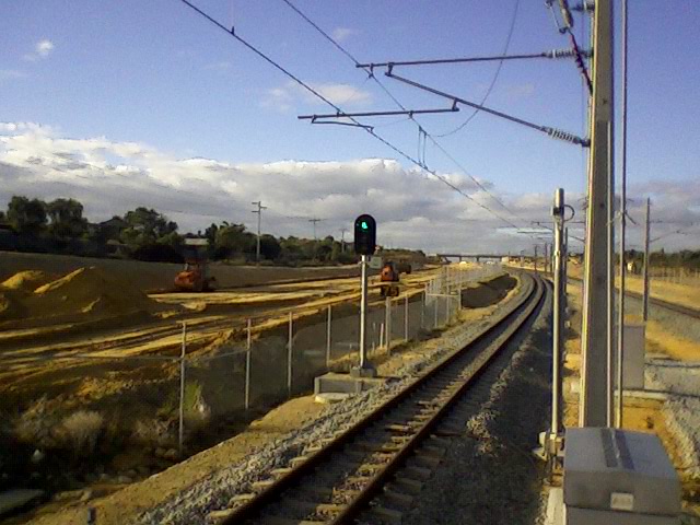
The median strip of the freeway houses the Joondalup railway line, and all but two of the suburban train stations are also located in the median. Additionally, a shared pedestrian and bike path is built alongside much of the freeway.
Contents
History
The Mitchell Freeway began as part of the Metropolitan Region Scheme in the mid-1950s. Its original proposed name was the Yanchep Highway, as this is where the freeway was (and still is) planned to end. The original planned route, as advertised in newspapers in 1961 and 1962, took the freeway inland from what is now Karrinyup Road to the intersection of Wanneroo and Balcatta Roads. The section between the Narrows Bridge and Sutherland Street, commenced in 1967 and completed in 1973, was referred to as "the western switch", and functioned only as a distributor for Narrows Bridge traffic accessing the CBD or areas further north.
Several stages were built through the late 1970s, 1980s and early 1990s. In the 1970s, the freeway was extended firstly to Vincent Street - slicing the suburb of Leederville in two - and then to Hutton Street. In 1983-84, it was extended first to Karrinyup Road, and then to Erindale Road. In 1986, the freeway was extended to Hepburn Avenue. The first stage of the Reid Highway (then known as the North Perimeter Highway) was built at the same time. In 1988, the freeway was extended further to Ocean Reef Road.
In 1991-1992, the median strip of the entire freeway was significantly widened to accommodate the Joondalup railway line, being built under the Northern Suburbs Transit System project. The line was to be located in the middle of the road reserve between the north and south-bound carriages. At the time, the section of freeway between Loftus Street and McDonald Streets were butted right next to each other, with space for further widening efforts of the section located on the eastern side of the road reserve[1]. To enable this, three new rail and road bridges were constructed at Vincent, Powis, and Scarborough Beach Roads[2]. Once the road bridges had been completed and surfacing works completed, the southbound carriage was relocated creating the required space for the railway line to continue construction. While the relevant road bridges and some associated works were included as part of the costs for the Northern Suburbs Transit System project, the addition of new lanes in the realigned section was funded from regular road funding sources[1].
After a 13-year-hiatus, a 3 km extension to Hodges Drive, was opened to traffic in mid-2001.
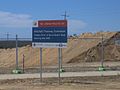
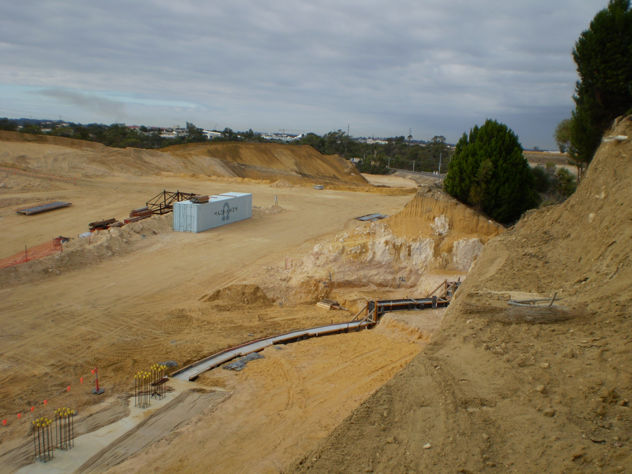
The latest extension, a 4 km stretch to Burns Beach Road with exits at Shenton Avenue and an overpass for Moore Drive, was opened on 2 November 2008 by Western Australia's Minister for Transport, Simon O'Brien, and the previous Minister for Planning and Infrastructure Alannah McTiernan. This was not without some opposition, as the original design of the extension involved building a wall several metres high, and opponents claimed the wall would be an eyesore and would physically divide the area. Plans were redrawn and construction of the extension was planned for May 2006 and began on 14 December 2006, managed by Main Roads in conjunction with Macmahon Contractors. By July 2008, 90% of the works had been completed and the new section was predicted to open in September 2008.[3] The opening featured more than 50 vintage cars dating from the 1920s through to the 1960s and was keenly watched by hundreds of local residents.
For most of its history, the freeway had two lanes in each direction, but various sections have been expanded to three and four lanes over the years due to increasing traffic. This happened most recently in 1999 when the section between Karrinyup Road and Hepburn Avenue became three lanes in each direction. Future lane additions are inevitable due to the large volume of traffic travelling between the city centre and the northern suburbs.
Exits and interchanges
The Mitchell Freeway commences at the end of the Narrows Bridge, Perth, continuing from the Kwinana Freeway, and terminates just north of the city of Joondalup at Burns Beach Road, Currambine. It is signed as
 for its entire length.
Perth City entrances/exits
Please update City Exits image

 Riverside Drive (no northbound exit), Perth
- Mounts Bay Road, Perth
- Hay Street (northbound exit only), West Perth
- Elder Street (southbound entry only), Perth
 Wellington Street (northbound entry/southbound exit only), West Perth
- Market Street (northbound exit/southbound entry only), West Perth
 Charles Street and Newcastle Street (northbound exit/southbound entry only), Northbridge
 Graham Farmer Freeway, Northbridge
- Sutherland Street (northbound entry only), West Perth
- James Street (southbound exit only), Northbridge
Inner & Outer Perth
Mitchell Freeway 
Northbound exits Distance to
Currambine
(km)Distance to
Perth CBD
(km)Southbound exits 
 Traffic Lights (clockwise from freeway)
Burns Beach Road to Burns Beach (3 km) and Clarkson via
  Marmion Avenue (10 km)
Burns Beach Road to Carramar (4 km)End Mitchell Freeway 0 29.0 Start Mitchell Freeway Currambine, Joondalup
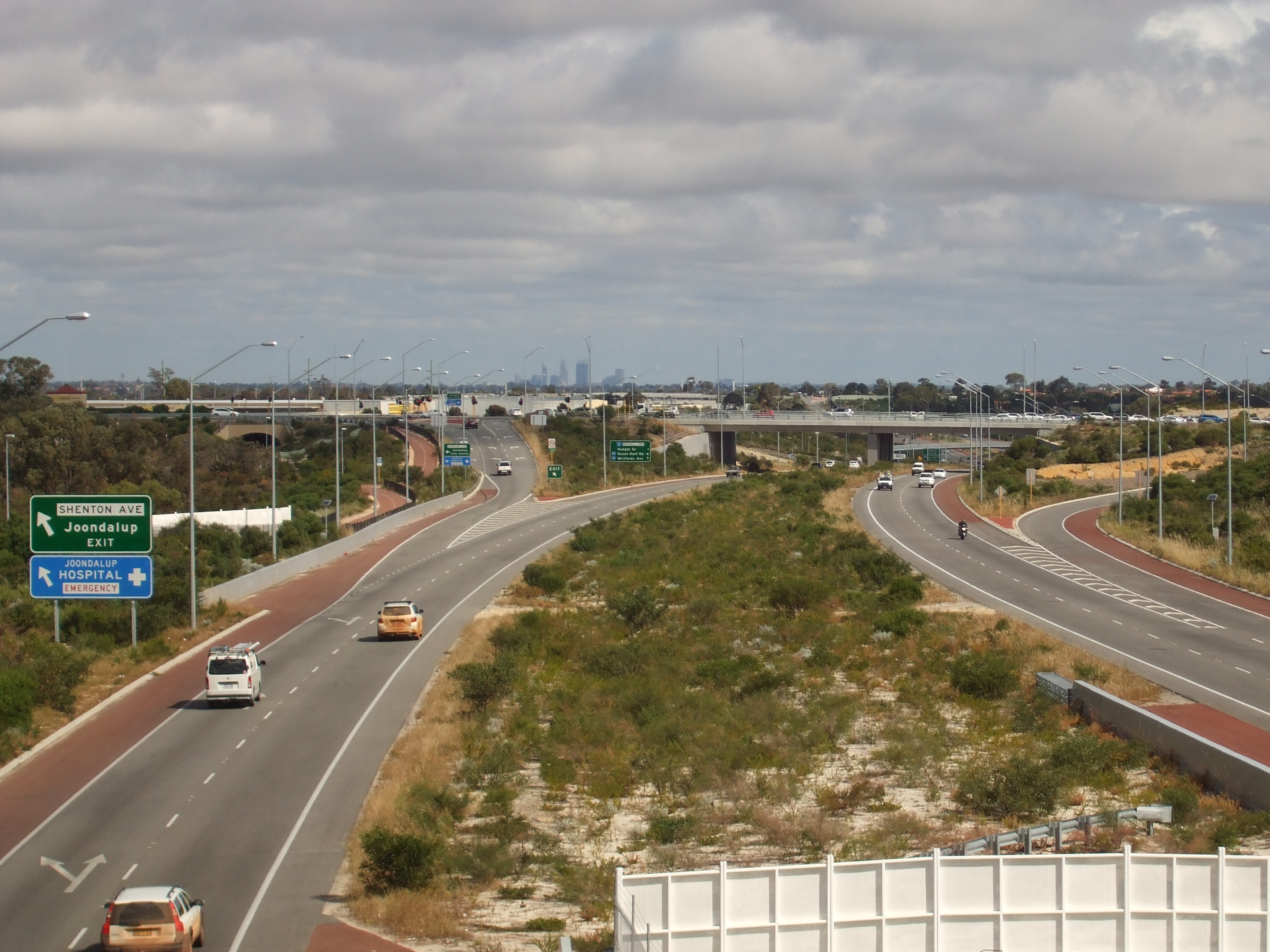
Shenton Avenue1.9 27.0 RAIL LINE Joondalup, Currambine
Shenton AvenueOcean Reef, Joondalup
Hodges Drive3.8 25.1 Heathridge, Ocean Reef
Hodges DriveOcean Reef, Edgewater
Ocean Reef Road
6.5 22.4 Edgewater, Ocean Reef
Ocean Reef RoadPadbury, Kingsley
Whitfords Avenue
9.2 19.7 Kingsley, Padbury
Whitfords AvenueDuncraig, Greenwood
Hepburn Avenue
11.3 17.6 Greenwood, Duncraig
Hepburn AvenueDuncraig, Warwick
Warwick Road
13.8 16.1 Warwick, Duncraig
Warwick RoadNorth Beach, Midland
Reid Highway

15.9 13.0 Midland, North Beach
Reid Highway Balcatta
Balcatta Road
Gwelup, Balcatta
Erindale Road
17.5 11.4 no exit Stirling, Karrinyup
Karrinyup Road
19.0 9.9 Karrinyup, Stirling
Karrinyup RoadStirling, Innaloo
Cedric Street
20.0 8.9 Innaloo, Stirling
Cedric StreetOsborne Park
Hutton Street22.0 6.3 Osborne Park
Hutton StreetCape Street Hector Street West Hector Street McDonald Street West McDonald Street Glendalough, Mount Hawthorn
Powis Street24.5 4.4 no exit Wembley, Leederville
Lake Monger Drive / Vincent Street
26.3 2.6 Leederville, Wembley
Vincent Street / Lake Monger Driveno exit 27.6 1.3 East Perth, Burswood
Graham Farmer Freeway no exit 27.8 1.1 James Street Perth CBD, West Perth
Wellington StreetEast Perth, Burswood
Graham Farmer Freeway 28.1 0.8 no exit North Perth, Yokine
Charles StreetMarket Street 28.3 0.6 no exit Hay Street 28.8 -- no exit Nedlands, Perth CBD
Mounts Bay Road29.3 -- Perth CBD
Riverside DriveNedlands, Fremantle
Mounts Bay RoadSWAN RIVER 30.2 -- SWAN RIVER Start Mitchell Freeway
from Kwinana FreewayEnd Mitchell Freeway
continues as Kwinana Freeway
to MandurahFuture widening
The State Government has committed $30m for the widening of the northbound Mitchell Freeway from Hepburn Avenue to Hodges Drive from 2 lanes to 3 lanes in its 2011/12 budget. Works are set to begin in 2012. [4].
Future extensions
The freeway's design has allowed for a long area of vacant land for future freeway extensions. The Mitchell Freeway is expected to follow north to the currently new developed areas such as Ridgewood, Butler and Jindalee. Future exits are planned at Neerabup Road, Hester Avenue, Lukin Drive, Romeo Road and Pipidinny Road, which all are currently either proposed, incomplete or single carriageway. By as late as 2020, depending on the timing of the Alkimos/Eglinton satellite city, the Yanchep/Two Rocks/St Andrews satellite city and further coastal development, the freeway could be developed as far as Two Rocks.
-

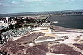
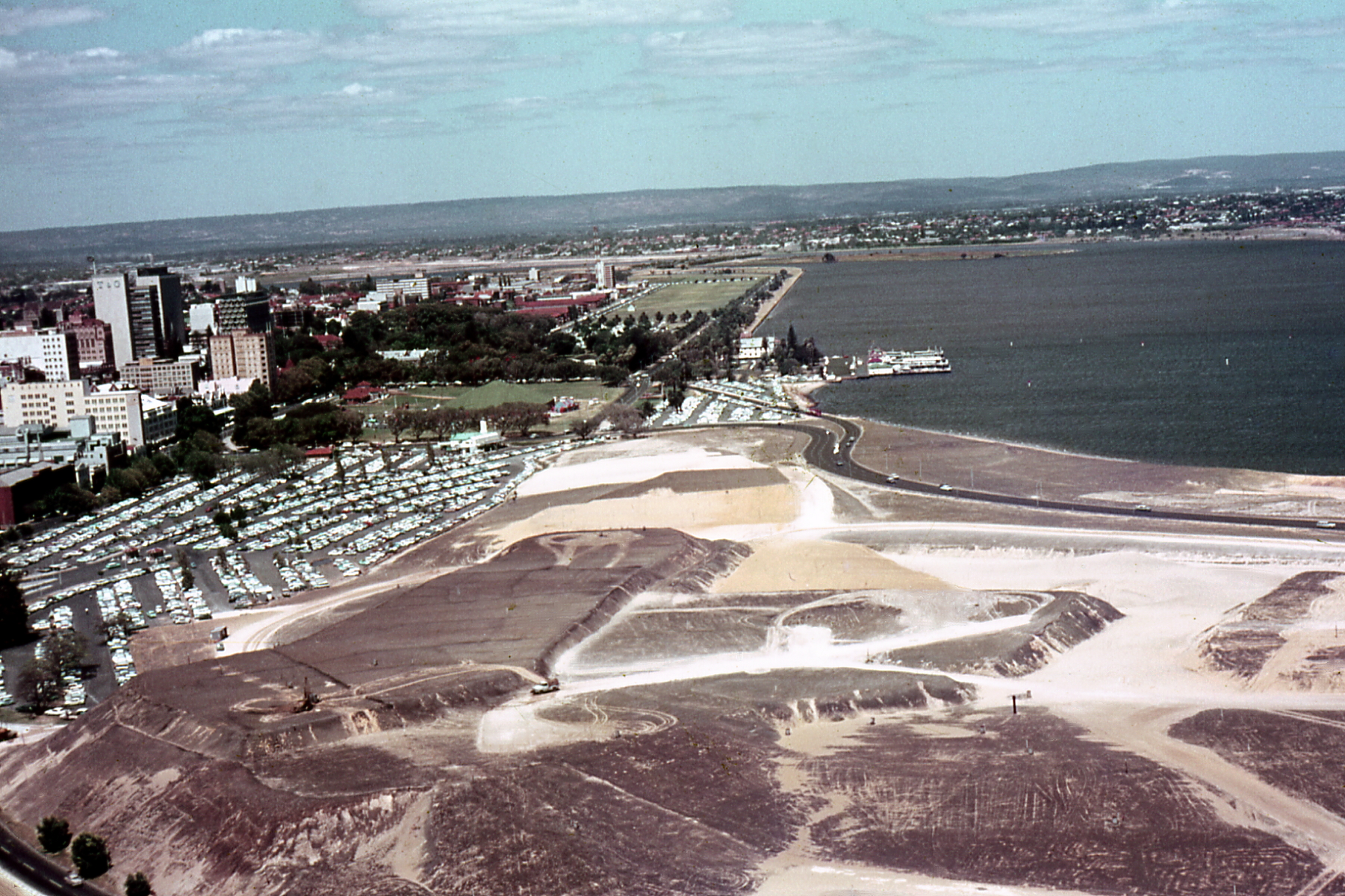
The Swan River reclamation area during the construction of the Mitchell Freeway. c. 1957
-
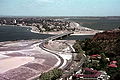
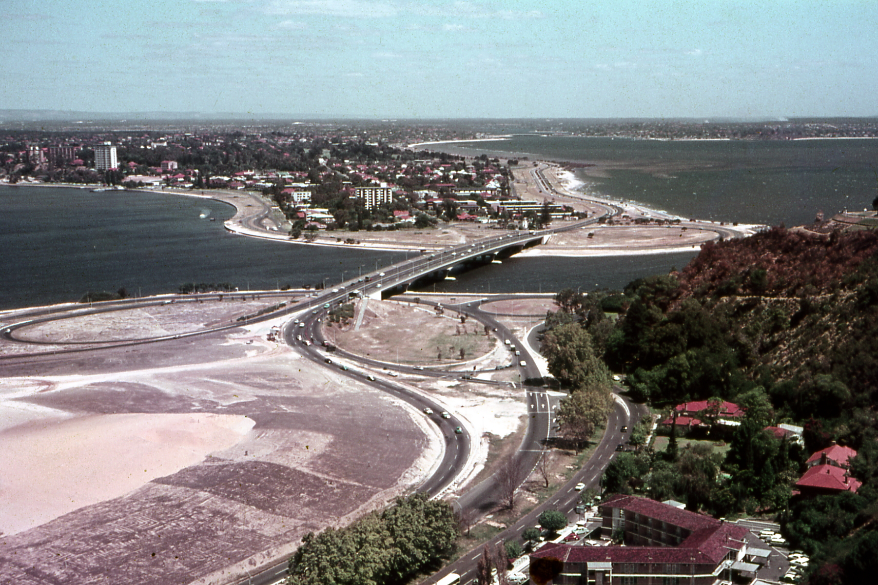
Narrows Interchange under construction . c. 1968
-
Compaction work on the Interchange prior to road construction
-
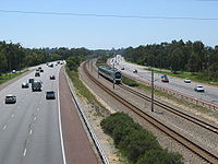
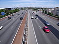
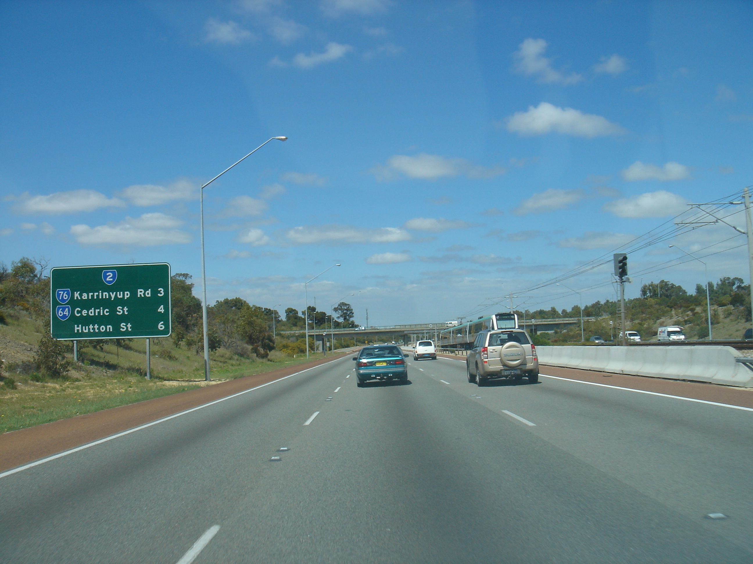
Mitchell Freeway southbound, at Reid Highway
-
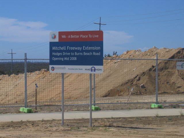
Mitchell Freeway Extension land clearing underway at Moore Drive, Joondalup (Jan 2007)
-
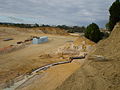
Mitchell Freeway Extension work in progress at Moore Drive, Joondalup (May 2007)
-

Mitchell Freeway Extension work in progress at Currambine Station (April 2008)
-
Mitchell Freeway as seen from Mount Street
-
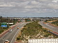
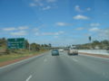
Mitchell Freeway southbound, at Moore Drive
See also
References
- ^ a b Northern Suburbs Transit System; Perth to Joondalup Railway; Progress Summary - June 1991. Perth, Western Australia: The Urban Rail Electrification Committee, Government of Western Australia. 1991. Pg. 1, Accessed at J S Battye Library, Perth
- ^ Northern Suburbs Transit System; Perth to Joondalup Railway; Progress Summary - June 1991. Perth, Western Australia: The Urban Rail Electrification Committee, Government of Western Australia. 1991. Pg. 6, Accessed at J S Battye Library, Perth
- ^ Main Roads WA (June 2008). "Urban Projects - Mitchell Freeway - Current Status". http://www.mainroads.wa.gov.au/Internet/Projects/Urban/mitchell.asp. Retrieved 2008-07-16.
- ^ [1], Mitchell Freeway widening to help reduce northbound congestion.
- Notes
- North Suburban Supplement, The West Australian (1961-1968)
- Government Gazette (1960s-1970s)
- Various directories, 1960s-1980s, Department of Lands and Surveys
- Streetsmart 2006 Directory, Main Roads
- Main Roads Western Australia
- Mitchell Freeway Joondalup
External links
- State Library of Western Australia Pictorial Collection of historical Mitchell Freeway Photographs
 Road infrastructure in Perth
Freeways Graham Farmer Freeway · Kwinana Freeway · Mitchell Freeway
Highways Bridges Transport in Perth Road infrastructure in Western AustraliaFreeways Graham Farmer Freeway • Kwinana Freeway • Mitchell FreewayMetropolitan highways Highways and major roads Albany Highway • Brand Highway • Brockman Highway • Brookton Highway • Bussell Highway • Coalfields Road • Coolgardie-Esperance Highway • Dampier Highway • Derby Highway • Eyre Highway • Forrest Highway • Geraldton-Mount Magnet Road • Goldfields Highway • Great Eastern Highway • Great Northern Highway • Great Southern Highway • Indian Ocean Drive • Mandjoogoordap Drive • Muirs Highway • North West Coastal Highway • Old Coast Road • South Coast Highway • South Western Highway • Vasse Highway • Victoria HighwayOutback Tracks Anne Beadell Highway • Buntine Highway • Canning Stock Route • Cape Leveque Road • Connie Sue Highway • Duncan Road • Gary Highway • Gibb River Road • Great Central Road • Gunbarrel Highway • Kalumburu Road • Tanami Road
Route 2: Currambine to Lake Clifton
via Perth and MandurahMitchell Freeway Dual carriageway - 4 to 10 lanes Kwinana Freeway Dual carriageway - 4 to 10 lanes Forrest Highway Dual carriageway - 4 lanes Coordinates: 31°57′22″S 115°50′57″E / 31.95602°S 115.84907°E
Categories:- 1970s establishments in Australia
- Highways and freeways in Perth, Western Australia


Wikimedia Foundation. 2010.