- Shire of Daylesford and Glenlyon
Infobox Australian Place | type = lga
name = Shire of Daylesford and Glenlyon
state = vic
region =
area = 609.3
est = 1860
seat = Daylesford
pop = 5,980 (1992) [cite book|title=Victorian Year Book|author=Australian Bureau of Statistics, Victoria Office|year=1994|page=49-52|id=ISSN 0067-1223]
logosize =
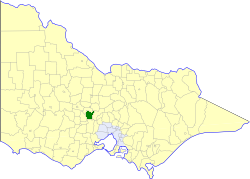
caption = Location in Victoria
county = Talbot
near-nw = Newstead
near-n = Newstead
near-ne = Metcalfe
near-w = Creswick
near-e = Kyneton
near-sw = Bungaree
near-s = Ballan
near-se = Ballan
_noautocat = yesThe Shire of Daylesford and Glenlyon was a Local Government Area located about convert|110|km|mi|0 northwest of
Melbourne , the state capital of Victoria,Australia . The shire covered an area of convert|609.3|km2|sqmi|1, and existed from 1860 until 1994.History
What became the Shire of Daylesford and Glenlyon had its origins in several different local authorities:
* The Borough of Daylesford was incorporated on 23 September 1859 with an area of convert|16.23|km2|sqmi|abbr=on surrounding the town of Daylesford.
* The Shire of Glenlyon was incorporated on 24 February 1860 as a district, becoming a shire on 12 December 1865.
* The Shire of Mount Franklin was incorporated on 11 May 1860 as a district, becoming a shire on 27 January 1871. After the passage of the "Local Government Amendment Act 1914", it was found that Mount Franklin did not meet the criteria of a shire as its rateable income was below £1,500 per annum, so it was amalgamated on 1 October 1915 with Glenlyon.On 3 May 1966, an Order in Council united the Borough of Daylesford with the Shire of Glenlyon to create the new Shire.cite book|title=Victorian Municipal Directory|year=1992|publisher=Arnall & Jackson|location=Brunswick|pages=646-647 Accessed at
State Library of Victoria , La Trobe Reading Room.]On 20 January 1995, the Shire was abolished, and merged with Shires of Creswick and parts of Kyneton and Talbot into the
Shire of Hepburn . [cite book|url=http://www.ausstats.abs.gov.au/ausstats/free.nsf/0/76E601D6DB55E88ACA25722500049195/$File/12570_1994-95.pdf|title=Victorian local government amalgamations 1994-1995: Changes to the Australian Standard Geographical Classification|author=Australian Bureau of Statistics |date=1 August 1995|publisher=Commonwealth of Australia|page=7|isbn=0-642-23117-6|accessdate=2008-01-05]Wards
Daylesford and Glenlyon was divided into four ridings on 31 May 1966, each of which elected three councillors:
* Daylesford Riding
* Glenlyon Riding
* Hepburn Riding
* Mount Franklin RidingTowns and Localities
Population
* Estimate in 1958 Victorian Year Book.
References
Wikimedia Foundation. 2010.