- Chenequa, Wisconsin
-
Chenequa, Wisconsin — Village — Location of Chenequa, Wisconsin
Coordinates: 43°7′24″N 88°22′52″W / 43.12333°N 88.38111°WCoordinates: 43°7′24″N 88°22′52″W / 43.12333°N 88.38111°W Country United States State Wisconsin County Waukesha Area – Total 4.7 sq mi (12.1 km2) – Land 3.5 sq mi (9.2 km2) – Water 1.1 sq mi (2.9 km2) Elevation[1] 909 ft (277 m) Population (2000) – Total 583 – Density 164.5/sq mi (63.5/km2) Time zone Central (CST) (UTC-6) – Summer (DST) CDT (UTC-5) FIPS code 55-14225[2] GNIS feature ID 1562974[1] Chenequa is a village in Waukesha County, Wisconsin, United States. The population was 583 at the 2000 census. Chenequa is the second-most wealthy incorporated area in Wisconsin, with an average per-capita income of $86,552.
Contents
Geography
Chenequa (pronounced "shaniqua") is located at 43°7′24″N 88°22′52″W / 43.12333°N 88.38111°W (43.123399, -88.381173).[3]
According to the United States Census Bureau, the village has a total area of 4.7 square miles (12.1 km²), of which, 3.5 square miles (9.2 km²) of it is land and 1.1 square miles (3.0 km²) of it (24.36%) is water.
Demographics
As of the census[2] of 2000, there were 583 people, 223 households, and 183 families residing in the village. The population density was 164.5 people per square mile (63.6/km²). There were 280 housing units at an average density of 79.0 per square mile (30.5/km²). The racial makeup of the village was 97.77 percent White, 0.34 percent Native American, 0.34 percent Asian, 0.17 percent Pacific Islander, and 1.37 percent from two or more races. Hispanic or Latino of any race were 0.86 percent of the population.
There were 223 households out of which 30.0 percent had children under age 18 living with them, 78.0 percent were married couples living together, 2.2 percent had a female householder with no husband present, and 17.5 percent were non-families. 13.9 percent of all households were made up of individuals and 6.7 percent had someone living alone who was 65-years-old or older. The average household size was 2.61 people and the average family size was 2.88 people.
In the village the population was spread out with 22.8 percent under age 18, 4.6 percent from 18-years-old to 24-years-old, 19.0 percent from 25-years-old to 44-years-old, 37.2 percent from 45-years-old to 64-years-old, and 16.3 percent who were 65-years-old or older. The median age was age 48. For every 100 females there were 102.4 males. For every 100 females age 18 and over, there were 101.8 males.
The median income for a household in the village was $163,428, and the median income for a family was $166,623. Males had a median income of $100,000 versus $40,000 for females. The per capita income for the village was $86,552. None of the families and 0.5 percent of the population were living below the poverty line, including no one under 18-years-old and none of those over age 64.
Notable people
- George A. Mayer, lawyer and legislator
References
- ^ a b "US Board on Geographic Names". United States Geological Survey. 2007-10-25. http://geonames.usgs.gov. Retrieved 2008-01-31.
- ^ a b "American FactFinder". United States Census Bureau. http://factfinder.census.gov. Retrieved 2008-01-31.
- ^ "US Gazetteer files: 2010, 2000, and 1990". United States Census Bureau. 2011-02-12. http://www.census.gov/geo/www/gazetteer/gazette.html. Retrieved 2011-04-23.
External links
Municipalities and communities of Waukesha County, Wisconsin Cities Brookfield | Delafield | Milwaukee‡ | Muskego | New Berlin | Oconomowoc | Pewaukee | Waukesha

Villages Big Bend | Butler | Chenequa | Dousman | Eagle | Elm Grove | Hartland | Lac La Belle‡ | Lannon | Menomonee Falls | Merton | Mukwonago‡ | Nashotah | North Prairie | Pewaukee | Oconomowoc Lake | Sussex | Wales
Towns CDP Unincorporated
communitiesColgate‡ | Genesee Depot | Goerke's Corners | Lake Five | Mapleton | Monches | Monterey | North Lake | Saylesville | Stone Bank | Summit Center | Summit Corners | Vernon
Ghost towns Footnotes ‡This populated place also has portions in an adjacent county or counties
Milwaukee Metropolitan Area Central City 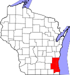
Largest Municipalities
(over 25,000 in 2000)BrookfieldC · FranklinC · GreenfieldC · Menomonee FallsV · New BerlinC · Oak CreekC · RacineC · WaukeshaC · WauwatosaC · West AllisC · West BendC
Municipalities
(over 10,000 in 2000)Brown DeerV · CaledoniaV · CedarburgC · CudahyC · GermantownV · GlendaleC · GraftonV · GreendaleV · MequonC · MuskegoC · OconomowocC · PewaukeeC · RichfieldT · ShorewoodV · South MilwaukeeC · Whitefish BayV
Smaller Municipalities
(under 10,000 in 2000)BaysideV · Big BendV · BrookfieldT · Elm GroveV · Fox PointV · HartlandV · Hales CornersV · MukwonagoV · PewaukeeV · River HillsV · SaukvilleV · Saint FrancisC · SussexV · ThiensvilleV · West MilwaukeeV
Counties Milwaukee · Ozaukee · Racine · Washington · Waukesha
Categories:- Villages in Wisconsin
- Populated places in Waukesha County, Wisconsin


Wikimedia Foundation. 2010.