Orchard Place, Illinois

Orchard Place, Illinois
Orchard Place
Neighborhood
Country United States
State Illinois
County Cook
Coordinates 41°58′43″N 87°54′17″W / 41.97861°N 87.90472°W / 41.97861; -87.90472
Government Part of Des Plaines, Illinois
Timezone CST (UTC-6)
 - summer (DST) CDT (UTC-5)
Postal code XXXXX
Area code XXX
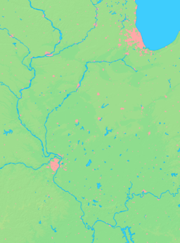
Location of Orchard Place within Illinois

Orchard Place, Illinois was a small farming community in Cook County, Illinois, just west of Chicago. Settled by German immigrants in the 1840s, Orchard Place became a stop on the Wisconsin Central Railroad in 1887 and received its name at that time. In 1942, Orchard Place was selected as the site of a new air base and aircraft manufacturing facility, Orchard Place Airport/Douglas Field[1]. After the Second World War, the city of Chicago bought the facility from the United States government and converted it into a commercial airport, Chicago Orchard Field, opened in 1946. The airport was renamed in 1949 to O'Hare International Airport and has grown into the Chicago metropolitan area's primary airport and a major North American transportation hub. Today, the former Orchard Place is incorporated in Des Plaines, Illinois. Its legacy persists in O'Hare's airport code, (FAA LID: ORD), as well as in the name of Orchard Place Elementary School in Des Plaines.

References

External links


Wikimedia Foundation. 2010.

Игры ⚽ Поможем написать реферат

Look at other dictionaries:

  • Orchard Place — may refer to: Orchard Place Airport/Douglas Field, now called O Hare International Airport and still abbreviated as ORD Orchard Place, Illinois, the small community where the airport was originally built and receiveed its name Orchard Place,… …   Wikipedia

  • Illinois World War II Army Airfields — Infobox Military Structure name=Illinois World War II Army Airfields partof = World War II location= coordinates= caption= type=Army Airfields code= built=1940 1944 builder= materials= height= used= 1940 Present demolished= condition= ownership=… …   Wikipedia

  • Orchard Beach State Park — Orchard Beach State Park …   Wikipedia

  • Orchard Township, Wayne County, Illinois — Coordinates: 38°31′00″N 88°38′30″W / 38.5166667°N 88.64167°W / 38.5166667; 88.64167 …   Wikipedia

  • List of unincorporated communities in Illinois — List of unincorporated communities in Illinois, arranged in alphabetical order. See also: List of towns and villages in Illinois, List of cities in Illinois. Index: compactTOC A*Adair *Aden *Adrian *Afolkey *Agnew *Akin *Albright *Alexander… …   Wikipedia

  • Des Plaines, Illinois — Des Plaines redirects here. For the river, see Des Plaines River. Des Plaines, Illinois County: Cook Township: Maine Mayor: Martin J. Moylan ZIP code(s): 60016, 60017, 60018, 60019 Area code(s): 847 224 …   Wikipedia

  • Community Consolidated School District 62 (Illinois) — Community Consolidated School District 62 Type and location Grades Pre K 8th Region Northwest Suburban Chicago Country United States Location Des Plaines, Illinois …   Wikipedia

  • List of ghost towns in Illinois — This is an incomplete list of ghost towns in the US state of Illinois* Anderson * Barr * Benjaminville * Brush Point * Cardiff * Challacombe * Clifford Eight * Coltonville * Comer * Enos * Evans * Greenridge * Green Rock * Griggsville Landing *… …   Wikipedia

  • Westfield Old Orchard — Location Skokie, Illinois, United States Coordinates …   Wikipedia

  • Skokie, Illinois — For the film of the same name, see Skokie (film). Skokie, Illinois County: Cook Township: Niles Incorporated …   Wikipedia

Share the article and excerpts

Direct link
Do a right-click on the link above
and select “Copy Link”