- Whaleback Shell Midden
-
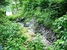
 Entrance to the State Historic Site.
Whaleback Shell Midden is a shell midden, or dump, consisting primarily of oyster shells located on the east side of the Damariscotta River in Maine. Other shell middens are located on the estuary in both Damariscotta and Newcastle. The middens in this area were formed over about 1,000 years between 200 BC to AD 1000 (By 1875 oysters that were once abundant were no longer native to New England waters.[1] Wild populations have been established in recent years by the spawn of aquaculture oysters.)[2]
The midden originally had three main layers of shells. In the bottom two layers, individual shells were generally 12–20 inches (30–50 cm) long. These two layers are separated by a layer of soil, and the middle layer is mixed with animal bones. The top layer contains smaller shells. Artifacts unearthed lead scientists to believe that successive tribes of prehistoric people used the area. The top layer was deposited by members of the Abenaki tribes that fished in the area in the summer.[3]
Originally, the Whaleback midden was more than thirty feet deep, more than 1,650 feet in length, and a width varying from 1,320 to 1,650 feet. It got its name from its shape. Only a small portion of this midden remains today as much of it was processed into chicken feed from 1886 to 1891 by the Massachusetts-based Damariscotta Shell and Fertilizer company. Because of this, the Glidden midden, located across the river in Newcastle, is now the largest in Maine and the largest on the U.S. east coast north of Georgia. The area around the remains of the Whaleback is a Maine state historic site, first opened for a full season in 2005, with some historical displays and a hiking trail.[4][5]
Contents
Gallery
-

Closeup of one of the thousand year old oyster shells.
-

The Glidden Shell Midden is located immediately across the Damariscotta River.
See also
- The Davistown Museum has a compilation of articles and annotations on shell middens in this area.
References
- ^ Drake, Samuel Adams (1875). Nooks and Corners of the New England Coast. New York: Harper & Brothers. as seen at Google Books
- ^ "Glidden Point Oyster Sea Farm". Glidden Point Oyster Sea Farm. http://www.oysterfarm.com/areas.html. Retrieved 2006-05-12.
- ^ Maine League of Historical Societies and Museums (1970). Doris A. Isaacson. ed. Maine: A Guide 'Down East'. Rockland, Me: Courier-Gazette, Inc.. p. 258.
- ^ "Whaleback Shell Midden". Bureau of Parks and Lands, Department of Conservation, State of Maine. http://www.maine.gov/doc/parks/programs/history/whaleback/index.htm. Retrieved 2010-10-11.
- ^ "Midden comes out of its shell". Outdoors, MaineToday.com. Archived from the original on 2006-05-15. http://web.archive.org/web/20060515034353/http://outdoors.mainetoday.com/naturewatching/050627midden.shtml. Retrieved 2010-10-11.
External links
- Whaleback Shell Midden - official site
Protected Areas of Maine Federal Acadia National Park • Saint Croix Island International Historic SiteNational Wildlife Refuges:Aroostook • Carlton Pond Waterfowl Production Area • Cross Island • Franklin Island • Moosehorn • Petit Manan • Pond Island • Rachel Carson • Seal Island • Sunkhaze Meadows
State Allagash Wilderness Waterway • Aroostook • Baxter • Birch Point • Bradbury Mountain • Camden Hills • Cobscook Bay • Crescent Beach • Damariscotta Lake • Ferry Beach • Fort Point • Grafton Notch • Holbrook Island Sanctuary • Lake St. George • Lamoine • Lilly Bay • Moose Point • Mount Blue • Peacock Beach • Peaks-Kenny • Penobscot River Corridor • Popham Beach • Quoddy Head • Range Ponds • Rangeley Lake • Reid • Roque Bluffs • Shackford Head • Sebago Lake • Swans Falls Campground • Swan Lake • Two Lights • Vaughan Woods • Warren Island • Wolfe's Neck Woods
Bible Point • Colburn House • Colonial Pemaquid • Eagle Island • Fort Baldwin • Fort Edgecomb • Fort Halifax • Fort Kent • Fort Knox • Fort McClary • Fort O'Brien • Major Reuben Colburn House • John Paul Jones • Katahdin Iron Works • Mayall Mills • Whaleback Shell Midden •
Durham State ForestMaine Department of Conservation (web)Categories:- National Register of Historic Places in Maine
- Pre-state history of Maine
- Protected areas of Lincoln County, Maine
- Maine state historic sites
- Shell middens in the United States
-


Wikimedia Foundation. 2010.