- Cities and Counties of Gyeonggi-do
-
Administrative divisions
of South KoreaProvincial level Province
(道 도 do)Special Self-Governing Province
(特別自治道 특별자치도 teukbyeoljachi-do)Special city
(特別市 특별시 teukbyeol-si)Metropolitan city
(廣域市 광역시 gwangyeok-si)Municipal level City
(市 시 si)County
(郡 군 gun)District
(區 구 gu)Town
(邑 읍 eup)Township
(面 면 myeon)Neighbourhood
(洞 동 dong)Ri
(里 리 ri)Gyeonggi-do is divided into 27 cities (si) and 4 counties (gun). Listed below is each entity's name in English, hangul and hanja.
Contents
Cities
Counties
- Gapyeong County (가평군, 加平郡)
- Yangpyeong County (양평군, 揚平郡)
- Yeoju County (여주군, 驪州郡)
- Yeoncheon County (연천군, 漣川郡)
List by Population and Area
Name Population Area Population Density Ansan 742,788 144.78 km² 5,130.5 /km² Anseong 167,511 553.46 km² 302.7 /km² Anyang 622,379 58.52 km² 10,635.3 /km² Bucheon 869,455 53.44 km² 16,269.7 /km² Dongducheon 93,718 95.66 km² 979.7 /km² Gimpo 232,364 276.64 km² 840.0 /km² Goyang 938,784 267.31 km² 3,512.0 /km² Gunpo 278,790 36.38 km² 7,663.2 /km² Guri 194,342 33.3 km² 5,836.1 /km² Gwacheon 72,088 35.81 km² 2,013.1 /km² Gwangju 242,559 430.69 km² 563.2 /km² Gwangmyeong 334,526 38.5 km² 8,687.0 /km² Hanam 139,414 93.07 km² 1,497.9 /km² Hwaseong 497,907 844 km² 590.0 /km² Icheon 196,230 461.20 km² 425.5 /km² Namyangju 551,395 458.44 km² 1,202.8 /km² Osan 166,809 42.76 km² 3,905.1 /km² Paju 341,203 672.42 km² 507.4 /km² Pocheon 159,490 826.38 km² 193.0 /km² Pyeongtaek 406,191 452.18 km² 898.3 /km² Seongnam 970,847 141.82 km² 6,845.6 /km² Siheung 417,037 166.6 km² 2,503.2 /km² Suwon 1,095,957 121.09 km² 9,050.8 /km² Uijeongbu 430,769 81.59 km² 5,279.7 /km² Uiwang 135,058 53.95 km² 2,503.4 /km² Yangju 179,923 310.34 km² 579.8 /km² Yongin 866,759 591.32 km² 1,465.8 /km² Gapyeong County 56,815 843.46 km² 67.3 /km² Yangpyeong County 92,529 877.08 km² 105.5 /km² Yeoju County 107,121 607.79 km² 176.2 /km² Yeoncheon County 45,572 695.61 km² 65.5 /km² General information
Name Sub-Divisions Points of Interest Image Location Description Ansan 
Anseong 
Anyang 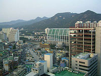

Bucheon 
Dongducheon 
Gimpo 
Goyang 
Gunpo 
Guri 
Gwacheon 
Gwangju 
Gwangmyeong 
Hanam 
Hwaseong 
Icheon 
Namyangju 
Osan 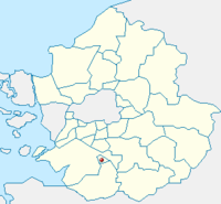
Paju 
Pocheon 
Pyeongtaek 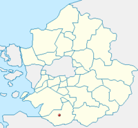
Seongnam 
Siheung 
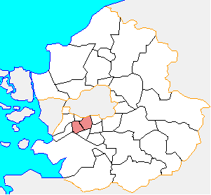
Suwon 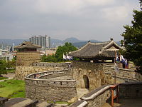
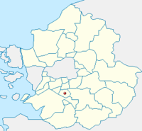
This is the capital of Gyeonggi-do. Uijeongbu 
Uiwang 
Yangju 
Yongin - Cheoin-gu
- Giheung-gu
- Suji-gu
Gapyeong County 
Yangpyeong County 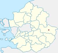
Yeoju County 
Yeoncheon County 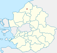
See also
Gyeonggi 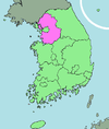
Capital Cities Counties Categories:- Cities in Gyeonggi
- Counties of Gyeonggi
- Lists of cities in South Korea


Wikimedia Foundation. 2010.