- Chilhowee (Cherokee town)
-
Coordinates: 35°33′08″N 84°00′27″W / 35.55231°N 84.00737°W
 Chilhowee on Henry Timberlake's 1762 "Draught of the Cherokee Country"
Chilhowee was a prehistoric and historic Native American site in Blount County and Monroe County, Tennessee, in the southeastern United States. Although now submerged by the Chilhowee Lake impoundment of the Little Tennessee River, the Chilhowee site was home to a substantial 18th-century Overhill Cherokee village and may have been the site of the Creek village "Chalahume" visited by Spanish explorer Juan Pardo in 1567.
Although Chilhowee was destroyed by Euro-American frontiersmen in the late 18th century, the village's name is still used for various entities throughout East Tennessee. Along with Chilhowee Dam and its reservoir, places and entities named after Chilhowee include a mountain, a geologic formation, several churches and schools, and a park and neighborhood in Knoxville.
Contents
Geographical setting
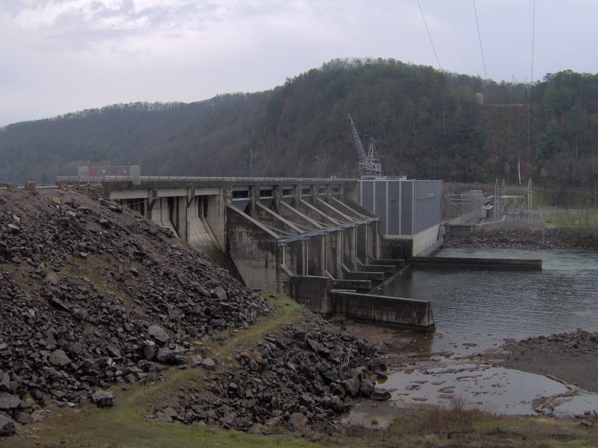
 Chilhowee Dam
The Little Tennessee River enters Tennessee from the south and flows northwestward for roughly 54 miles (87 km) through parts of Blount, Monroe, and Loudon counties before emptying into the Tennessee River near Lenoir City. Chilhowee Dam, completed in 1957 by the Aluminum Company of America's Tapoco Division, is situated approximately 34 miles (55 km) above the mouth of the river. The dam has created Chilhowee Lake, a reservoir stretching for roughly 10 miles (16 km) between Chilhowee Dam and Calderwood Dam, near the state line. Before inundation, the Chilhowee site was located along a bend in the Little Tennessee opposite the river's Abrams Creek confluence, approximately 36 miles (58 km) above river's mouth. The site is visible immediately southeast of the junction of U.S. Route 129 and Foothills Parkway.
The Chilhowee site is situated in an area where the Appalachian Mountains— namely, the Great Smoky Mountains to the northeast and the Unicoi Mountains to the south— give way to the rolling hills of the Appalachian Ridge-and-Valley Province. Chilhowee Lake provides part of the boundary between the Great Smoky Mountains National Park and the Cherokee National Forest.
History
Chalahume
According to anthropologist Charles Hudson, the Juan Pardo expedition entered the upper Tennessee Valley (then part of the Chiaha chiefdom) in late 1567 via the Pigeon River, which Pardo followed to its confluence with the French Broad River near modern Newport. The expedition rested for several days at the Chiaha capital of Olamico, which Hudson believes was located on Zimmerman's Island (now submerged by Douglas Lake). On October 13, Pardo left Olamico, traveling southwest across the Foothills of the Great Smoky Mountains en route to the Coosa chiefdom in northern Georgia. The expedition crossed Little River near modern Walland and traversed Happy Valley to reach "Chalahume" in the Little Tennessee Valley on October 15.[1] Expedition notary Juan de la Bandera described Chalahume's topographic situation as similar to the Spanish city of Córdoba— a grapevine-filled valley at the base of high mountains— a description that fits Chilhowee.[2]
Hudson points out that the phoneme "/m/" is infrequent in the Cherokee language, and thus when the Cherokee replaced Chalahume's Mississippian-era occupants, they retained the site's name but substituted a "w" for the "m". A similar situation occurred 5 miles (8.0 km) downstream from Chilhowee at Citico, which Hudson argues was the "Satapo" visited by the Pardo expedition on October 16.[2]
The Cherokee period
 The now-submerged ancient site of Chilhowee
Anthropologist James Mooney recorded two Cherokee legends regarding Chilhowee. The first told the story of the Utlunta, an ogress who roamed the Chilhowee area devouring children before the Cherokee cornered and killed her on the slopes of Chilhowee Mountain. Another legend concerned the "False Warriors of Chilhowee," a band of warriors who attacked a force from an allied city and returned to Chilhowee claiming they had heroically killed several of the village's enemies. Mooney believed the word "Chilhowee" was rooted in the Cherokee word for "kingfisher," although Hudson's research rejects this, arguing that "Chilhowee" is the Cherokee pronunciation of the Muskogean name "Chalahume."[2][3]
Chilhowee doesn't appear among the Overhill towns until the mid-18th century, although its neighbors Citico and Tallassee appear in the earliest English records of the region. Colonel George Chicken, who visited the Overhill towns in 1725 in hopes of cementing an alliance against the Creeks, met at the Tanasi townhouse with the head men of Tanasi, Citico, Tallassee, Great Tellico, and "Coosaw." George Hunter's map of the Overhill country shows Tallassee, Citico, Tanasi, and Great Tellico, but makes no mention of Chilhowee.[4] Henry Timberlake visited Chilhowee on a peace mission in 1761 and engaged in a pipe-smoking ceremony with the town's head men, but didn't elaborate.[5] Timberlake's "Draught of the Cherokee Country" shows 18 dwellings and a townhouse at Chilhowee, and lists Yachtino as the town's chief. The 110 warriors reportedly residing at Chilhowee represented the third largest fighting contingent among the Overhill towns, behind only Citico and Chota.
The encroachment of Euro-American settlers into the Tennessee Valley in the 1770s led to increased conflict with the valley's Cherokee inhabitants. Around this time, the chief of Chilhowee, known as Old Abraham (or "Abram"), had risen to prominence among the Overhill Cherokees. When the Cherokee aligned themselves with the British at the outbreak of the American Revolution in 1776, Old Abraham and Dragging Canoe (the head man at Mialoquo) led a two-pronged attack against Fort Watauga and Heaton's Station, respectively. The expedition was a disaster, and prompted Virginia to dispatch Colonel William Christian with a small force to subdue the Overhill towns. Christian entered the Little Tennessee Valley unopposed and made a truce with several older chiefs, but when Dragging Canoe refused to accept a peace offering, Christian burned several Overhill towns, including Chilhowee.[6] In 1788, Old Abraham and several other chiefs were tomahawked to death under a flag of truce by a son of John Kirk, a settler whose family was massacred by renegade Cherokees on Nine Mile Creek.[7]
The site's later history
 Sign pointing the way to Abrams Creek Campground
Around 1850, brothers William and Robert James established a cotton and woolen mill at the mouth of Abrams Creek. The mill used power generated by the creek's flow to spin and weave fabric. The mill closed at the outset of the American Civil War.[8]
The Cherokee National Forest, established in 1911, now protects the western shoreline above Chilhowee Lake, and the Great Smoky Mountains National Park, established in 1932, protects the eastern shoreline. Abrams Creek, the longest stream located entirely within the park, is named for Old Abraham of Chilhowee.[9] A campground and ranger station is located along the creek a few miles upstream from Chilhowee.
When ALCOA announced plans to build Chilhowee Dam in 1955, the Knoxville Chapter of the Tennessee Archaeological Society arranged to conduct salvage excavations at the Chilhowee site and the Tallassee site (near modern Calderwood), both of which would be flooded by the dam's reservoir. Due to the greater amount of surface material at Tallassee and the Tallassee site's accessibility, the Knoxville Chapter decided to focus on Tallassee, and conducted only limited surface collections at Chilhowee.[10]
References
- ^ Charles Hudson, The Juan Pardo Expeditions: Explorations of the Carolinas and Tennessee, 1566-1568 (Tuscaloosa, Ala.: University of Alabama Press, 2005), 36-40.
- ^ a b c Hudson, 105.
- ^ James Mooney, Myths of the Cherokee and Sacred Formulas of the Cherokee (Nashville, Tenn.: C and R Elder, 1972), 316-319, 375-376, 539.
- ^ Samuel Cole Williams, Early Travels in the Cherokee Country (Johnson City, Tenn.: The Watauga Press, 1928), 102, 114.
- ^ Henry Timberlake, Samuel Williams (ed.), Memoirs, 1756-1765 (Marietta, Georgia: Continental Book Co., 1948), 65.
- ^ Kurt Russ and Jefferson Chapman, Archaeological Investigations at the Eighteenth Century Overhill Cherokee Town of Mialoquo (40MR3) (University of Tennessee Department of Anthropology Report of Investigations 37, 1983), 18-19.
- ^ Inez Burns, History of Blount County, Tennessee: From War Trail to Landing Strip, 1795-1955 (Nashville: Benson Print Co., 1957), 11-16.
- ^ Information obtained from Tennessee Historical Commission marker IE 14 along US-129, 30 March 2008.
- ^ Durwood Dunn, Cades Cove: The Life and Death of An Appalachian Community (Knoxville: University of Tennessee Press, 1988), 260.
- ^ Kenneth Cornett, "Excavations at Tallassee (40Bt8): An Historic Cherokee Village Site in East Tennessee." Tennessee Archaeologist 32, no. 1 (Spring of 1976), 11-19.
Categories:- Mississippian culture
- Geography of Monroe County, Tennessee
- Geography of Blount County, Tennessee
- Cherokee towns
- Archaeological sites in Tennessee
- Communities of the Great Smoky Mountains


Wikimedia Foundation. 2010.