- Colfax, Washington
-
Colfax — City — Colfax, looking southeast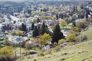 Location of Colfax, Washington
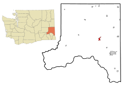
Coordinates: 46°53′3″N 117°21′49″W / 46.88417°N 117.36361°WCoordinates: 46°53′3″N 117°21′49″W / 46.88417°N 117.36361°W Country United States State Washington County Whitman Area – Total 1.7 sq mi (4.3 km2) – Land 1.7 sq mi (4.3 km2) – Water 0.0 sq mi (0.0 km2) Elevation 1,972 ft (601 m) Population (2000) – Total 2,805 – Density 1,650.0/sq mi (652.3/km2) Time zone Pacific (PST) (UTC-8) – Summer (DST) PDT (UTC-7) ZIP code 99111 Area code 509 FIPS code 53-13785[1] GNIS feature ID 1533329[2] Colfax is the county seat of Whitman County, Washington, United States.[3] The population was 2,805 at the 2010 census. It is situated amidst wheat-covered hills in a valley at the confluence of the north and south forks of the Palouse River. U.S. Route 195, which forms the town's main street, intersects with State Route 26 at the north end of town; in the past, Colfax also lay at the junction of three railway lines. It was named after Schuyler Colfax, the vice president from 1869-73.
Contents
History
Palouse Indians were the first known human inhabitants of the Colfax area. White settlers arrived in the summer of 1870, and soon built a sawmill. A flour mill and other businesses followed, and Colfax soon grew into a prosperous town. Originally, pioneer citizen James Perkin called the settlement "Belleville" in honor of his girlfriend; when he found a new love, he changed the town's name to Colfax[4] for then-Vice President Schuyler Colfax.[5]
Colfax was officially incorporated on November 29, 1873. In 1889-90, the town vied with several other finalists to become the site of a new state agricultural college, present-day Washington State University. The honor ultimately fell to nearby Pullman, 15 miles (24 km) southeast.
The early history of Colfax was distinguished by prominent lynchings in 1894 and 1898.[5]
Until passed by Pullman at the 1930 census, Colfax was the largest city in the county.
Notable natives
Either born, raised, or made Colfax their home:
- Dinsmore Alter, astronomer and meteorologist
- Ida Lou Anderson, radio pioneer, professor
- Roland Bainton, professor of ecclesiastical history, Reformation scholar
- Yakima Canutt, rodeo champion and Hollywood stuntman
- Timothy Ely, contemporary American artist
- William La Follette, politician, congressman from Washington
- Abe Goff, politician, Republican congressman from Idaho
- John Kitzhaber, Governor of Oregon, 1995–2003, 2011 -
- Morten Lauridsen, composer of classical music
- Virgil T. McCroskey, 1876–1970, an amateur conservationist who created two state parks: Steptoe Butte state park in Washington and Mary Minerva McCroskey State Park in Idaho. A pharmacist until 1920, McCroskey owned the Elk Drugstore on Main Street, the facade of which still bears his name.
- Kate Bigelow Montague, (5 May 1885 - 30 October 1984) A novelist, author, and journalist. She also made amateur travel films of primarily southeast Asia, Europe and North America ca. the mid to late 1930s.[6]
- Robert Osborne, Hollywood historian and journalist, prime-time host of Turner Classic Movies. As a teenager, he worked at The Rose, a long-defunct movie theater in downtown Colfax, and broke both arms while putting Elizabeth Taylor's name on the marquee.[7]
- Mimi LaFollette Summerskill, author, educator, political activist and vintner
Geography and climate
 South fork of the Palouse River in early autumn, at the end of the dry season
Colfax is located in southeastern Washington at 46°53′3″N 117°21′49″W / 46.88417°N 117.36361°W (46.884033, -117.363668),[8] at an elevation of 1,962 feet (598 m). The nearest cities are Spokane, Pullman, Moscow, and Lewiston/Clarkston. The area is geologically interesting, lying in the midst of the fertile Palouse country in the middle of the Columbia River Plateau, with the Rocky Mountains to the east, the Channeled Scablands to the west, and the Snake River to the south.
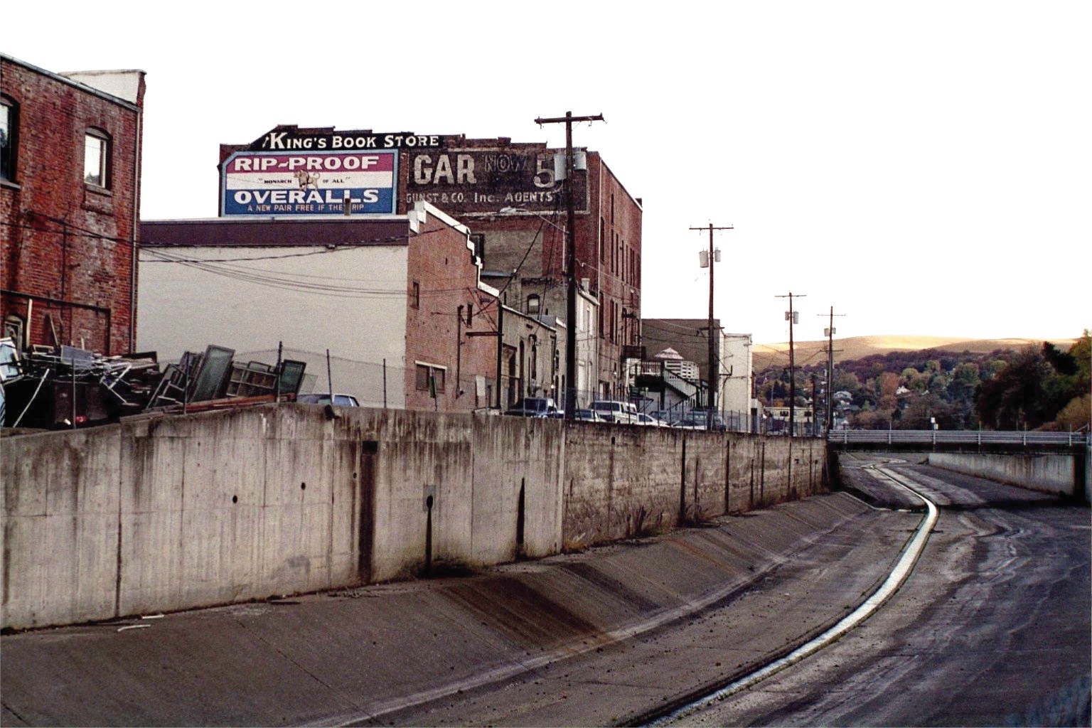
According to the United States Census Bureau, the city has a total area of 1.7 square miles (4.3 km²).1.7 square miles (4.3 km²) of it is land and none of the area is covered with water. The Palouse River, confined for flood control to a concrete bed that reduces it to an eighteen-inch-wide stream during the dry season, runs through the middle of town, parallel to Main Street.
Colfax has a four-season continental climate (Köppen Dsb), with hot, dry summers, cold winters, and a rainy season that generally runs from autumn til spring. The annual rainfall averages less than 20 inches (510 mm) a year. This climate, together with the deep, rich palouse topsoil, makes for near-ideal wheat growing conditions.
Climate data for Colfax, Washington (1971-2000) Month Jan Feb Mar Apr May Jun Jul Aug Sep Oct Nov Dec Year Average high °F (°C) 37.4
(3.0)43.5
(6.4)51.2
(10.7)58.9
(14.9)66.8
(19.3)73.9
(23.3)82.7
(28.2)83.3
(28.5)74.6
(23.7)62.0
(16.7)45.6
(7.6)37.6
(3.1)59.79
(15.44)Daily mean °F (°C) 30.9
(−0.6)35.3
(1.8)41.0
(5.0)47.3
(8.5)54.1
(12.3)60.5
(15.8)66.6
(19.2)66.4
(19.1)58.2
(14.6)47.7
(8.7)37.8
(3.2)31.3
(−0.4)48.09
(8.94)Average low °F (°C) 24.3
(−4.3)27.0
(−2.8)30.8
(−0.7)35.7
(2.1)41.3
(5.2)47.0
(8.3)50.4
(10.2)49.4
(9.7)41.7
(5.4)33.3
(0.7)29.9
(−1.2)24.9
(−3.9)36.31
(2.39)Precipitation inches (mm) 2.33
(59.2)1.94
(49.3)2.02
(51.3)1.73
(43.9)1.80
(45.7)1.37
(34.8)0.72
(18.3)0.72
(18.3)0.73
(18.5)1.20
(30.5)2.55
(64.8)2.93
(74.4)20.04
(509)Source: NOAA (normals, 1971-2000) [9] Community resources
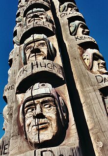 The Codger Pole
Tourist attractions
- The Codger Pole is a chainsaw-carved monument by master carver Jonathan LaBenne. It is located on Main Street and commemorates a 1988 rematch, 50 years after the original 1938 game, between archrival football teams from Colfax High School and St. John. At 65 feet (20 m) tall, it is the largest sculpture of its type in the world, and consists of portraits, carved into five upended red cedar logs, of the 51 players involved. The players are shown in old age but are wearing the football uniforms of the thirties.
- The Perkins House, on Perkins Avenue, is a meticulously restored Victorian home built in 1886. The original owner was James Perkins, a leading pioneer citizen. The Perkins family occupied the home until 1968, by which time it was sadly dilapidated and slated for demolition. In 1970, the Whitman County Historical Society assumed ownership and began restoring the house, which is now listed on the National Register of Historic Places. Behind the house is a log cabin, built in 1870, where Perkins lived for sixteen years. This cabin is the oldest standing structure in Whitman County. The house is open for tours from May to September, on Thursdays and Saturdays.
- Colfax Golf Course and Country Club is a nine-hole course beside the river on North Palouse River Road.
- McDonald Park, located immediately north of the golf course, consists of playing fields surrounded by a paved walking/jogging path. Regional baseball and softball tournaments are hosted here.
- The Colfax Trail is a three-mile (5 km) path converted from a disused railway line. It begins at a gravel quarry off Highway 26, just beyond the town's western limit, and follows the Palouse River westward, traversing cow pastures, pine woods, wetlands, and basalt cliffs.
Public services, businesses, and churches
Among the town's other amenities are a public school, a hospital, several city parks, a skateboard park, a swimming pool and a public library that was recently named among the best in Washington State. As the county seat, Colfax is also home to the Whitman County Courthouse and the Whitman County Jail. The local government consists of a seven-member City Council and a mayor (currently Norma Becker, serving her fifth term).
There is a small assortment of businesses, including building and farm supply stores, a medium-sized grocery (Rosauers), a pharmacy, a hotel, a Bed & Breakfast guesthouse, a fitness center, a florist, a coffee stall, four gift shops, a pawn shop, and ten restaurants. Local service-based businesses include lawyers, dentists, auto mechanics, banks, and retirement homes.
Switchboard.com lists nine churches in Colfax, including one Catholic Church, one congregation of the Church of Jesus Christ of Latter-day Saints (aka LDS or Mormon), and various Protestant and non-denominational churches including, Colfax Assembly (Assemblies of God), Colfax Nazarene Church, First Baptist Church, United Methodist Church, and The Community Bible Church.
A weekly newspaper called Whitman County Gazette is published in Colfax. In addition, there is a daily newspaper called "The Daily Bulletin" which consists of a one page paper with daily news and advertisements that is published in Colfax.
Annual Colfax events
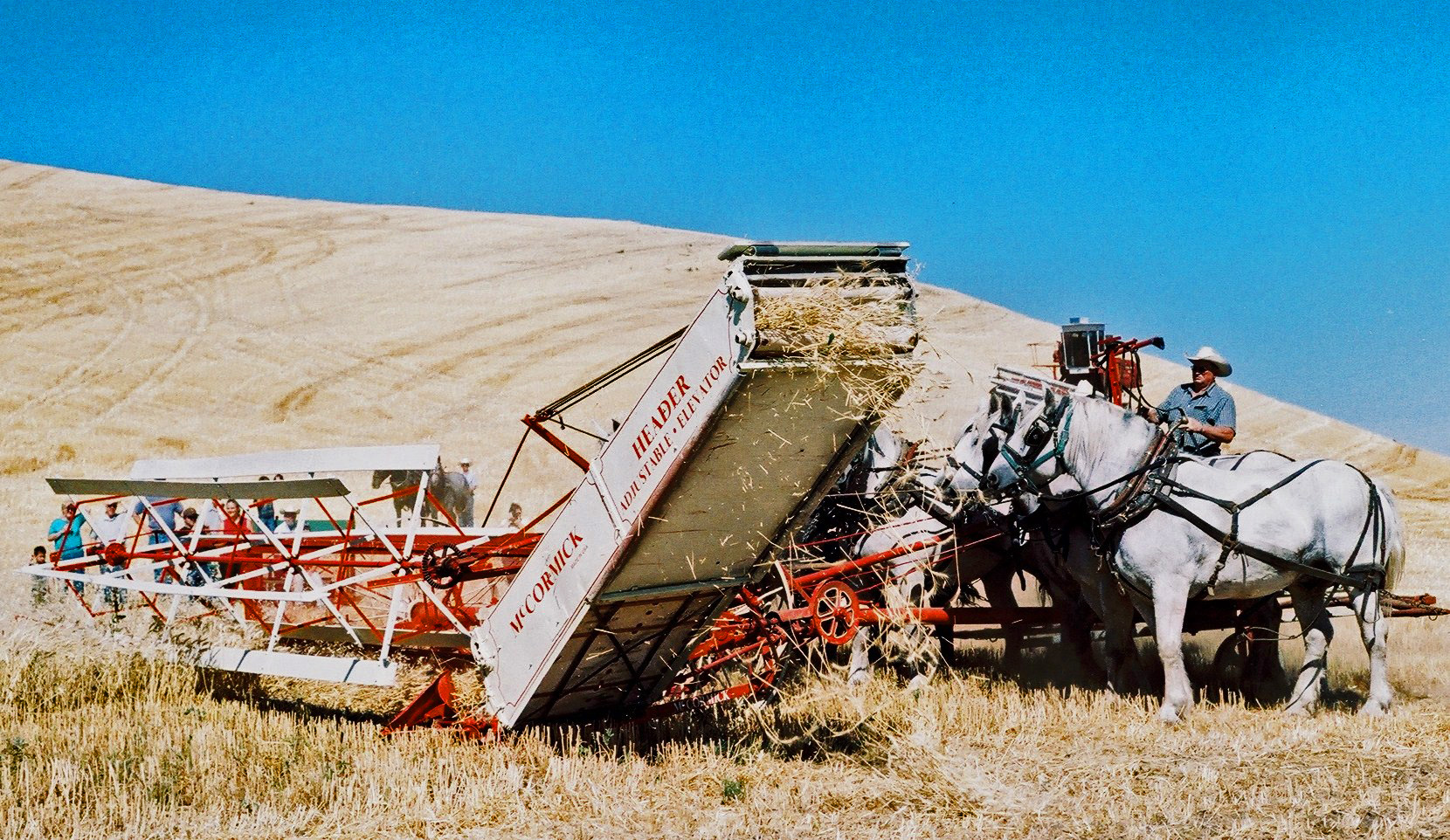
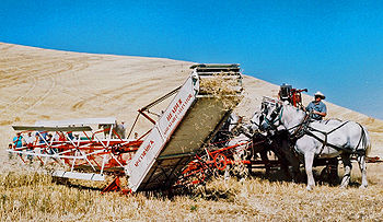 Antiquated threshing techniques are demonstrated at the annual threshing bee
- Palouse Plowing Bee and Palouse Empire Threshing Bee– held respectively on the third weekend in April and the first weekend after Labor Day. Farmers demonstrate traditional plowing and harvesting methods in a 15-acre (61,000 m2) field five miles (8 km) west of town.
- Perkins House Ice Cream Social – Held on the last Sunday in June on the lawn of the Perkins House; ice cream, pie, live Dixieland music, displays, and free house tours.
- Concrete River Days – A summer festival held on the second weekend in July, with a parade, sidewalk sales, and many outdoor activities; so named because the Palouse riverbed in downtown Colfax has been lined with concrete for the sake of flood control, and the water descends into a narrow central channel during the dry season.
- Palouse Empire Fair – Held in early September five miles (8 km) west of town; a midway, a rodeo, live music, and barns full of livestock and handicrafts.
- Lighted Christmas Parade– a night parade held in downtown Colfax, Mill Street, on the first Thursday in December. Festive floats, free candy, special programs at the public library, and Santa Claus.
- Autumn Harvest Hullabaloo The Hullabaloo is an a fall festival similar to Colfax's Concrete River Days.
Demographics
Historical populations Census Pop. %± 1880 444 — 1890 1,649 271.4% 1900 2,121 28.6% 1910 2,783 31.2% 1920 3,027 8.8% 1930 2,782 −8.1% 1940 2,853 2.6% 1950 3,057 7.2% 1960 2,860 −6.4% 1970 2,664 −6.9% 1980 2,780 4.4% 1990 2,713 −2.4% 2000 2,844 4.8% 2010 2,805 −1.4% source:[10][11] The population has hovered near 3,000 since 1910.[12] As of the 2000 census[1], there were 2,844 people, 1,191 households, and 740 families residing in the city. The population density was 1,705.6 people per square mile (657.5/km²). There were 1,357 housing units at an average density of 813.8 per square mile (313.7/km²). The racial makeup of the city was 94.16% White, 0.25% African American, 0.84% Native American, 2.07% Asian, 0.60% from other races, and 2.07% from two or more races. Hispanic or Latino of any race were 1.48% of the population.
There were 1,191 households out of which 27.9% had children under the age of 18 living with them, 52.6% were married couples living together, 6.9% had a female householder with no husband present, and 37.8% were non-families. 35.0% of all households were made up of individuals and 18.1% had someone living alone who was 65 years of age or older. The average household size was 2.24 and the average family size was 2.90.
In the city the age distribution of the population shows 23.5% under the age of 18, 6.2% from 18 to 24, 25.6% from 25 to 44, 22.6% from 45 to 64, and 22.1% who were 65 years of age or older. The median age was 41 years, well above the national average of 35.3—possibly due to the presence of several retirement communities. For every 100 females there were 93.6 males. For every 100 females age 18 and over, there were 89.6 males.
The median income for a household in the city was $36,622, and the median income for a family was $47,589. Males had a median income of $32,188 versus $26,349 for females. The per capita income for the city was $18,519. About 6.1% of families and 9.3% of the population were below the poverty line, including 9.7% of those under age 18 and 6.8% of those age 65 or over.
References
- ^ a b "American FactFinder". United States Census Bureau. http://factfinder.census.gov. Retrieved 2008-01-31.
- ^ "US Board on Geographic Names". United States Geological Survey. 2007-10-25. http://geonames.usgs.gov. Retrieved 2008-01-31.
- ^ "Find a County". National Association of Counties. http://www.naco.org/Counties/Pages/FindACounty.aspx. Retrieved 2011-06-07.
- ^ LaFollette, Taber, The History of Colfax, Colfax History Committee, 1956, p. 8.
- ^ a b Majors, Harry M. (1975). Exploring Washington. Van Winkle Publishing Co. p. 143. ISBN 9780918664006. http://books.google.com/books?id=CoWrPQAACAAJ.
- ^ The California Montagues (full text)
- ^ Waugh, Lisa. "Oscar expert held court with Hollywood's elite", CNN Interactive, March 20, 1998 (Full Text)
- ^ "US Gazetteer files: 2010, 2000, and 1990". United States Census Bureau. 2011-02-12. http://www.census.gov/geo/www/gazetteer/gazette.html. Retrieved 2011-04-23.
- ^ "Climatography of the United States NO.81". National Oceanic and Atmospheric Administration. http://cdo.ncdc.noaa.gov/climatenormals/clim81/WAnorm.pdf. Retrieved January 11, 2011.
- ^ Moffatt, Riley. Population History of Western U.S. Cities & Towns, 1850-1990. Lanham: Scarecrow, 1996, 317.
- ^ "Subcounty population estimates: Washington 2000-2007" (CSV). United States Census Bureau, Population Division. 2009-03-18. http://www.census.gov/popest/cities/files/SUB-EST2007-53.csv. Retrieved 2009-04-26.
- ^ Erickson, Edith E. Colfax 100 Plus, 1981, p. 64 (privately printed)
External links
- Colfax information from the Chamber of Commerce
- History of Colfax at HistoryLink
- Colfax, Washington at the Open Directory Project
Municipalities and communities of Whitman County, Washington County seat: ColfaxCities 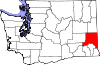
Towns Unincorporated
communitiesGhost town Categories:- Cities in Washington (state)
- Populated places in Whitman County, Washington
- County seats in Washington (state)
- Populated places established in 1873


Wikimedia Foundation. 2010.