- Nédélec, Quebec
-
Nédélec — Township municipality — 
 Nédélec
Coordinates: 47°41′N 79°26′W / 47.683°N 79.433°WCoordinates: 47°41′N 79°26′W / 47.683°N 79.433°W Country  Canada
Province  Quebec
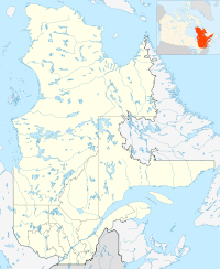
Region Abitibi-Témiscamingue Regional county Témiscamingue Settled 1895 Incorporated February 1, 1909 Government[1] – Mayor Carmen Rivard – Federal riding Abitibi—Témiscamingue – Prov. riding Rouyn-Noranda—Témiscamingue Area[2] – Land 373.52 km2 (144.2 sq mi) Population (2006)[2] – Total 416 – Density 1.1/km2 (2.8/sq mi) Time zone EST (UTC-5) – Summer (DST) EDT (UTC-4) Postal Code J0Z 2Z0 Area code(s) 819 Nédélec is a township in northwestern Quebec, Canada, in the Témiscamingue Regional County Municipality.
History
By 1895, a general store was supplying the many logging camps of the area. The first permanent settlers arrived in 1909, the same year the township and township municipality were formed. They were both named after Jean-Marie Nédélec (1834-1896) who was a missionary among the Algonquins of Lake Timiskaming and Lake Abitibi from 1867 to 1869 and from 1892 to 1896.[3]
On October 7, 1995, the unorganized territory of Roulier, named after Ulric Roulier who was priest at Nédélec in the mid-1930s, was added to the municipality.[3]
Demographics
Population trend:[4]
- Population in 2006: 416 (2001 to 2006 population change: -3.0 %)
- Population in 2001: 429
- Population in 1996: 474
- Population in 1991: 524
Private dwellings occupied by usual residents: 163 (total dwellings: 178)
Mother tongue:[2]
- English as first language: 7.2 %
- French as first language: 83.1 %
- English and French as first language: 2.4 %
- Other as first language: 7.2 %
References
- ^ "Nédélec" (in French). Répertoire des municipalités. Ministère des Affaires Municipales, Régions et Occupation du territoire. http://www.mamrot.gouv.qc.ca/repertoire-des-municipalites/fiche/municipalite/85100/. Retrieved 2011-01-04.
- ^ a b c "Nédélec community profile". 2006 Census data. Statistics Canada. http://www12.statcan.ca/census-recensement/2006/dp-pd/prof/92-591/details/page.cfm?Lang=E&Geo1=CSD&Code1=2485100&Geo2=PR&Code2=24&Data=Count&SearchText=Nedelec&SearchType=Begins&SearchPR=01&B1=All&Custom=. Retrieved 2011-01-04.
- ^ a b "Nédélec (Municipalité de canton)" (in French). Commission de toponymie du Québec. http://www.toponymie.gouv.qc.ca/ct/ToposWeb/fiche.aspx?no_seq=43629. Retrieved 2011-01-04.
- ^ Statistics Canada: 1996, 2001, 2006 census, and Population and dwelling count amendments

Rouyn-Noranda Unorganized Timiskaming, Ontario
Brethour, Ontario
Casey, Ontario
Rémigny  Nédélec

Notre-Dame-du-Nord, Timiskaming Guérin Subdivisions of Témiscamingue Regional County Municipality Cities Villages Municipalities Townships Parishes Unorganized territories Other RCMs in Abitibi-Témiscamingue: Abitibi · Abitibi-Ouest · La Vallée-de-l'Or · Rouyn-Noranda (Independent city)Categories:- Townships of Quebec
- Incorporated places in Abitibi-Témiscamingue
- Abitibi-Témiscamingue geography stubs


Wikimedia Foundation. 2010.