- Colonial Beach, Virginia
-
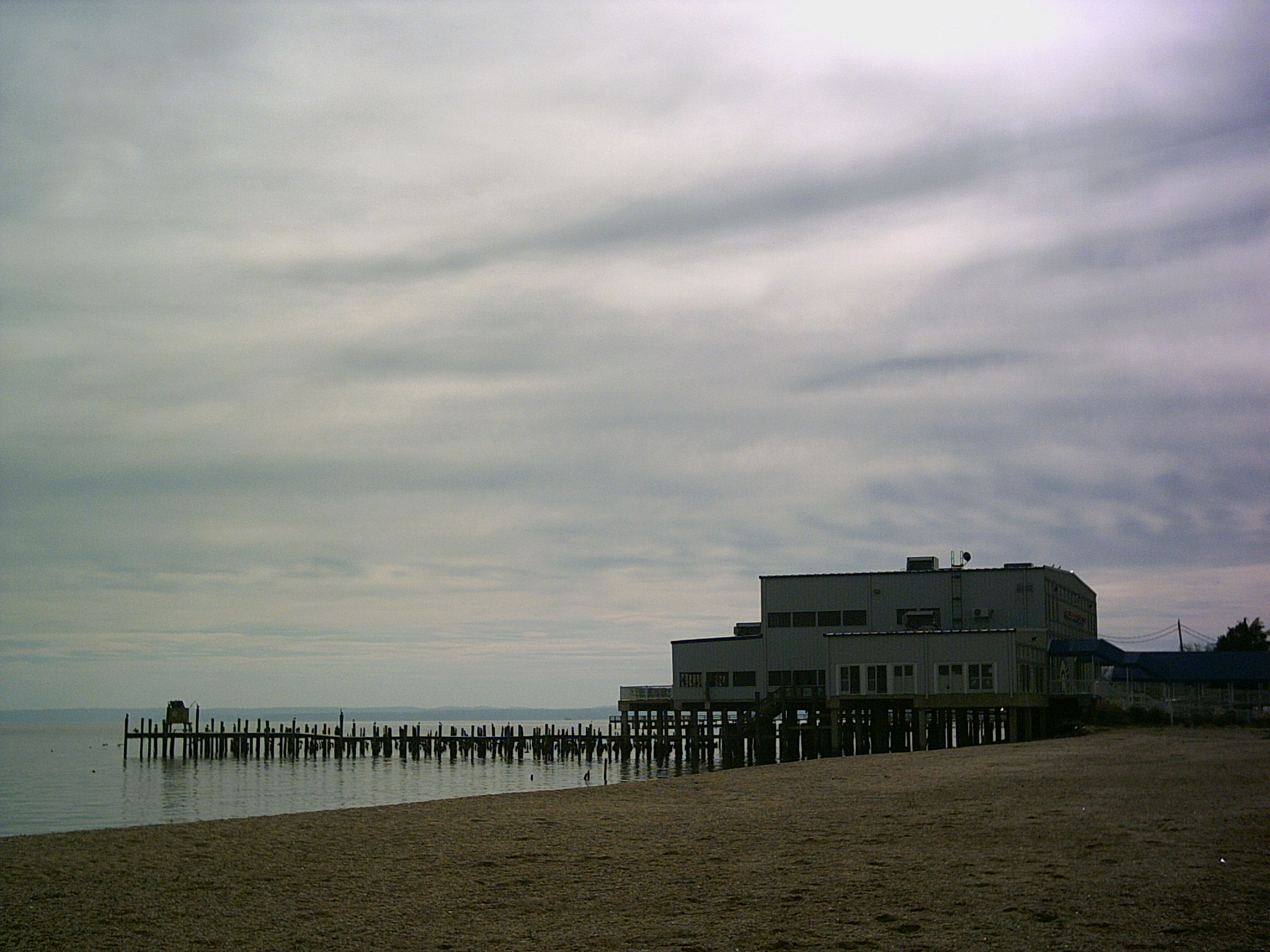
Colonial Beach, Virginia — Town — Pier and Riverboat Off Track Betting, Restaurant, and Lounge.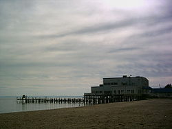
SealNickname(s): Golf Cart Town, Playground on the Potomac Location in the Commonwealth of Virginia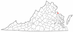
Coordinates: 38°15′14″N 76°58′8″W / 38.25389°N 76.96889°W Country United States State Virginia County Westmoreland Founded 1892 Area - Total 2.8 sq mi (7.4 km2) - Land 2.6 sq mi (6.7 km2) - Water 0.2 sq mi (0.6 km2) Elevation 120 ft (36 m) Population (2010) - Total 3,542 - Density 1,362.3/sq mi (528.7/km2) Time zone EST (UTC-5) - Summer (DST) EDT (UTC-4) ZIP code 22443 Area code(s) 804 FIPS code 51-18400[1] GNIS feature ID 1493549[2] Website http://www.colonialbeachva.net/ Colonial Beach is a town in Westmoreland County, Virginia, United States. The population was 3,228 at the 2000 census. Possessing the second largest beach front in the state, Colonial Beach was a popular resort town in the early to mid-20th century, before the Chesapeake Bay Bridge made ocean beaches on the Eastern Shore of Maryland more accessible to visitors from Washington, D.C. The family of Alexander Graham Bell maintained a summer home in Colonial Beach, the Bell House, which still stands today. Sloan Wilson, author of The Man in the Gray Flannel Suit, retired and died in Colonial Beach. George Washington, the first President of the United States, was born near here at what is now the George Washington Birthplace National Monument. As of 2011[update], the birthplace of President James Monroe now has a small monument to him. A museum is planned for the future.
Contents
History
The town was first settled in 1650 by Andrew Monroe, the great-great grandfather of President James Monroe, as Monrovia.[3]
Colonial Beach emerged as a bathing and fishing resort in the late 19th century known as the "Playground on the Potomac." Prior to automobile travel, most visitors arrived by boat from Washington, D.C.[4]
The town was incorporated on 25 February 1892 and there was extensive construction of houses, summer cottages, and, hotels. Arguably the most famous of these structures is the Alexander Graham Bell house which still stands on Irving Avenue as the Bell House Bed and Breakfast.[4]
The area was at the center of the Potomac River Oyster Wars between Virginia watermen and the Maryland State Oyster Police that lasted from the late 19th century to the 1960.[5]
The town began to gradually decline as the automobile made travel to more distant ocean beaches more feasible. However, because gambling was legal in Maryland and the Maryland state line ends at the low-water mark of Virginia's Potomac River shore, from 1949[6] to 1958,[7] Colonial Beach offered slot machines in pier casinos extending into Maryland waters. This temporarily revitalized the town although it was sometimes called "the poor man's Las Vegas."[5] However, the piers burned in the 1960s in a devastating fire and the town continued to decline.[4]
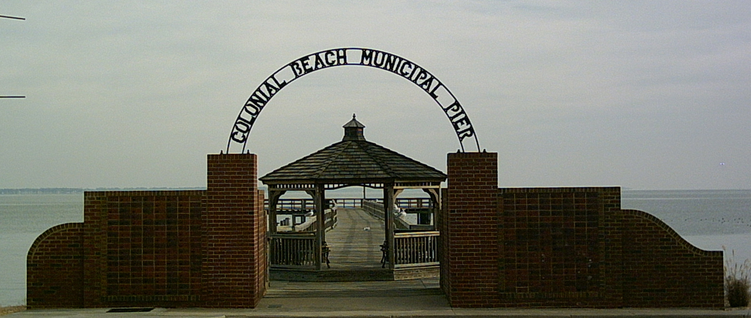
 Entrance to the Colonial Beach Municipal Pier
Colonial Beach has been devastated by several hurricanes including the 1933 Chesapeake Potomac hurricane which destroyed an amusement park and three "beer piers,"[8] Hurricane Hazel in 1954, and Hurricane Isabel in 2003.
Colonial Beach is also the home of the 2009 Group A Division 1 High School Basketball State Champions.[9]
Geography
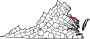
Colonial Beach is located at 38°15′14″N 76°58′8″W / 38.25389°N 76.96889°WCoordinates: 38°15′14″N 76°58′8″W / 38.25389°N 76.96889°W[10] in the northwestern part of Westmoreland County in Virginia's Northern Neck. It is aligned on a northwest-southeast axis along the shoreline of the Potomac River which bounds the town to the northeast. The southern part of the town forms a peninsula which ends just above Monroe Bay and divides Monroe Creek from the Potomac. Just to the north of town is the community of Potomac Beach and the mouth of Rosier Creek. Inland from Colonial Beach lie the settlements of Monroe Hall, near the birthplace of President James Monroe, and Maple Grove.
 Hotel in downtown Colonial Beach
According to the United States Census Bureau, the town has a total area of 2.8 square miles (7.3 km2), of which, 2.6 square miles (6.7 km2) of it is land and 0.2 square miles (0.52 km2) of it (8.80%) is water. The town's 2.5 miles (4.0 km) of beaches are second in length only to those of Virginia Beach in the Commonwealth of Virginia.
Transportation
Colonial Beach is served by Virginia State Route 205, a spur of which bisects the town as State Route 205Y (Colonial Avenue). The town is accessible by boat and is the last deepwater port for pleasure boats going north on the Potomac River.[11]
Demographics
As of the census[1] of 2000, there were 3,228 people, 1,437 households, and 863 families residing in the town. The population density was 1,246.7 /sq mi (481.4 /km2). There were 2,030 housing units at an average density of 784.0 /sq mi (302.7 /km2). The racial makeup of the town was 79.21% White, 16.95% African American, 0.09% Native American, 0.62% Asian, 1.64% from other races, and 1.49% from two or more races. Hispanic or Latino of any race were 3.38% of the population.
There were 1,437 households out of which 24.1% had children under the age of 18 living with them, 40.9% were married couples living together, 15.3% had a female householder with no husband present, and 39.9% were non-families. 34.9% of all households were made up of individuals and 18.2% had someone living alone who was 65 years of age or older. The average household size was 2.20 and the average family size was 2.77.
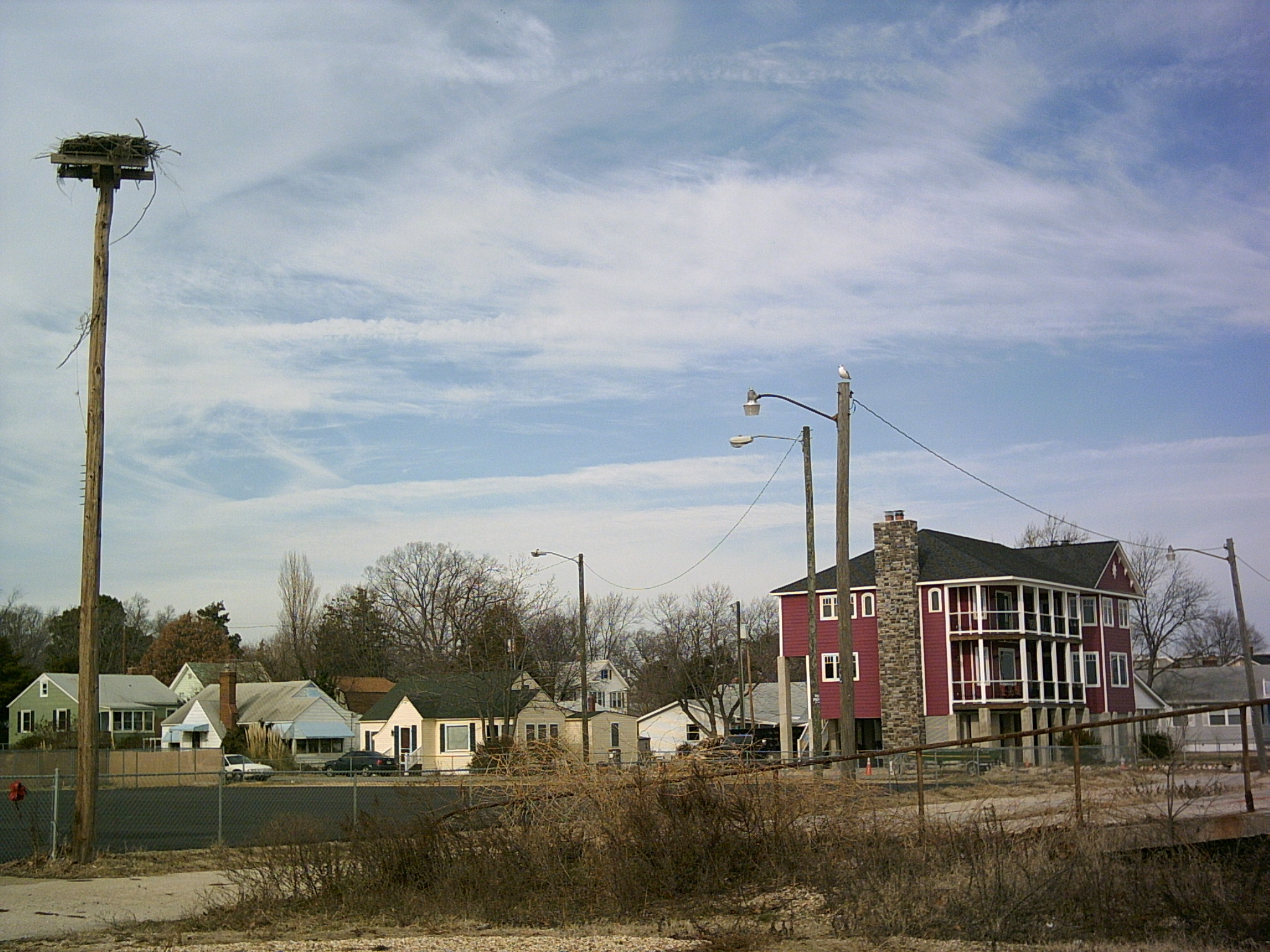
 Houses on the Colonial Beach waterfront
In the town the population was spread out with 22.0% under the age of 18, 6.3% from 18 to 24, 23.2% from 25 to 44, 26.0% from 45 to 64, and 22.5% who were 65 years of age or older. The median age was 44 years. For every 100 females there were 82.7 males. For every 100 females age 18 and over, there were 77.6 males.
The median income for a household in the town was $31,711, and the median income for a family was $38,080. Males had a median income of $30,000 versus $19,535 for females. The per capita income for the town was $19,991.20 About 23.0% of families and 25.4% of the population were below the poverty line, including 45.7% of those under age 18 and 16.6% of those age 65 or over.
Notes
- ^ a b "American FactFinder". United States Census Bureau. http://factfinder.census.gov. Retrieved 2008-01-31.
- ^ "US Board on Geographic Names". United States Geological Survey. 2007-10-25. http://geonames.usgs.gov. Retrieved 2008-01-31.
- ^ William J. Burnham, Mary K. Burnham, Bill Burnham. Rediscovering America: Exploring the Small Towns of Virginia and Maryland. Hunter Publishing, 2003. p. 140. ISBN 9781588433190
- ^ a b c Town of Colonial Beach: History at the official town website. Retrieved 5 November 2008.
- ^ a b William J. Burnham, Mary K. Burnham, Bill Burnham. Rediscovering America: Exploring the Small Towns of Virginia and Maryland. Hunter Publishing, 2003. p. 136. ISBN 9781588433190
- ^ "Slots on Piers Evade Law In Virginia." Washington Post. 23 July 1949.
- ^ "Supreme Court Refuses to Review Maryland Ban on Potomac Casinos." Washington Post. 25 February 1959.
- ^ These piers extended into Maryland's territorial waters and took advantage of that state's more liberal alcohol sales laws. William J. Burnham, Mary K. Burnham, Bill Burnham. Rediscovering America: Exploring the Small Towns of Virginia and Maryland. Hunter Publishing, 2003. p. 136. ISBN 9781588433190
- ^ http://www.vhsl.org/files/bkb-state-results-2009-d1-boys.pdf
- ^ "US Gazetteer files: 2010, 2000, and 1990". United States Census Bureau. 2011-02-12. http://www.census.gov/geo/www/gazetteer/gazette.html. Retrieved 2011-04-23.
- ^ William J. Burnham, Mary K. Burnham, Bill Burnham. Rediscovering America: Exploring the Small Towns of Virginia and Maryland. Hunter Publishing, 2003. p. 137. ISBN 9781588433190
External links
- Welcome to the Town of Colonial Beach
- Colonial Beach Chamber of Commerce
- Pictures of Hurricane Isabel damage.
Municipalities and communities of Westmoreland County, Virginia County seat: Montross Towns Colonial Beach | Montross
Unincorporated
communitiesAcorn | Baynesville | Bayside | Bryant Town | Bull Neck | Carys Corner | Chiltons | Chisford | Coles Point | Currioman Landing | East End | Erica | Flat Iron | Grays Corner | Griffiths Corner | Hague | Hinnom | Hogans Hill | Horners | Kinsale | Kremlin | Latanes | Laurel Grove | Leedstown | Leesville | Lerty | Machodoc | Maple Grove | Mattox Bridge | Meter | Monroe Hall | Mount Holly | Narrow Beach | Nash Town | Neenah | Nomini | Nomini Grove | Oak Grove | Oldhams | Onawmanient | Palmtown | Peeds | Pomona | Potomac Beach | Potomac Mills | Ragged Point Beach | Sandy Point | Smith Hill | Springfield | Stratford Hall | Stratford Mill | Templeman | Threeway | Tidwells | Tucker Hill | Wakefield Corner | Westmoreland | Wilberts Corner | Zacata
Categories:- Towns in Virginia
- Populated places in Westmoreland County, Virginia
- Populated places on the Potomac River
- Populated places established in 1892


Wikimedia Foundation. 2010.