- Oxfordshire Way
-
Oxfordshire Way 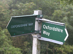
Length 68 miles (109 km) Location Oxfordshire (and Gloucestershire), England Trailheads Bourton-on-the-Water to Henley-on-Thames Use Hiking The Oxfordshire Way is a long-distance walk in Oxfordshire, England, with 6 miles in Gloucestershire and very short sections in Buckinghamshire. The path links with the Heart of England Way and the Thames Path.
The path runs for 68 miles (109 km) from Bourton-on-the-Water, Gloucestershire[1] to Henley-on-Thames[2]. It passes from the Cotswolds to the Chiltern Hills, with hilly sections towards each end and gentler country in the middle sections. It takes between 4 and 6 days to walk.
From Bourton-on-the-Water to Kirtlington the path forms part of European walking route E2.
Contents
Route
 Oxfordshire Way route map
From Bourton-on-the-Water the path passes through the villages of Wyck Rissington and Bledington, then follows the valley of the River Evenlode to Shipton-under-Wychwood, Ascott-under-Wychwood and the small town of Charlbury. It then passes through Stonesfield and follows Akeman Street for 6 miles, including a crossing of Blenheim Park. After crossing the Oxford Canal the path passes through Kirtlington and Weston-on-the-Green to Islip, the half way point.
From Islip the path runs by Noke, Beckley and the southern edge of Bernwood Forest to Waterperry. It then passes through Waterstock, Tiddington and Tetsworth. Across the M40 motorway it passes the small settlements of Adwell and Wheatfield, then after a glimpse of Shirburn Castle it reaches Pyrton.
From Pyrton the path crosses the Ridgeway National Trail, and climbs the Chiltern escarpment to Christmas Common. The remainder of the route is through the Chiltern beechwoods, passing Pishill, Maidensgrove, Bix Bottom and Middle Assendon to arrive at Henley.
Transport
Railway stations at Shipton-under-Wychwood and Charlbury (on the Cotswold Line), Islip and Henley-on-Thames are on the path. Bourton-on-the-Water can be reached by good bus services from railheads at Cheltenham and Moreton-in-Marsh.
References
- Oxfordshire County Council (2004) The Oxfordshire Way: a Walker's Guide ISBN 1 900478 01 3
External links
Categories:- Long-distance footpaths in England
- Geography of Oxfordshire
- Visitor attractions in Oxfordshire


Wikimedia Foundation. 2010.