- Bastrop, Texas
-
Bastrop, Texas — City — Main Street of Bastrop, Texas, featuring the small shops and old-fashioned architecture typical of rural towns Location of Bastrop, Texas
Coordinates: 30°6′43″N 97°19′1″W / 30.11194°N 97.31694°WCoordinates: 30°6′43″N 97°19′1″W / 30.11194°N 97.31694°W Country United States State Texas County Bastrop Area – Total 7.3 sq mi (18.9 km2) – Land 7.3 sq mi (18.8 km2) – Water 0.0 sq mi (0.1 km2) Elevation 367 ft (112 m) Population (2000) – Total 5,340 – Density 734.8/sq mi (283.7/km2) Time zone Central (CST) (UTC-6) – Summer (DST) CDT (UTC-5) ZIP code 78602 Area code(s) 512 FIPS code 48-05864[1] GNIS feature ID 1330128[2] Bastrop is a city and the county seat of Bastrop County, Texas, United States. Located about thirty miles southeast of Austin, it is part of the Greater Austin metropolitan area. The population was 5,340 at the 2000 census. By 2007, the city had an estimated population of 7,823, twice the population of the early 1970s.[3]
Contents
History
Spanish soldiers lived temporarily at the current site of Bastrop as early as 1804, when a fort was established where the Old San Antonio Road crossed the Colorado River and named Puesta del Colorado.
Bastrop's namesake, Felipe Enrique Neri, Baron de Bastrop was actually a commoner named Philip Hendrik Nering Bogel wanted for embezzlement in his native country of the Netherlands. In Texas, he assisted Moses and Stephen F. Austin in obtaining land grants in Texas, and he served as S.F. Austin's land commissioner.
In 1827, Stephen F. Austin located 100 families in an area adjacent to his earlier Mexican contracts. Austin arranged for Mexican officials to name a new town there after the baron who died the same year.
On June 8, 1832, the town was platted along conventional Mexican lines, with a square in the center and blocks set aside for public buildings and officially named Bastrop, but two years later the Coahuila y Texas legislature renamed it Mina in honor of Francisco Javier Mina, a Mexican martyr and hero. The town was incorporated under the laws of Texas on December 18, 1837, and the name changed back to Bastrop.
 Map of city in 1887
Overlooking the center of the town is the Lost Pines Forest. Composed of Loblolly Pine (Pinus taeda), the forest is the center of the westernmost stand of the southern pine forest. As the only timber available in the area, the forest contributed to the local economy. Bastrop began supplying Austin with lumber in 1839 and then San Antonio, the western Texas frontier, and into Mexico.
The first edition of The Bastrop Advertiser and County News (now just The Bastrop Advertiser) was published on March 1, 1853, giving it claim to being the oldest continuously published weekly (semi-weekly since September 5, 1977) in the state of Texas.
A fire in 1862 destroyed most of downtown Bastrop's commercial buildings and the county courthouse. Thus, most current downtown structures post date the Civil War.
In 1979, the National Register of Historic Places admitted 131 Bastrop buildings and sites to its listings. This earned Bastrop the title of the "Most Historic Small Town in Texas."
Geography
 The Colorado River of Texas at Bastrop Riverside Park
According to the United States Census Bureau, the city has a total area of 7.3 square miles (19 km2), of which, 7.3 square miles (19 km2) of it is land and 0.1 square miles (0.26 km2) of it is water. The total area is 0.68% water.
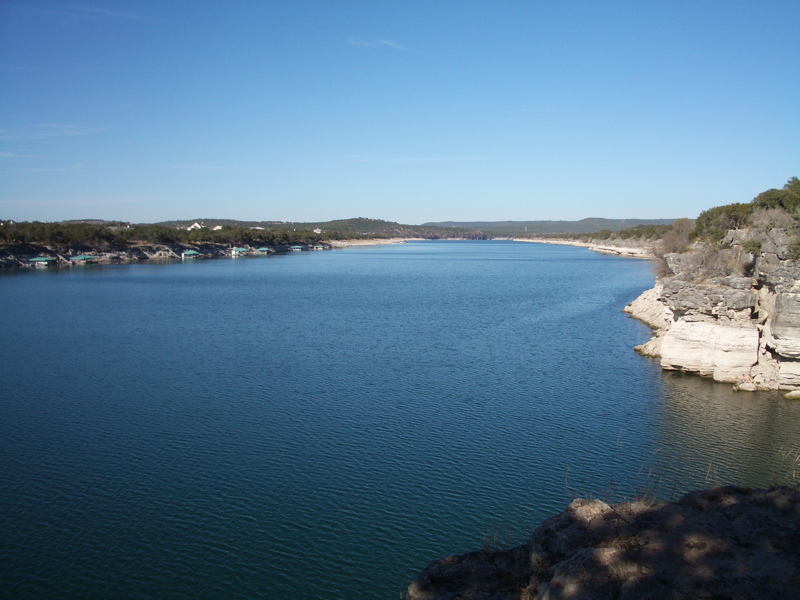
Three miles (5 km) northeast of the town, Lake Bastrop is a 906 acres (3.67 km2) reservoir operated by the Lower Colorado River Authority since its impounding in 1964. Although primarily used as a cooling pond for the Sim Gideon Power Plant, the lake is also used for recreation, and the LCRA maintains two public parks on the lake.
 Bastrop Christian Church is located adjacent to the municipal library.
 The Bastrop Library is located in the western end of the Historic District near the First Christian Church.
 Calvary Episcopal Church of Bastrop is in the Historic District.
 Ascension Catholic Church on Pine Street in Bastrop is across from the county courthouse.
Climate
Bastrop tends to be cooler than other central Texas cities, but can reach 100°F in the summer. The record is 113°F and the low is 0°F.
Climate data for Bastrop, Texas USA Month Jan Feb Mar Apr May Jun Jul Aug Sep Oct Nov Dec Year Record high °F (°C) 84
(29)95
(35)98
(37)102
(39)106
(41)105
(41)110
(43)113
(45)107
(42)101
(38)95
(35)88
(31)113
(45)Average high °F (°C) 52
(11)58
(14)64
(18)77
(25)80
(27)91
(33)96
(36)98
(37)95
(35)88
(31)75
(24)64
(18)86 Average low °F (°C) 42
(6)47
(8)55
(13)70
(21)73
(23)75
(24)76
(24)76
(24)71
(22)64
(18)46
(8)30
(−1)59 Record low °F (°C) 0
(−18)14
(−10)16
(−9)32
(0)47
(8)53
(12)56
(13)58
(14)44
(7)26
(−3)13
(−11)5
(−15)3
(−16)Precipitation inches (mm) 3.71
(94.2)6.65
(168.9)4.51
(114.6)7.2
(183)2.38
(60.5)1.46
(37.1)0.91
(23.1)0.08
(2)1.83
(46.5)3.22
(81.8)3.601
(91.5)6.60
(167.6)57.59
(1,462.8)Source: weather.com[4] Demographics
As of the census[1] of 2000, there are 5340 people in Bastrop, organized into 2034 households and 1336 families. The population density is 734.8 people per square mile (283.6/km2). There are 2,239 housing units at an average density of 308.1 per square mile (118.9/km2). The racial makeup of the city is 72.34% White, 17.00% African American, 0.99% Asian, 0.73% Native American, 0.00% Pacific Islander, 7.02% from other races, and 1.91% from two or more races. 17.75% of the population are Hispanic or Latino of any race.
There are 2,034 households out of which 32.8% have children under the age of 18 living with them, 46.6% are married couples living together, 15.3% have a female householder with no husband present, and 34.3% are non-families. 29.4% of all households are made up of individuals and 12.6% have someone living alone who is 65 years of age or older. The average household size is 2.46 and the average family size is 3.05.
In the city the population is spread out with 25.5% under the age of 18, 8.3% from 18 to 24, 29.6% from 25 to 44, 21.8% from 45 to 64, and 14.8% who are 65 years of age or older. The median age is 36 years. For every 100 females there are 97.0 males. For every 100 females age 18 and over, there are 91.2 males.
The median income for a household in the city is $40,212, and the median income for a family is $49,258. Males have a median income of $34,388 versus $27,582 for females. The per capita income for the city is $19,862. 11.7% of the population and 10.1% of families are below the poverty line. Out of the total population, 15.6% of those under the age of 18 and 13.6% of those 65 and older are living below the poverty line.
The 2006 census estimates the population of bastrop county at 71,684, a 24% growth from 2000 with a slightly lower poverty rate of 12.7% (2004). With the addition of new retail space in the town center anchored by Lowes and other planned housing development, the area is showing some growth, even with the credit and housing crunch (2008).
 Historic buildings with quaint shops and restaurants line Main Street in Bastrop.
 Roadhouse Restaurant on Texas State Highway 21 in Bastrop across from the entrance to Bastrop State Park
Economy
According to the Bastrop Economic Development Corporation as of 2004[update], the area's three largest employers are the Bastrop Independent school district, Wal-Mart, and the Bastrop County government. The Hyatt Regency Lost Pines Resort and Spa opened on June 2, 2006 and has given a huge boost to employment in the area.
Education
The Bastrop Independent School District serves Bastrop. Austin Community College conducts night and continuing education classes at the Bastrop High School.
Film industry
Several movies were at least partially filmed in Bastrop, including Lovin' Molly (1974), the original The Texas Chain Saw Massacre (1974), Home Fries (1998), Courage Under Fire (1996), and the 2004 remake of The Alamo. Projects not yet released include All The Boys Love Mandy Lane and Fireflies in the Garden, which was filmed in Bastrop in April 2007 starring Willem Dafoe and Julia Roberts. Recently, the remake of Friday the 13th was also partially filmed in Bastrop. Filmed in and near Bastrop: "The Life of David Gale" with Kevin Spacey & Kate Winslet; "Michael" 1996 With John Travolta, Andie MacDowell & William Hurt; "Hope Floats" 1998 With Sandra Bullock, Harry Connick Jr.; "True Women" 1998 (TV movie) with Angelina Jolie, Dana Delaney & Michael York; "The Tree of Life" 2010 with Brad Pitt & Sean Penn. "Bernie" 2010 with Jack Black, Shirley MacLaine & Matthew McConaughey. Also partially filmed near Bastrop on the Buck Steiner Ranch was "A Perfect World" with Kevin Costner, Clint Eastwood and Laura Dern.
Notable citizens
- Carolyn Banks, fiction writer
- Greenleaf Fisk (1807–1888), legislator in the Republic of Texas, Bastrop county chief justice, later moved to Brown County and became known as "The Father of Brownwood"
- Tom Phillips, Texas Supreme Court Chief Justice
- The Undertaker, WWE wrestler
2011 Fire
In September 2011 over 34,000 acres were destroyed by the Bastrop County Complex fire in and around Bastrop.
See also
- Bastrop State Park
- Colorado River Bridge at Bastrop
- Crocheron-McDowall House
- H. P. Luckett House
- Kerr Community Center
- List of Registered Historic Places in Bastrop County, Texas
- T. A. Hasler House
References
- ^ a b "American FactFinder". United States Census Bureau. http://factfinder.census.gov. Retrieved 2008-01-31.
- ^ "US Board on Geographic Names". United States Geological Survey. 2007-10-25. http://geonames.usgs.gov. Retrieved 2008-01-31.
- ^ Bastrop County Profile
- ^ "Monthly Averages for Muldoon, TX". http://www.weather.com/weather/wxclimatology/monthly/graph/USTX0928?from=36hr_bottomnav_undeclared. Retrieved 2009-09-10.
External links
- Bastrop's official website
- Handbook of Texas Online article
- Community information from a former City Council member
Municipalities and communities of Bastrop County, Texas County seat: BastropCities Bastrop | Elgin‡ | Mustang Ridge‡ | Smithville
CDPs Unincorporated
communitiesAlum Creek | Bateman | Butler | Cedar Creek | Clearwater | Colorado | Flower Hill | Humble Camp | Jeddo | Jorden | Kovar | McDade | Paige | Pettytown‡ | Pin Oak | Phelan | Red Rock | Rockne | Rosanky | Salem | Sayersville | String Prairie | Togo | Utley | Upton | Watterson | Willman
Ghost towns Grassyville | McDuff
Footnotes ‡This populated place also has portions in an adjacent county or counties
Austin–Round Rock–San Marcos Largest cities 
Other
communitiesBastrop · Buda · Burnet · Elgin · Hudson Bend · Hutto · Jollyville · Kyle · Lago Vista · Leander · Lakeway · Lockhart · Lost Creek · Luling · Marble Falls · Taylor · Smithville · Wells Branch · West Lake Hills · Wimberley · Windemere · WyldwoodCounties Parks and
preservesBalcones Canyonlands · Bastrop · Emma Long · Enchanted Rock · Hippie Hollow · Indiangrass · McKinney Falls · Mount Bonnell · Onion Creek · Pedernales Falls · John Stokes · Wild Basin · ZilkerGeography Bodies of
water State of Texas
Topics Architecture · Climate · Geography · Government · History · Languages · Literature · Sports · Texans · Transportation · Symbols · Visitor Attractions
Society Regions Ark‑La‑Tex · Big Bend · Blackland Prairies · Brazos Valley · Central Texas · Coastal Bend · Cross Timbers · Deep East Texas · East Texas · Edwards Plateau · Golden Triangle · Hill Country · Llano Estacado · Northeast Texas · North Texas · Osage Plains · Panhandle · Permian Basin · Piney Woods · Rio Grande Valley · Southeast Texas · South Plains · South Texas · Trans-Pecos · West Texas
Metropolitan
areasAbilene · Amarillo · Austin–Round Rock–San Marcos · Beaumont–Port Arthur · Brownsville–Harlingen · College Station–Bryan · Corpus Christi · Dallas–Fort Worth–Arlington · El Paso · Houston–Sugar Land–Baytown · Killeen–Temple–Fort Hood · Laredo · Longview · Lubbock · McAllen–Edinburg–Mission · Midland · Odessa · San Angelo · San Antonio–New Braunfels · Sherman–Denison · Texarkana · Tyler · Victoria · Waco · Wichita Falls
Counties See: Table of Texas counties or List
Categories:- Cities in Texas
- Populated places in Bastrop County, Texas
- County seats in Texas
- Austin – Round Rock metropolitan area


Wikimedia Foundation. 2010.