- Mount Namuli
-
Mount Namuli 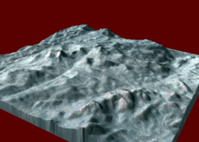
Mount Namuli - Landsat7Elevation 2,419 m (7,936 ft) Location Location Mozambique Coordinates 15°22′S 37°02′E / 15.367°S 37.033°E Mount Namuli is the highest peak in the Zambezia Province of Mozambique. With 2,419 metre it is the second highest mountain of Mozambique behind the Monte Binga. The Namuli massif consists of a level plateau which rises 700 to 800 metre. The granite dome of the Namuli rises 1,600 metre above the plateau. The area above 1,200 metre measures 50 x 30 km. Mount Namuli is located 12 km north-east of Gurué and about 160 km from the Mulanje Massif in south-eastern Malawi.
The forests of Mount Namuli are an important biodiversity hotspot which means that they have a high biodiversity rate of threatened animals and plant taxa. Species like the Namuli apalis (Apalis lynesi) and the Vincent's Bush Squirrel (Paraxerus vincenti) are endemic to Mount Namuli. Other rare species are the Thyolo Alethe (Alethe choloensis) and the Dapple-throat (Modulatrix orostruthus) which occur elsewhere too.
The lower slopes of Mount Namuli are dominated by tea plantations. The middle slopes are agrarian oriented. Indigenous forests are confined to corridors along stream courses. The nearest town is Gurúè which is the largest tea estate of Mozambique.
Mount Namuli was discovered in August 1886 by Henry Edward O'Neill who was the British consul in Mozambique in 1879. It became notable in ornithological circles for the expedition by Hubert Lynes and Jack Vincent in 1931/1932. Due to the Mozambican Civil War and poor road access, it was not until 1998 when a South African team of ornithologists were able to explore the forests of Mount Namuli.
References
- The birds of Namuli, northern Mozambique: retracing Vincent's footsteps
- New records of Ficus (Moraceae) species emphasize the conservation significance of inselbergs in Mozambique PDF, online
- Jack Vincent: The Namuli Mountains, Portuguese East Africa In: The Geographical Journal, Vol. 81, No. 4 (Apr., 1933), p. 314-327
Categories:- Mountains of Mozambique
- Mozambique geography stubs

Wikimedia Foundation. 2010.