- Green Line "D" Branch
-
Green Line "D" Branch
Riverside Branch
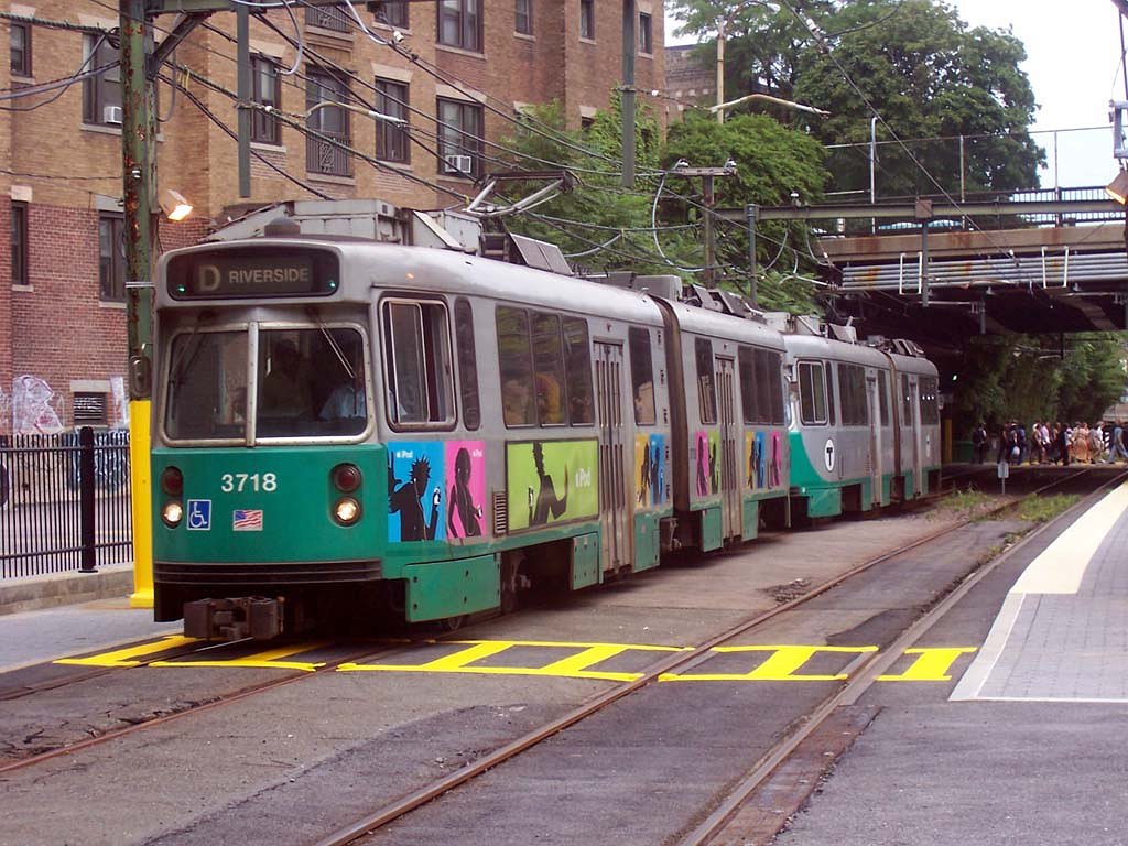
MBTA Green Line "D" Type 7 train leaving the Fenway station for Riverside.Overview Type Light rail System Green Line Locale Greater Boston Termini Government Center
RiversideStations 20 Daily ridership 20,960 (1995 typical weekday, surface boardings only)[1] Operation Opened July 4, 1959 Owner MBTA Operator(s) MBTA Character Underground (Kenmore and eastward)
Grade-separated ROW (west of Kenmore)Rolling stock Kinki Sharyo Type 7
Ansaldobreda Type 8Technical Track gauge 4 ft 8 1⁄2 in (1,435 mm) Route map Legend

"C" and "E" branches 

Government Center 
Park Street 
Boylston Arlington Copley 

"E" branch Hynes Convention Center Kenmore 


Fenway Incline 

"B" and "C" branches 
Fenway 
Longwood Brookline Village Brookline Hills Beaconsfield "C" branch 

Reservoir 
Chestnut Hill Newton Center Newton Highlands Eliot Waban Woodland 
Riverside The "D" Branch, also called the Highland Branch or Riverside Branch, is a branch of the Massachusetts Bay Transportation Authority Green Line in the Boston, Massachusetts area, along which light rail vehicles run. The majority of the line is a grade-separated right-of-way formerly used by the Highland Branch of the Boston and Albany Railroad. Just west of Kenmore, the two-track line goes underground via the Fenway Incline, merging with the "B" and "C" Branches at Kenmore. From there, "D" trains continue through the Boylston Street Subway and Tremont Street Subway (merging with the "E" Branch along the way), with regular service turning around at Government Center as of May 2008[update].
The "D" Branch is the most recent light rail service in the Boston area, opening in 1959. The Newton Center and Newton Highlands stations still feature classic station houses from the late 19th century. The Newton Center station was renovated into shops in the 1980s, but the Newton Highlands station is not actively used.
Contents
History
In short, opening dates for the different sections were:
- 1847 Kenmore–Brookline Village
- Summer 1852 Brookline Village–Cook Street Junction
- 1886 Cook Street Junction–Riverside
Boston and Albany Railroad service ended on May 31, 1958, and MBTA operations began July 4, 1959.
The earliest part of the line to be built was the Brookline Branch of the Boston and Worcester Railroad, which opened in 1847. It stretched 1.55 miles (2.50 km) from the B&W main line south of Kenmore Square southwest to the current location of Brookline Village station. The B&W became part of the Boston and Albany Railroad in 1867.
Next came the Charles River Branch Railroad, opened Summer 1852 from the end of the Brookline Branch to Newton Upper Falls. The line was at first operated by the Boston and Worcester, but in 1856 it was merged into the New York and Boston Railroad (having been merged with the Charles River Railroad in 1853), a company intending to build a new route between Boston and New York City in competition with the Boston and New York Central Railroad. Both of these companies passed through several changes in name and ownership before they merged in 1868 to form the Boston, Hartford and Erie Railroad. The BH&E became the New York and New England Railroad in 1873 and the New England Railroad in 1895 before being leased by the New York, New Haven and Hartford Railroad in 1898.
In 1884, the Boston and Albany Railroad built a connecting line from Riverside on their main line southeast to what became Cook Street Junction on the NY&NE in Newton Highlands. The NY&NE had been sold to the B&A in 1882 north of the junction, giving the B&A full ownership of their Highland Branch. The B&A instituted loop service ("Newton Circuit"), going one way to Riverside on the main line and the other way on the Highland Branch; the NY&NE continued to use the branch as well.
In 1906 the New York, New Haven and Hartford Railroad built a new cutoff from Needham Junction east to their Dedham Branch at West Roxbury, and began routing NY&NE trains that way. However, in 1911, they too began running loop service on the "Needham Circuit", running one way on the old Boston and Providence Railroad to West Roxbury and the other way on the B&A Highland Branch.
NYNH&H service through Newton stopped in 1925, and the last B&A train ran over the Highland Branch on May 31, 1958. The east end was connected via the new Fenway Incline to the existing Boylston Street Subway at Kenmore, and streetcar operations began July 4, 1959 (at first by the Metropolitan Transit Authority until the MBTA took over in 1964). Service ran to Riverside, a bit south of the old turnback onto the main line towards Boston. Because of budget cuts, the new fleet for the new Riverside Line service could not be purchased, and therefore MTA Director Edward Dana decided to terminate streetcar service on the Waverley and Watertown Square streetcar lines to provide the fleet for the Riverside Line. The Watertown, Waverley and North Cambridge lines were converted to trackless trolley. No passenger connection for Riverside has been provided to the old main line, now the MBTA Commuter Rail Framingham/Worcester Line, and the nearest commuter rail station is in the Newton village of Auburndale, about half a mile away. Passenger service to the Riverside station on that line was ended in the 1970s, although a pedestrian underpass and platform still exist in very poor condition. The track from the D line to the Boston and Albany main were severed and overgrown until, to facilitate the delivery of new light rail vehicles in the 1990s, they were rebuilt and have since been maintained, although they are not used for any regular service. Special commuter rail trains did run to South Station from a temporary platform near the Riverside station from October 23–25, 1996, after extensive flooding in the Boston area forced much of the underground portion of the Green Line to shut down.[2]
The MBTA takes over
The first operating pattern was for Highland Branch streetcars to turn around at Park Street. At first, some trains operated on short-turn service, turning around at Reservoir via a grade-separated turnaround loop. Ridership beyond Reservoir was higher than expected and soon after service began, short turning was discontinued.
By August 1964, when the MBTA took over, service on the branch (numbered 4) was extended on all days but Sundays to Lechmere. Sunday service was extended September 10, 1966.
Letters were assigned in 1967, and the 4 Riverside-Lechmere became the D Riverside.
The following changes in eastern terminal have been made:
- March 25, 1974: cut back from Lechmere to North Station (swapped with Green Line "B" Branch)
- June 26, 1976: cut back to Government Center due to construction at North Station
- September 11, 1976: extended to North Station (Canal St. loop terminal).
The MBTA's first Boeing light rail vehicles operated on the "D" Branch on December 30, 1976, and turned around at Park Street or Government Center due to the North Station loop not being wired for LRVs.
- January 1, 1977: extended to Lechmere weekdays, cut back to Government Center weekends
- March 19, 1977: cut back to Government Center always
- June 18, 1977: extended to Lechmere
- September 9, 1977: cut back to Government Center
- December 15, 1977: extended to the North Station terminal, reconfigured with stub end tracks; any PCC cars were looped at Government Center
Use of PCC cars on the "D" line officially ended March 23, 1978, however later LRV shortages every once in awhile saw a return of PCC cars.
- March 21, 1980: extended to Lechmere
- June 21, 1980: cut back to North Station
- April 4, 1981: extended to Lechmere
- January 2, 1983: cut back to Government Center rush hours and middays
- March 26, 1983: extended to Lechmere rush hours, midday and some rush hour "D" trains continue to loop at Government Center
- January 20, 1984 to shortly after: cut back to Government Center rush hours due to North Station on the MBTA Commuter Rail being closed due to a bridge fire, and all rush hour Lechmere service being provided by a shuttle to Government Center
- June 20, 1987: cut back to Government Center always
- March 28, 1997: extended to Lechmere weekends, due to North Station turnback facility being permanently closed
- June 21, 1997: extended to Lechmere always
- June 28, 2004: cut back to Government Center, due to the line north of North Station being closed
- November 12, 2005: Lechmere viaduct reopens, however D line service is not re-extended.
- November, 2006: Service during off-peak hours (except for LRV trains) extended to North Station.
In addition, the following construction-related changes have been made to the Newton and Brookline section of the line (in addition, the line has seen temporary bustitution on some nights and weekends for construction):
- September 8, 1974 until December 28, 1974: Service cut back to Newton Highlands with a temporary turning loop built beyond this station for use while the rest of the line to Riverside was rebuilt (as the original tracks had been hastily refurbished and could not handle new, LRV cars).
- mid-June to mid-September, 1974, service was eliminated between Reservoir and Kenmore for track reconstruction. A rather ingeniously placed, at grade, inbound to outbound turning loop was built in the Cleveland Circle-Reservoir yard. This was used by both inbound and outbound cars to access the existing grade separated short turn loop which also connected to Beacon Street and its subway connection, eliminating the need for passengers to make transfers. (Since this time the track has been rebuilt with crossovers and a relocated ramp out to Beacon St. and the temporary Reservoir via Beacon St. to the subway routing can be repeated with cars, now all double ended, changing ends just east of Reservoir. This routing has not always been exploited; a bus shuttle from Reservoir to Kenmore or Fenway has been used on several occasions.)
- September 13, 1974 until September 29, 1975: Full service to Riverside was provided, but with single-track service operated in selected portions of the run between Newton Highlands and Reservoir to facilitate track rebuilding.[3]
- June 23 until August 3, 2007: Service replaced by shuttle buses between Riverside and Reservoir for upgrading of track and facilities. Travelers reported delays of 15 to 30 minutes.[4] The work was originally planned for evenings and overnights, but the loud noises in the residential neighborhoods through which the line passes angered neighbors. The work will allow low-floor, handicap-accessible Breda cars to operate at high speeds on the D Line, and will increase the speed on the entire line to 50 mph. The line was not fully out of service, and was used for non-revenue moves to the car shops at Riverside. In addition, full service operated on the July 4 holiday to handle crowds attending the annual concert and fireworks display.[4]
- August 4 until August 31, 2007: Service was replaced by shuttle buses between Reservoir and Fenway for upgrading of track and facilities.[4] Extra service is planned on both lines.
- Timeline of the extent of "D" service

May 2008 Accident
Main article: Newton, Massachusetts rail accidentOn May 28, 2008, just after 6pm, two trains collided between Woodland and Waban stations, behind 56 Dorset Road.[5] MBTA spokesman Joe Pesaturo says there are multiple injuries. The driver of the rear train, Terrese Edmonds, was trapped by the collision and died.[6] One passenger was airlifted to a local hospital.[7] An investigation by the National Transportation Safety Board is underway.
Station listing
Station Location Time to Park Street[8] Opened Transfers and notes  Fenway
Park Drive near The Fenway, Boston 16 minutes July 4, 1959 The only station added by the MBTA
47 Bus to Central Square/Broadway & CT2 To Sullivan/Ruggles LongwoodChapel Street at Longwood Street, Boston/Brookline border 18 minutes July 4, 1959 Recommended stop for Longwood medical district Brookline VillageStation Street off Harvard Street between Route 9 and Washington Street, Brookline 20 minutes July 4, 1959 within walking distance of Riverway Station
was Brookline as a B&A station Brookline HillsCypress Street at Tappan Street, Brookline 22 minutes July 4, 1959 near Brookline High School Beaconsfield Dean Road south of Beacon Street, Brookline 25 minutes July 4, 1959 no MBTA parking ReservoirCleveland Circle near Chestnut Hill Avenue and Beacon Street, Brookline/Brighton 27 minutes July 4, 1959 within walking distance of Chestnut Hill Avenue station and Cleveland Circle station
transfer to Boston College shuttle bus (Sept-May)
Bus connections: 51, 86Chestnut Hill Hammond Street at Boylston Street, Newton 30 minutes July 4, 1959 within walking distance of Boston College Newton CenterUnion Street between Herrick Street and Langley Road, Newton 32 minutes July 4, 1959 near Newton Center shopping district
52 Bus to Dedham MallNewton Highlands Lincoln Street at Walnut Street, Newton 34 minutes July 4, 1959 near Newton Highlands shopping district
59 Bus to Needham JunctionEliot Route 9 near Woodward Street, Newton 37 minutes July 4, 1959 MBTA parking available Waban Beacon Street at Waban Square, Newton 40 minutes July 4, 1959 MBTA parking available WoodlandWashington Street northeast of Beacon Street, Newton 42 minutes July 4, 1959 near Newton-Wellesley Hospital
MBTA parking (garage) available RiversideGrove Street south of Commonwealth Avenue, exit 22 off Interstate 95, named for the Charles River 44 minutes July 4, 1959 was originally further north, at the junction with the B&A main line (MBTA Commuter Rail Framingham/Worcester Line)
MBTA parking lots availableReferences
- ^ http://www.bostonmpo.org/bostonmpo/resources/CMS/Entrances.pdf
- ^ http://members.aol.com/netransit8/flood/flood.html
- ^ http://blogs.townonline.com/newton/wp-content/uploads/2007/07/riverside-rebuilds-red-size.pdf
- ^ a b c On D line, A for effort, D for delay - The Boston Globe
- ^ Trolley operator dies after collision in Newton - Local News Updates - The Boston Globe
- ^ Trolley operator dies after collision in Newton - Local News Updates - The Boston Globe
- ^ Several hurt as 2 T trains collide in Newton - BostonHerald.com
- ^ Association for Public Transportation, Car-Free in Boston, A Guide for Locals and Visitors, 10th ed. (2003), p. 117.
- Changes to Transit Service in the MBTA district (PDF)
- History of the Railways of Massachusetts
- Ronald Dale Karr (1994) The Rail Lines of Southern New England: A Handbook of Railroad History. Branch Line Press. ISBN 0-942147-02-2
- Kenneth W. Newcomb, The Makers of the Mold
- Railroad History Database
External links
- MBTA.com - Green Line "D" Branch station listing & street map
- History of Newton Highlands - Includes photos of old railway stations
Categories:- Green Line (MBTA)
- Boston and Albany Railroad lines
- Rail infrastructure in Massachusetts
- Railway lines opened in 1959
Wikimedia Foundation. 2010.