- Meshoppen, Pennsylvania
-
Borough of Meshoppen Borough Country United States State Pennsylvania County Wyoming Elevation 623 ft (189.9 m) Coordinates 41°36′53″N 76°02′47″W / 41.61472°N 76.04639°W Area 0.7 sq mi (1.8 km2) - land 0.7 sq mi (2 km2) - water 0.0 sq mi (0 km2), 0% Population 459 (2000) Density 642.7 / sq mi (248.1 / km2) Mayor Floyd Newhart Timezone EST (UTC-5) - summer (DST) EDT (UTC-4) Area code 570 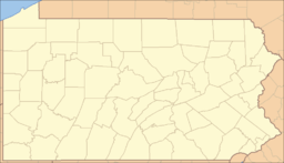
 Location of Meshoppen in Pennsylvania
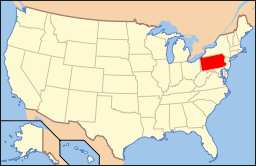 Location of Pennsylvania in the United States
Website: www.meshoppen.com Meshoppen is a borough in Wyoming County, Pennsylvania, United States. The population was 459 at the 2000 census.
Contents
Geography
Meshoppen is located at 41°36′53″N 76°2′47″W / 41.61472°N 76.04639°W (41.614691, -76.046276)[1].
According to the United States Census Bureau, the borough has a total area of 0.7 square miles (1.8 km2), all of it land.
Demographics
As of the census[2] of 2000, there were 459 people, 175 households, and 113 families residing in the borough. The population density was 642.7 people per square mile (249.6/km²). There were 209 housing units at an average density of 292.6 per square mile (113.7/km²). The racial makeup of the borough was 99.35% White, 0.22% Native American, 0.22% from other races, and 0.22% from two or more races. Hispanic or Latino of any race were 0.22% of the population.
There were 175 households out of which 38.9% had children under the age of 18 living with them, 37.7% were married couples living together, 19.4% had a female householder with no husband present, and 34.9% were non-families. 27.4% of all households were made up of individuals and 10.3% had someone living alone who was 65 years of age or older. The average household size was 2.62 and the average family size was 3.19.
In the borough the population was spread out with 34.9% under the age of 18, 9.2% from 18 to 24, 28.8% from 25 to 44, 17.9% from 45 to 64, and 9.4% who were 65 years of age or older. The median age was 29 years. For every 100 females there were 90.5 males. For every 100 females age 18 and over, there were 85.7 males.
The median income for a household in the borough was $26,324, and the median income for a family was $26,375. Males had a median income of $26,161 versus $15,714 for females. The per capita income for the borough was $13,408. About 16.3% of families and 20.2% of the population were below the poverty line, including 34.8% of those under age 18 and 15.8% of those age 65 or over.
References
- ^ "US Gazetteer files: 2010, 2000, and 1990". United States Census Bureau. 2011-02-12. http://www.census.gov/geo/www/gazetteer/gazette.html. Retrieved 2011-04-23.
- ^ "American FactFinder". United States Census Bureau. http://factfinder.census.gov. Retrieved 2008-01-31.
External links
Municipalities and communities of Wyoming County, Pennsylvania Boroughs Factoryville | Laceyville | Meshoppen | Nicholson | Tunkhannock

Townships Braintrim | Clinton | Eaton | Exeter | Falls | Forkston | Lemon | Mehoopany | Meshoppen | Monroe | Nicholson | North Branch | Northmoreland | Noxen | Overfield | Tunkhannock | Washington | Windham
Categories:- Populated places established in 1775
- Boroughs in Wyoming County, Pennsylvania


Wikimedia Foundation. 2010.