- North Wales, Pennsylvania
-
Borough of North Wales Borough Country United States State Pennsylvania County Montgomery Elevation 400 ft (121.9 m) Coordinates 40°12′39″N 75°16′30″W / 40.21083°N 75.275°W Area 0.6 sq mi (1.6 km2) - land 0.6 sq mi (2 km2) - water 0.0 sq mi (0 km2), 0% Population 3,229 (2010) Density 5,848.7 / sq mi (2,258.2 / km2) Incorporated 1869 Government Council-manager Mayor Douglas Ross Timezone EST (UTC-5) - summer (DST) EDT (UTC-4) ZIP Code 19454 Area code 215  Location of North Wales in Montgomery County
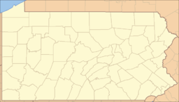
 Location of North Wales in Pennsylvania
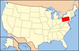 Location of Pennsylvania in the United States
Website: http://www.northwalesborough.org North Wales is a borough in Montgomery County, Pennsylvania, United States. It is a suburb of Philadelphia, Pennsylvania, and is one of the three historic population centers that make up the North Penn Valley. The population was 3,229 at the 2010 census.
Like many small boroughs in Pennsylvania, North Wales is at "build out", meaning that its boundaries have not kept up with population growth. Summarily, many businesses and residences with North Wales addresses are located in outlying townships that were never annexed by the borough, such as the Montgomery Mall in Montgomery Township. North Wales is in the North Penn School District.
Contents
Location
North Wales is located at 40°12′39″N 75°16′30″W / 40.21083°N 75.275°W (40.210703, -75.274994)[1].
According to the United States Census Bureau, the borough has a total area of 0.6 square miles (1.6 km2), all of it land.
History
As its name suggests, North Wales was settled by Welsh immigrants who named it after North Wales in Wales. (For more on Welsh settlements in colonial Pennsylvania, see "Welsh Tract".) Part of a 1702 William Penn land grant, this rich farming country was given the name "Gwynedd" for the homeland of the earliest settlers and it began as a pastoral village in agricultural Gwynedd Township.
Before 1850, a number of farms, plus a 1776 church, shared by the Lutheran and Reformed congregations, dotted the present borough's landscape. What is now Main Street was originally an old Indian trail, and was laid out as the Great Road in 1728. By 1828, it had become today's Sumneytown Pike, and was a toll road until 1914. It had always been an important route to Philadelphia, and continues to serve as a connection to Routes 202 and 309 to the east and the Northeastern Extension of the Pennsylvania Turnpike to the west.
Its rural character was abruptly disrupted by the building of the North Pennsylvania Railroad starting in 1852. Service from Bethlehem to Philadelphia through North Wales began in 1857. The town quickly grew around the railroad station, with hotels and restaurants lining Walnut Street and Main Street within walking distance. North Wales is the oldest of the North Penn boroughs, incorporated in 1869, by taking land from today's Upper Gwynedd Township, then the northern portion of Gwynedd Township.
Some of the large homes at the start of the 20th century were opened to summer guests from the city. "Idlewilde", still present on Main Street, hosted the Emperor of Brazil, Dom Pedro II, when he was visiting Philadelphia to open the 1876 U.S. Centennial Exhibition with President Ulysses S. Grant.
During the late 19th and early 20th century, much of North Wales borough's housing was built. Most houses along South Main Street between Montgomery and Prospects Streets remain much as they were when built and are lovingly maintained. The borough also features a variety of single family homes, as well as twins, and rowhomes.
Between 1900 and 1926, Lehigh Valley Transit Company operated its Chestnut Hill Branch trolley line, which connected North Wales to surrounding towns through service to either Philadelphia or Allentown. The trolley ran down Main Street through the borough, but detoured onto Pennsylvania Avenue for two blocks to enable it to cross the North Penn Railroad on a bridge. The bridge was required because the railroad, citing safety concerns, refused to allow the trolleys to cross at the Main Street grade crossing. Lehigh Valley Transit Company's combined passenger/freight station was located on the north (east) side of Pennsylvania Avenue between Shearer Street and Montgomery Avenue. After Main Street trolley service ended in 1926, Lehigh Valley Transit high-speed trolleys continued to serve the Wales Junction station, located on Sumneytown Pike three-quarters of a mile west of town. High-speed trolley serviced ended in September 1951.
Passenger rail service to North Wales is currently provided by SEPTA. Many North Wales residents commute to Center City, Philadelphia by the Lansdale/Doylestown Line train. The 1870s-vintage brick railroad station, thoroughly restored in 2010, is open weekdays from 5 a.m. to 1 p.m.
In 2000, the North Wales Historic Preservation District was established by Borough Council and the Pennsylvania Historic and Museum Commission to protect the architecture that is a visual reminder of the borough's past. It is the first Historic District in the North Penn boroughs.
Business District
North Wales' Main and Walnut Streets have been home to many businesses over the town's history and these two thoroughfares still serve the community today by providing a number of basic services such as one Tae Kwon Do school, two banks, a variety of hair salons and beauty parlors, a pharmacy, doctors' offices, a dry cleaner, a running and walking shoe specialty store, a yoga studio, two auto repair facilities, two auto body shops, two laundromats, a post office, convenience store, and a custom cabinetry shop, among many others. Eateries and bars include two pizza parlors a tex-mex restaurant, two cafes and two bakeries.
Community Outreach
The borough houses the headquarters for the Montgomery County Association for the Blind, as well as the non-profit organization The Lamb Foundation, which provides housing and life skills support to the area's mentally-challenged residents. The Lamb Foundation also runs a consignment/second hand shop, Sweet Repeats, located on South 5th St. near the North Wales train station. The borough also is home to the Boy Scouts of America Pack/Troop 84, whose meeting place is located at Second and Church Streets.
Schools & Library
The borough is home to North Wales Elementary School, which is part of the North Penn School District. The school formerly housed the North Wales Memorial Free Library from 1927 to 2009. Due to the growing number of students at school, as well as the Library's need for more space, the library has purchased and recently relocated to a much larger (10,000 ft2, over 900 m2) building at 233 South Swartley Street. They began operating with limited hours at the new location on January 4, 2010, and had their grand opening in April 2010. The library has also changed its name to "North Wales Area Library" upon its move. The borough is also home to St. Rose of Lima Catholic School.
Parks & Recreation
Weingartner Park is located at Second and Summit Streets with a large variety of trees. There are many pathways and benches to enjoy and the park is particularly shady and breezy during the spring and summer months.
The Wee Walers park is on Shearer St. and it is a playground developed for children ages 2 to 10.
Second Street Park, located at Second Street & Prospect Avenue, is a tennis court area open to the public seven days a week, closing at dusk.
Ninth Street Park, located at Ninth & Church Streets is a watershed runoff area designed to attract birds. There is a trail that goes through park with footbridge over the drainage area and is a nice natural-feeling area.
The Fourth Street Park is an approximately 11,000-square-foot (1,000 m2) open area used for various sporting activities. The clay totem poles were made by residents.
Eighth Street Park, also known as "A Child's Garden," was developed by local children. It has a brick walking path, plantings and benches.
Demographics
Historical populations Census Pop. %± 1930 2,393 — 1940 2,450 2.4% 1950 2,998 22.4% 1960 3,673 22.5% 1970 3,911 6.5% 1980 3,391 −13.3% 1990 3,802 12.1% 2000 3,342 −12.1% 2010 3,229 −3.4% www.dvrpc.org/data/databull/rdb/db82/appedixa.xls. As of the 2010 census, the borough was 87.7% White, 5.1% Black or African American, 0.1% Native American, 2.5% Asian, and 3.5% were two or more races. 3.8% of the population were of Hispanic or Latino ancestry [1].
As of the census[2] of 2000, there were 3,342 people, 1,299 households, and 869 families residing in the borough. The population density was 5,848.7 people per square mile (2,263.8/km²). There were 1,330 housing units at an average density of 2,327.6 per square mile (900.9/km²). The racial makeup of the borough was 90.31% White, 4.82% African American, 0.06% Native American, 2.09% Asian, 0.18% Pacific Islander, 0.78% from other races, and 1.77% from two or more races. Hispanic or Latino of any race were 1.50% of the population.
There were 1,299 households out of which 34.6% had children under the age of 18 living with them, 53.9% were married couples living together, 9.1% had a female householder with no husband present, and 33.1% were non-families. 27.8% of all households were made up of individuals and 8.8% had someone living alone who was 65 years of age or older. The average household size was 2.56 and the average family size was 3.18.
In the borough the population was spread out with 26.8% under the age of 18, 7.4% from 18 to 24, 33.7% from 25 to 44, 21.7% from 45 to 64, and 10.4% who were 65 years of age or older. The median age was 36 years. For every 100 females there were 99.4 males. For every 100 females age 18 and over, there were 95.9 males.
The median income for a household in the borough was $54,605, and the median income for a family was $63,235. Males had a median income of $41,265 versus $33,045 for females. The per capita income for the borough was $26,590. About 3.2% of families and 4.7% of the population were below the poverty line, including 8.0% of those under age 18 and 4.0% of those age 65 or over.
Government
North Wales has a borough form of government with a mayor and a nine-member borough council. The mayor is Doug Ross and the President of Council is Michael McDonald.
The borough is part of the Thirteenth Congressional District (represented by Rep. Allyson Schwartz), the 61st State House District (represented by State Representative Kate Harper) and the 12th State Senate District (represented by State Senator Stewart Greenleaf).
Police
The North Wales Police Department, headed by Chief Barry J. Hackert, has four full time and four part-time officers.
One officer is assigned to the Montgomery County D.U.I. Task Force. This officer along with officers from surrounding departments participates in DUI road check points and DUI roving patrols in our community.
Three officers are Special Agents for the Montgomery County Drug Task Force.
One officer is assigned to the Montgomery County Tobacco Compliance program. This program monitors sales of tobacco and meets with local merchants concerning sales to minors.
One officer is part of the Community Action Team for Domestic Violence.
One officer is certified E.M.T. (Emergency Medical Technician).
Two officers are certified Firearms Instructors / both NRA and State Police Certified.
Two officers are Crisis Intervention Specialists who deal with mental health issues.
Tactical Response Team:
The North Wales Police Department has one officer assigned to the North Penn Tactical Response Team. The team was formed in 1981, and is composed of highly trained professionals, from six local police departments, who respond to high-risk situations.
Notable people
- John Oates, of the popular Blue-Eyed Soul group, Hall & Oates was raised in North Wales.
- William B. T. Trego, well known historical painter resided at 509 E Montgomery Ave
- Sharon Little, Singer/Songwriter
- Tom Cipriano (a.k.a. Captain Janks), prank phone caller, frequent guest on Howard Stern's radio program
- Jay "La-z-boy" Joseph, former UNC (Greensboro) basketball player, known for producing good stats with minimal effort
References
- ^ "US Gazetteer files: 2010, 2000, and 1990". United States Census Bureau. 2011-02-12. http://www.census.gov/geo/www/gazetteer/gazette.html. Retrieved 2011-04-23.
- ^ "American FactFinder". United States Census Bureau. http://factfinder.census.gov. Retrieved 2008-01-31.
External links
Categories:- Populated places established in 1857
- Boroughs in Montgomery County, Pennsylvania


Wikimedia Foundation. 2010.