- Mogyoród
-
Mogyoród 
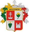
Coat of armsCoordinates: 47°35′46″N 19°14′10″E / 47.59624°N 19.23611°E Country  Hungary
County Pest Area – Total 34.47 km2 (13.3 sq mi) Population (2007) – Total 5,727 – Density 144.71/km2 (374.8/sq mi) Time zone CET (UTC+1) – Summer (DST) CEST (UTC+2) Website www.mogyorod.hu Contents
Location
The town is 18 km from Budapest next to the M3 freeway in the valley of the Gödöllői-hills. Its highest point is the Somlyó-mountain, (Gyertyános 326m) which can be seen from the freeway or the HÉV. Many people move here because of its proximity to Budapest while retaining the quiet of the country. It is the location every year for the Formula 1 Hungarian Grand Prix.
History
Origin of the name
The name of the town derives from the Hungarian word for hazelnut, and can be roughly translated as "rich in hazelnuts". Although today there are only a few hazelnut bushes, local tradition holds that the town's presbytery still holds the town's first.
The name of the town can be found in many documents as "Mogyoród" in the Western alphabet, in Turkish tax papers as "Magoród" and "Mogyorós", and in foreign ecclesiastical charters as "Monorond", "Mangerat", "Munerod", and "Mamorade".
Battle of Mogyoród
The most authentic paper of the battle is a charter from the Holy Roman Empire from the end of the year 1074, which didn't tell the place of the battle but contains that the Hungarian king, Salamon lost the battle. The next resource in time is from the 'Képes Krónika' (Chronicon Pictum) which tell us details of the battle: (free translate by myself) 'The only important place near to the battle was Zymgota (Cinkota), which is near to Monorod ("rich in hazelnuts") mountain on which the battle was fought. The only way to find the exact place to find the massgrave which was created by the fight, cause the writings from that time can't be used now because those aren't true for the lie of the land of these days (mostly cause of the location of the forests and the meadows).
Before the battle at Vác Géza, royal prince of Hungary promised that if they won, he makes the Minster of the Miter of Vác in Honor of Mary be build. Ladislaus I of Hungary right before the fight – thanks to his visions – made a similar promise that a church to Saint Martin will be built at the place of the battle.
Before the fight Ladislaus I of Hungary and Géza, royal prince of Hungary by the idea of Ladislaus – changed their insignias so they could mystified the enemy who already known that Ladislaus is better in strategy then Géza. The enemy made so big mistakes thanks to the change in the fight which gave the victory to the prince what made the long argument an end.
After the battle the church was built from the capture to honor Saint Martin.
Using the data of the Chronicum Pictum its obvious that the battle was in 14 March 1074. friday.
The building which was built was a church with a Monastery. From the Chronicum Pictum we know that the Monastery was only mentioned first with its abbot in 1235 in a charter from the Pope. It's easy to locate the buildings today in Mogyoród.They should be somewhere near in the area of Klastromdomb, Templomhegy, or Kővár. These are the parts of the town today. But unfortunately the building operations of the 18th–19th century there cannot be seen any ruin. As the excavations prove us in the 11th–12th century there was a little church, then later they altered it into a bigger church using its basic.
Mongol and Tatar states in Mogyoród
1241. March: the Tatars mounted an offensive against the village and monastery, and continued until the Danube, where they attacked Vác. Because they could not cross the river, they used Vác as a base from which to attack areas to the east and north.
1242. February: the Tartars crossed the frozen Danube to mount several attacks upon Mogyoród.
It is not known how much damage the Tatars inflicted, but it is known that they took every animal and all produce, and killed about 50–60% of the population, as well as burning many buildings.
The XIV. century
In the first trierce of the 14th century the existence of the abbey of Mogyoród was in danger but thanks to the abbot ofGgaramszentbenedek and the bishop of Eger, between 1338–1342 it became alive again. The abbey became more and more important and about a 70 year of prosperty began: in 1366 it was the place of the chapter, and in the beginning of the 15th century the abbots followed orders of the Pope in big projects.
Things to see
- Catholic church (Baroque, 1749, built on the ruin of the old monastery of the Order of Saint Benedict)
- Kalvaria and the statue of John of Nepomuk 17th century)
- Hungaroring
- Pince sor (wineries in a street)
- Main square
- Aquaréna[1] (aquapark)
- south from the town is Csörsz árok.
References
External links
Categories:- Populated places in Pest County
Wikimedia Foundation. 2010.

