- Hughesville, Pennsylvania
Infobox Settlement
official_name = Hughesville, Pennsylvania
settlement_type = Borough
nickname =
motto =
imagesize =
image_caption =
image_
mapsize = 250x200px
map_caption = Map of Lycoming County, Pennsylvania highlighting Hughesville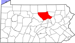
mapsize1 = 250x200px
map_caption1 = Map of Pennsylvania highlighting Lycoming Countysubdivision_type = Country
subdivision_name =United States
subdivision_type1 = State
subdivision_name1 =Pennsylvania
subdivision_type2 = County
subdivision_name2 = Lycominggovernment_footnotes =
government_type =
leader_title =
leader_name =
leader_title1 =
leader_name1 =
established_title = Settled
established_date = 1816
established_title1 = Incorporated
established_date1 = 1852
unit_pref = Imperial
area_footnotes =area_magnitude =
area_total_km2 = 1.7
area_land_km2 = 1.7
area_water_km2 = 0.0
area_total_sq_mi = 0.6
area_land_sq_mi = 0.6
area_water_sq_mi = 0.0population_as_of = 2000
population_footnotes =
population_total = 2220
population_density_km2 = 1320.7
population_density_sq_mi = 3420.6timezone = Eastern (EST)
utc_offset = -5
timezone_DST = EDT
utc_offset_DST = -4
elevation_footnotes =GR|3
elevation_m = 177
elevation_ft = 581
latd = 41 |latm = 14 |lats = 25 |latNS = N
longd = 76 |longm = 43 |longs = 29 |longEW = Wpostal_code_type =
ZIP code
postal_code = 17737
area_code = 570
blank_name = FIPS code
blank_info = 42-36160GR|2
blank1_name = GNIS feature ID
blank1_info = 1213971GR|3
website =
footnotes =Hughesville is a borough in Lycoming County,
Pennsylvania , United States. The population was 2,220 at the 2000 census. It is part of theWilliamsport, Pennsylvania Metropolitan Statistical Area .History
Hughesville is named for Jeptha Hughes who purchased land from John Heap in 1816 and laid out the town of "Hughesburg". Hughes sold the entire plot in 1820 to Daniel Harrold. The town grew slowly around a
gristmill that was constructed by Jacob Clayton. Atavern was built in 1820 andgeneral store was opened ten years later in 1830. The first doctor in Hughesville, John W. Peale, arrived in 1828. Hughesville was incorporated as aborough onApril 23 ,1852 . The first dentist opened an office in 1853 and the first lawyer settled in Hughesville in 1875.*cite book
last = Meginness
first = John Franklin
title = History of Lycoming County, Pennsylvania: including its aboriginal history; the colonial and revolutionary periods; early settlement and subsequent growth; organization and civil administration; the legal and medical professions; internal improvement; past and present history of Williamsport; manufacturing and lumber interests; religious, educational, and social development; geology and agriculture; military record; sketches of boroughs, townships, and villages; portraits and biographies of pioneers and representative citizens, etc. etc."
origdate = 1892
url = http://www.usgennet.org/usa/pa/county/lycoming/history/lyco-history-01.html
accessdate = 2007-02-27
edition = 1st Edition
publisher = Brown, Runk & Co.
location = Chicago, IL
id = ISBN 0-7884-0428-8
chapter = XXX
chapterurl = http://www.usgennet.org/usa/pa/county/lycoming/history/Chapter-34.html
quote = (Note: ISBN refers to Heritage Books July 1996 reprint. URL is to a scan of the 1892 version with some OCR typos).]Early industries in Hughesville were built to serve the farmers and citizens of eastern Lycoming County. They included a chair factory opened in 1829, a
wagon shop in 1830, several distilleries, asawmill and planing mill, and a furniture factory. Electricity was introduced to Hughesville in 1891 along with running water.Geography
Hughesville is located at coor dms|41|14|25|N|76|43|29|W|city (41.240402, -76.724852).GR|1 It is completely surrounded by Wolf Township.
As the crow flies , Lycoming County is about convert|130|mi|km|0 northwest ofPhiladelphia and convert|165|mi|km|0 east-northeast of Pittsburgh.According to the
United States Census Bureau , the borough has a total area of 0.6square mile s (1.7km² ), all of it land.Hughesville hosts the Lycoming County Fair and is home to the East Lycoming School District.
Demographics
As of the
census GR|2 of 2000, there were 2,220 people, 967 households, and 608 families residing in the borough. Thepopulation density was 3,420.6 people per square mile (1,318.7/km²). There were 1,029 housing units at an average density of 1,585.5/sq mi (611.2/km²). The racial makeup of the borough was 98.60% White, 0.18% African American, 0.36% Native American, 0.05% Asian, 0.18% from other races, and 0.63% from two or more races. Hispanic or Latino of any race were 0.81% of the population.There were 967 households out of which 29.0% had children under the age of 18 living with them, 48.9% were married couples living together, 10.5% had a female householder with no husband present, and 37.1% were non-families. 32.4% of all households were made up of individuals and 15.5% had someone living alone who was 65 years of age or older. The average household size was 2.30 and the average family size was 2.90.
In the borough the population was spread out with 24.9% under the age of 18, 7.0% from 18 to 24, 28.8% from 25 to 44, 21.3% from 45 to 64, and 18.1% who were 65 years of age or older. The median age was 38 years. For every 100 females there were 92.7 males. For every 100 females age 18 and over, there were 83.9 males.
The median income for a household in the borough was $29,361, and the median income for a family was $37,905. Males had a median income of $29,750 versus $20,794 for females. The
per capita income for the borough was $16,271. About 4.0% of families and 6.9% of the population were below thepoverty line , including 4.5% of those under age 18 and 11.7% of those age 65 or over.References
External links

Wikimedia Foundation. 2010.