Endelave

Endelave

Geobox|Settlement
name = Endelave Island
native_name = | other_name=
category = Island


image_size = 280px
image_caption =

| flag_size =
symbol = | symbol_size = 90px
country = Denmark | state=
region =
district = Odder municipality
district_type = Municipality | district_label=
part_type = | part_count =
part = | part1 =
area = 13.2
area_round = 0
location =
lat_d = 55 | lat_m = 45 | lat_s = 0 | lat_NS= N
long_d= 10 | long_m= 18 | long_s= 0 | long_EW= E
elevation =
population_as_of = 2005
population = 175 | population_density=
established_type =
established =
established1_type = | mayor=
timezone = CET | utc_offset= +1
timezone_DST = CEST
utc_offset_DST=+2
postal_code = [Web www.Postnumre.dk.]
postal_code_type = Postal codes
area_code = | area_code_type=
free_type = | free=
free1_type = | free1=

map_size=
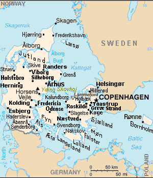
map_caption = Endelave island (left center) is south of Aarhus, southeast of Horsens, southwest of Samsø island, and north of Odense on Funen.
map_locator =
map_locator_x = 30.8
map_locator_y = 64.3
website =

Endelave is a Danish island in the Kattegat, north of Odense, off the coast of Funen, and west of Samsø. The island covers an area of 13.2 km² (5 square miles) and has 175 inhabitants.

Location map | DenmarkCIAx
lat=56.60 | long=9.83
mark = Circle sheer red 33.gif| marksize=33
Alternative

caption = Endelave island (upper left) is west of Samsø island, north of Funen island.
float=left | width=290

ee also

* Nearby islands: Tunø, Samsø, Æbelø, Airø.
* Nearby cities: Horsens, Aarhus.

Notes

References

* Tageo.com, "VESTSJAELLAND DENMARK Geography Population" (coordinates), 2007, webpage: [http://www.tageo.com/index-e-da-v-14.htm Tageo-index] .
* Denmark Postal codes, webpage: [http://www.postnumre.dk/ Postnumre-DK] .
* Tele.dk Denmark detailed road map, webpage: [http://home6.inet.tele.dk/vlh/danmark.jpgTele-DK-Danmark] .

External links


Wikimedia Foundation. 2010.

Игры ⚽ Поможем написать реферат

Look at other dictionaries:

  • Endelave — Saltar a navegación, búsqueda Endelave es una isla de Dinamarca, ubicada en el estrecho de Kattegat. La isla ocupa una superficie de 13,2 km² y alberga una población de 175 habitantes. 55°45′N 10°18′E /  …   Wikipedia Español

  • Endelave — Endelave, dän. Eiland im südwestlichen Teil des Kattegats, vor Horsens Fjord, zum jütländischen Amt Aarhus gehörig, 13 qkm, mit dem Kirchdorf E. und (1901) 654 Einw …   Meyers Großes Konversations-Lexikon

  • Endelave — Vorlage:Infobox Insel/Wartung/Höhe fehlt Endelave Kirche von Endelave Gewässer Kattegat …   Deutsch Wikipedia

  • Endelave — Sp Endelãvė Ap Endelave L s. Baltijos j., Danija …   Pasaulio vietovardžiai. Internetinė duomenų bazė

  • Endelavė — Sp Endelãvė Ap Endelave L s. Baltijos j., Danija …   Pasaulio vietovardžiai. Internetinė duomenų bazė

  • Endelave Kro — (Endelave By,Дания) Категория отеля: Адрес: Kongevejen 15, Endelave, 8700 Endelave By, Дания …   Каталог отелей

  • List of islands of Denmark — Map showing some of the larger islands This is a list of islands of Denmark. Contents 1 Overview 1.1 …   Wikipedia

  • Horsens Municipality — is a municipality (Danish, kommune ) in Region Midtjylland on the east coast of the Jutland peninsula in central Denmark. The municipality includes the island of Endelave, and covers an area of 542 km². It has a total population of ca. 80,102… …   Wikipedia

  • Tunø — Geobox Settlement name = Tunø Island native name = | other name= category = Island image size = 280px image caption = | flag size = symbol = | symbol size = 90px country = Denmark | state= region = district = Odder municipality district type =… …   Wikipedia

  • Danske småøer — Der Verband dänischer Kleininseln (Sammenslutningen af danske småøer) ist eine Interessengemeinschaft von 27 kleineren dänischen Inseln. Diese Inseln sind jeweils zu klein, um eine eigene Gemeinde zu bilden. Inhaltsverzeichnis 1 Ursprung 2… …   Deutsch Wikipedia

Share the article and excerpts

Direct link
Do a right-click on the link above
and select “Copy Link”