- Olyphant, Pennsylvania
-
Borough of Olyphant Settlement Country United States State Pennsylvania County Lackawanna Elevation 843 ft (256.9 m) Coordinates 41°27′45″N 75°35′44″W / 41.4625°N 75.59556°W Area 5.5 sq mi (14.2 km2) - land 5.4 sq mi (14 km2) - water 0.1 sq mi (0 km2), 1.82% Population 5,151 (2010) Density 953.9 / sq mi (368.3 / km2) Mayor Jayme Morano Timezone EST (UTC-5) - summer (DST) EDT (UTC-4) ZIP code 18447-18448 Area code 570 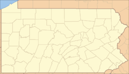
 Location of Olyphant in Pennsylvania
 Location of Pennsylvania in the United States
Olyphant is a borough in Lackawanna County, Pennsylvania, approximately five miles (8 km) northeast of Scranton on the Lackawanna River in the heart of the anthracite region of the State. Once engaged in the shipping of coal as its main source of employment, Olyphant experienced a severe downturn in the twentieth century. Other industries of the past were the manufacturing of blasting powder, iron and steel goods, cigars, silks, etc. In 1900, the population stood at 6,180 people; in 1910, 8,305; in 1920, 10,326; and in 1940, 9,252. The population was 5,151 at the 2010 census.
Contents
Geography
Olyphant is located at 41°27′45″N 75°35′44″W / 41.4625°N 75.59556°W (41.462630, -75.595617)[1].
According to the United States Census Bureau, the borough has a total area of 5.5 square miles (14 km2), of which, 5.4 square miles (14 km2) of it is land and 0.1 square miles (0.26 km2) of it (1.82%) is water.
Demographics
As of the census[2] of 2010, there were 5,151 people, 2,324 households, and 1,357 families residing in the borough. The population density was 953.9 people per square mile (368.3/km²). There were 2,521 housing units at an average density of 466.9 per square mile (182.4/km²). The racial makeup of the borough was 96.2% White, 1.6% African American, 0.1% Native American, 0.3% Asian, 0.7% from other races, and 1.1% from two or more races. Hispanic or Latino of any race were 3.4% of the population.
There were 2,324 households out of which 23.8% had children under the age of 18 living with them, 41.9% were married couples living together, 11.6% had a female householder with no husband present, and 41.6% were non-families. 36.1% of all households were made up of individuals and 17.2% had someone living alone who was 65 years of age or older. The average household size was 2.22 and the average family size was 2.90.
In the borough the population was spread out with 19.3% under the age of 18, 63.7% from 18 to 64, and 17% who were 65 years of age or older. The median age was 42.6 years.
The median income for a household in the borough was $32,721, and the median income for a family was $45,091. Males had a median income of $30,647 versus $24,825 for females. The per capita income for the borough was $17,049. About 7.4% of families and 11.3% of the population were below the poverty line, including 10.2% of those under age 18 and 24.2% of those age 65 or over.
Education
Olyphant is part of the Mid Valley School District. Prior to the district's founding, the town had a series of public schools. Most of the Catholic churches in town also at one point had their own school as well as St. Cyril's Ukrainian Catholic church. Private schools in other towns though receive Olyphant students, among them La Salle Academy in Jessup (K-8), Bishop O'Hara High School in Dunmore and Scranton Preparatory School in Scranton.
Notable people
The borough was originally named Queen City but later the community was named after George Talbot Olyphant, president of the Delaware and Hudson Canal Company.
Broadway actress Judy McLane (played Tania in Mama Mia!) was born in Olyphant, PA, though she proudly states in interviews that she was "raised near Scranton, Pennsylvania." [1]
Mike Gazella was a utility infielder for the 1926-28 New York Yankees. He brought Babe Ruth for a visit to Olyphant during the Babe’s prime. [2]
Nestor Chylak, American League umpire, and only the eighth umpire in the Baseball Hall of Fame. [3]
Actress Patricia Crowley.[3] [4] [5]
Michael J. Metrinko, taken hostage in Tehran, Iran in 1979, held 444 days. [6] Metrinko also was the hero (and dedicatee) of the book Razi Crossing, by Tom Burchill, when he saved a number of westerners' lives during a revolutionary uprising in Tabriz, Iran in 1978. [7]
Legend
According to certain occult theorists, a hidden treasure, or alternatively, some form of occult mystery, is hidden within Olyphant. Hints are said to be encoded in the location of the town's many downtown churches, the positions of which, if plotted on a map, form roughly the same pattern as the stars in the constellation Orion. [8] Others have made speculative hay of the town's elevation, which is supposedly twice the height of the Great Pyramid of Giza. A thorough discussion of this can be found here: [9]
References
- ^ "US Gazetteer files: 2010, 2000, and 1990". United States Census Bureau. 2011-02-12. http://www.census.gov/geo/www/gazetteer/gazette.html. Retrieved 2011-04-23.
- ^ "American FactFinder". United States Census Bureau. http://factfinder2.census.gov. Retrieved 2011-05-14.
- ^ Pat Crowley
External links
- Pointon, Terri. Rootsweb.com. St. Patrick's Cemetery, Olyphant, Pennsylvania.
Municipalities and communities of Lackawanna County, Pennsylvania Cities 
Boroughs Townships Benton | Carbondale | Clifton | Covington | Elmhurst | Fell | Glenburn | Greenfield | Jefferson | La Plume | Madison | Newton | North Abington | Ransom | Roaring Brook | Scott | South Abington | Spring Brook | Thornhurst | Waverly | West Abington
CDPs Unincorporated
communityCategories:- Populated places established in 1850
- Boroughs in Lackawanna County, Pennsylvania


![[8]](http://www.xradiograph.com/xradiograph//OlyphantUniverseMap-2002-11-12b.jpg)
Wikimedia Foundation. 2010.