- Mercersburg, Pennsylvania
-
"Mercersburg" redirects here. For other uses, see Mercersburg Theology.
Mercersburg, Pennsylvania — Borough — 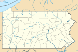

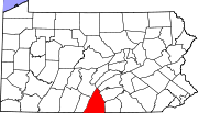
Coordinates: 39°49′46″N 77°54′07″W / 39.82944°N 77.90194°WCoordinates: 39°49′46″N 77°54′07″W / 39.82944°N 77.90194°W Country United States State Pennsylvania County Franklin Settled Incorporated Government - Type Borough Council - Mayor James Zeger Area - Total 1.0 sq mi (2.6 km2) Elevation 558 ft (170 m) Population (2000) - Total 1,540 - Density 1,581.0/sq mi (610.4/km2) Time zone Eastern (EST) (UTC-5) - Summer (DST) EDT (UTC-4) Zip code 17236 Area code(s) 717 Website Mercersburg Borough Mercersburg is a borough in Franklin County, Pennsylvania, 73 miles (117 km) southwest of Harrisburg. Originally called Black Town, it was incorporated in 1831. In 1900, 956 people lived here, and in 1910, 1,410 people lived here. The population was 1,540 at the 2000 census.
Contents
Geography
Mercersburg is located at 39°49′46″N 77°54′7″W / 39.82944°N 77.90194°W (39.829388, -77.901952)[1].
According to the United States Census Bureau, the borough has a total area of 1.0 square mile (2.6 km2), all of it land.
Mercersburg is located at the foot of the Appalachian mountains just north of the Mason-Dixon Line, which serves as the state border with Maryland. Whitetail Ski Resort is located near the town, opens around Thanksgiving for the winter season.
Pennsylvania state highways 16, 75 and 416 all pass through Mercersburg, which is approximately 10 miles (16 km) west of Interstate 81.
Demographics
As of the census[2] of 2000, there were 1,540 people, 686 households, and 439 families residing in the borough. The population density was 1,581.0 people per square mile (613.0/km²). There were 770 housing units at an average density of 790.5 per square mile (306.5/km²). The racial makeup of the borough was 92.08% White, 6.49% African American, 0.58% Asian, 0.52% from other races, and 0.32% from two or more races. Hispanic or Latino of any race were 1.36% of the population.
There were 686 households out of which 30.8% had children under the age of 18 living with them, 48.8% were married couples living together, 11.2% had a female householder with no husband present, and 36.0% were non-families. 32.4% of all households were made up of individuals and 14.7% had someone living alone who was 65 years of age or older. The average household size was 2.24 and the average family size was 2.80.
In the borough the population was spread out with 23.6% under the age of 18, 6.5% from 18 to 24, 29.7% from 25 to 44, 22.7% from 45 to 64, and 17.4% who were 65 years of age or older. The median age was 39 years. For every 100 females there were 88.3 males. For every 100 females age 18 and over, there were 88.8 males.
The median income for a household in the borough was $32,619, and the median income for a family was $46,042. Males had a median income of $30,602 versus $23,000 for females. The per capita income for the borough was $18,934. About 7.2% of families and 8.6% of the population were below the poverty line, including 7.5% of those under age 18 and 10.2% of those age 65 or over.
Education
Tuscarora School District
The Tuscarora School District covers an area of 201 square miles (520 km2), stretching north-south from just south of 40 degrees north latitude to the Maryland border and from east of the 78 degree west longitude line to just west of Chambersburg, PA. The District is located within the borders of Franklin County in south-central Pennsylvania and includes the Borough of Mercersburg and Montgomery, Peters, St. Thomas and Warren townships. The District is primarily a rural agricultural area with a total population of approximately 17,000 people. The District consists of four K-5 elementary schools (Saint Thomas, Mountain View, Mercersburg, Montgomery), one grade 6-8 middle school (James Buchanan MS) and one grade 9-12 high school (James Buchanan HS). Tuscarora, the name of the mountain on the western boundary, is derived from the Tuscarora Tribe of the Iroquois Confederation. The Tribe came north from the Carolinas about 1713 and settled for a time along the mountains. The name Tuscarora comes from the Indian name Skaruron or hemp gatherers. Conococheague, the name of the creek that flows through the District on its way from the Path Valley south to the Potomac River, is an Indian name from the Delaware Tribe meaning clear water.
Mercersburg Academy
Mercersburg Academy has a rich athletic tradition that has produced 48 olympians, 9 of whom won gold medals. In the 1980s, Mercersburg had a dominant swimming program, with two of its students, Betsy Mitchell and Melvin Stewart, winning olympic gold. In this period, coach John Trembley led Mercersburg seven times to the National Prep School Championship, and six times to the Eastern Intercollegiate Swimming Championship.
More recently, Mercersburg has become known and respected for its Men's Cross Country team. The 2006 season was highlighted by a third place finish at the MAPL (Mid Atlantic Prep League) Championships. Mercersburg runners placed 1st and 2nd overall at the MAPL meet. The team is coached by Betsy Willis.
Marshall College
Marshall College was a college founded in Mercersburg in 1836. It later merged with Franklin College, in Lancaster County, and produced the so-called Mercersburg Theology.
Notable people
- James Buchanan, the only Pennsylvanian to be elected President of the United States, was born in a log cabin in the village of Cove Gap near Mercersburg and grew up in the town. His log cabin still stands today on the Mercersburg Academy Campus near the athletics building.
- Academy Award–winning actors Jimmy Stewart and Benicio del Toro both attended Mercersburg Academy, as well as John Hamilton, who played Perry White on Adventures of Superman TV series.
- Vanessa Branch, actress (the "Orbit Gum Girl")
See also
- The Buchanan Hotel
References
- ^ "US Gazetteer files: 2010, 2000, and 1990". United States Census Bureau. 2011-02-12. http://www.census.gov/geo/www/gazetteer/gazette.html. Retrieved 2011-04-23.
- ^ "American FactFinder". United States Census Bureau. http://factfinder.census.gov. Retrieved 2008-01-31.
External links
- Mercersburg Area Chamber of Commerce
- Tuscarora School District
- Mercersburg Academy is a boarding school in Mercersburg, PA.
Municipalities and communities of Franklin County, Pennsylvania County seat: Chambersburg Boroughs Chambersburg | Greencastle | Mercersburg | Mont Alto | Orrstown | Shippensburg‡ | Waynesboro
Townships Antrim | Fannett | Greene | Guilford | Hamilton | Letterkenny | Lurgan | Metal | Montgomery | Peters | Quincy | Southampton | St. Thomas | Warren | Washington
CDPs Unincorporated
communitiesBlue Ridge Summit | Cove Gap | Johnston | Marion | Old Forge | Roxbury | Scotland | State Line
Footnotes ‡This populated place also has portions in an adjacent county or counties
Categories:- Populated places established in 1780
- Boroughs in Franklin County, Pennsylvania


Wikimedia Foundation. 2010.