- Ménil-Hermei
-
Ménil-Hermei

 Ménil-HermeiLocation within Lower Normandy region
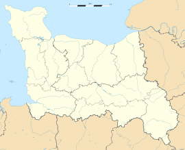 Ménil-Hermei
Administration Country France Region Lower Normandy Department Orne Arrondissement Argentan Canton Putanges-Pont-Écrepin Intercommunality Community of communes of the Val d'Orne Mayor Sylvie Pégat
(2008–2014)Statistics Elevation 63–216 m (207–709 ft)
(avg. 171 m/561 ft)Land area1 6.61 km2 (2.55 sq mi) Population2 180 (2006) - Density 27 /km2 (70 /sq mi) INSEE/Postal code 61267/ 61210 1 French Land Register data, which excludes lakes, ponds, glaciers > 1 km² (0.386 sq mi or 247 acres) and river estuaries. 2 Population without double counting: residents of multiple communes (e.g., students and military personnel) only counted once. Coordinates: 48°49′38″N 0°19′30″W / 48.8272222222°N 0.325°W
Ménil-Hermei is a commune in the Orne department in the Basse-Normandie region of north-western France.
Contents
Administration
The mayor since March 2001 has been Sylvie Pégat. She is politically an independent.
Demography
Historical population of Ménil-Hermei
(Source : INSEE[1])1962 1968 1975 1982 1990 1999 2004 221 208 203 210 176 155 176 From the year 1962 on: population without double counting—residents of multiple communes (e.g. students and military personnel) are counted only once. History
- In 1321, Jean de Corday bought the fief of Mesnil-Hermey.
- In 1465, the title of nobility of Raoul de Corday du Mesnil-Hermé is confirmed.
- In 1505, Marguerite - the daughter of Guillaume "Raoult", Esquire, Lord of Mesnil-Hermey - marries Thomas Williamson, a Scottish knight staying in France with the French king, Charles VIII).
- In the 18th century, the land of Mesnil-Hermey belonged to the Marquis de Rabodanges.
Places of interest
- The valley of the River Orne with:
- the raised stone which bygone people named: "Pierre à Gargantua".
- the rock called "Bec Corbin", dominating the river, at the foot of which passed the old stone road from Domfront to Falaise, via Durcet, La Forêt-Auvray and Ménil-Hermei.
Between these two towns, the road followed (unlike the current asphalt road) the route of the old path of "Bougas". It was by this route that the imposing stone pedestal of the monument to William the Conqueror, erected at the foot of Falaise Castle in 1850, was sent, causing considerable difficulties for the horse teams between "Forest Bridge" and Ménil-Hermei.
-

The Lavoir (washing place) of "La Vieville"
-

Another lavoir
-

The interior of the lavoir
See also
References
Categories:- Communes of Orne
- Orne geography stubs


Wikimedia Foundation. 2010.