- Donville-les-Bains
-
Donville-les-Bains

 Donville-les-BainsLocation within Lower Normandy region
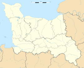 Donville-les-Bains
Administration Country France Region Lower Normandy Department Manche Arrondissement Avranches Canton Granville Intercommunality Communauté de communes du Pays granvillais Mayor Jean-Paul Launay
(2008–2014)Statistics Elevation 0–68 m (0–223 ft) Land area1 2.75 km2 (1.06 sq mi) Population2 3,309 (2006) - Density 1,203 /km2 (3,120 /sq mi) INSEE/Postal code 50165/ 50350 Website www.ville-donville-les-bains.fr 1 French Land Register data, which excludes lakes, ponds, glaciers > 1 km² (0.386 sq mi or 247 acres) and river estuaries. 2 Population without double counting: residents of multiple communes (e.g., students and military personnel) only counted once. Coordinates: 48°50′48″N 1°34′52″W / 48.8467278°N 1.58102778°W
Donville-les-Bains is a commune in the Manche department in north-western France.
Introduction
Donville-les-Bains is located just outside of Granville, a port on the Norman coast noted for ferry traffic to the Channel Islands. Rail service is available from Granville to Paris on a regular basis provided by SNCF, the French National Railway. Donville les Bains is also the ancestral heritage town of the Dunville family (derivative: Donville), scattered throughout the UK and former British colonies, especially United States and Canada. People descended from this Norman line can be found in concentrations around Toronto (Donville), Thunder Bay, Chicago, Detroit, St. Louis, and South Carolina. The residents of Dunville, Newfoundland, are not related; the city was originally home to the Dunphy family.
Heraldry
The arms of Donville-les-Bains are blazoned :
Gules, a sea-horse, and in chief a sun of 8 points Or. NB: this is a sea-horse 'monster' (a horse finned and with a fish tail), not a seahorse (the natural fish).See also
Categories:- Communes of Manche
- Manche geography stubs


Wikimedia Foundation. 2010.