- West Sunbury, Pennsylvania
-
West Sunbury, Pennsylvania — Borough — 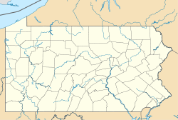
 West Sunbury, Pennsylvania
Coordinates: 41°00′22″N 79°53′46″W / 41.00611°N 79.89611°WCoordinates: 41°00′22″N 79°53′46″W / 41.00611°N 79.89611°W Country United States State Pennsylvania County Butler Settled 1828 Incorporated 1866 Government – Type Borough Council – Mayor Richard Wagner Area – Total 0.1 sq mi (0.3 km2) Population (2000) – Total 104 – Density 1,021.8/sq mi (401.5/km2) Time zone Eastern (EST) (UTC-5) – Summer (DST) EDT (UTC-4) Zip code 16061 West Sunbury is a borough in Butler County, Pennsylvania, United States. The population was 104 at the 2000 census.
Contents
Geography
West Sunbury is located at 41°0′22″N 79°53′46″W / 41.00611°N 79.89611°W (41.006153, -79.896107)[1].
According to the United States Census Bureau, the borough has a total area of 0.1 square miles (0.26 km2), all of it land.
Demographics
As of the census[2] of 2000, there were 104 people, 42 households, and 25 families residing in the borough. The population density was 1,021.8 people per square mile (401.5/km²). There were 47 housing units at an average density of 461.8 per square mile (181.5/km²). The racial makeup of the borough was 100.00% White. Hispanic or Latino of any race were 1.92% of the population.
There were 42 households out of which 33.3% had children under the age of 18 living with them, 47.6% were married couples living together, 14.3% had a female householder with no husband present, and 38.1% were non-families. 31.0% of all households were made up of individuals and 14.3% had someone living alone who was 65 years of age or older. The average household size was 2.48 and the average family size was 3.19.
In the borough the population was spread out with 26.9% under the age of 18, 7.7% from 18 to 24, 27.9% from 25 to 44, 22.1% from 45 to 64, and 15.4% who were 65 years of age or older. The median age was 36 years. For every 100 females there were 116.7 males. For every 100 females age 18 and over, there were 76.7 males.
The median income for a household in the borough was $25,625, and the median income for a family was $33,750. Males had a median income of $27,000 versus $15,750 for females. The per capita income for the borough was $12,643. There were 14.8% of families and 21.3% of the population living below the poverty line, including 32.1% of under eighteens and 12.5% of those over 64.
Schools
Students in the borough and surrounding region belong to the Moniteau School District. Children in kindergarten through sixth grade receive education at the only elementary school, Dassa McKinney, located east of borough. Students continue their education at Moniteau Jr./Sr. High School, located to the north of borough.
References
- ^ "US Gazetteer files: 2010, 2000, and 1990". United States Census Bureau. 2011-02-12. http://www.census.gov/geo/www/gazetteer/gazette.html. Retrieved 2011-04-23.
- ^ "American FactFinder". United States Census Bureau. http://factfinder.census.gov. Retrieved 2008-01-31.
External links
Municipalities and communities of Butler County, Pennsylvania City 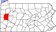
Boroughs Bruin | Callery | Cherry Valley | Chicora | Connoquenessing | East Butler | Eau Claire | Evans City | Fairview | Harmony | Harrisville | Karns City | Mars | Petrolia | Portersville | Prospect | Saxonburg | Seven Fields | Slippery Rock | Valencia | West Liberty | West Sunbury | Zelienople
Townships Adams | Allegheny | Brady | Buffalo | Butler | Center | Cherry | Clay | Clearfield | Clinton | Concord | Connoquenessing | Cranberry | Donegal | Fairview | Forward | Franklin | Jackson | Jefferson | Lancaster | Marion | Mercer | Middlesex | Muddy Creek | Oakland | Parker | Penn | Slippery Rock | Summit | Venango | Washington | Winfield | Worth
CDPs Fernway | Fox Run | Homeacre-Lyndora | Meadowood | Meridian | Nixon | Oak Hills | Shanor-Northvue
Unincorporated
communitiesFootnotes ‡This populated place also has portions in an adjacent county or counties
Categories:- Populated places established in 1828
- Pittsburgh metropolitan area
- Boroughs in Butler County, Pennsylvania


Wikimedia Foundation. 2010.