- North Cadbury
-
Coordinates: 51°02′44″N 2°31′19″W / 51.0456°N 2.5220°W
North Cadbury 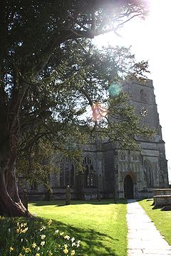
The church of St. Michael the Archangel at North Cadbury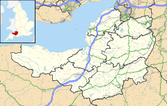
 North Cadbury
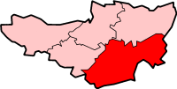
North Cadbury shown within SomersetPopulation 877 [1] OS grid reference ST635275 District South Somerset Shire county Somerset Region South West Country England Sovereign state United Kingdom Postcode district BA22 Police Avon and Somerset Fire Devon and Somerset Ambulance South Western EU Parliament South West England List of places: UK • England • Somerset North Cadbury is a village 5 miles (8 km) west of Wincanton in the River Cam in the South Somerset district of Somerset, England. It shares its parish with nearby Yarlington and includes the village of Galhampton[2], which got its name from the settlement of the rent-paying peasants,[3] and the hamlet of Woolston.
Contents
History
The name Cadbury means Cada's fort and refers to Cadbury Castle.[3]
The parish was part of the hundred of Catsash.[4]
Barony of North Cadbury
In the Domesday Book of 1086 the manor is recorded as held as part of the extensive fiefdom of Turstin FitzRolf, the standard-bearer to William the Conqueror at the Battle of Hastings in 1066.[5]. The lands held by Turstin were subsequently proved to have been held under the feudal tenure per baroniam, making the holder a feudal baron. The caput of this barony is stated by Professor Ian Sanders (1960)[6] to have been North Cadbury, although Turstin's central area of operation seems to have been around Caerleon Castle on the English border with Glamorgan, South Wales. Turstin seems to have been banished in about 1088, possibly having opposed King William II of England in his struggle for the English crown with his elder brother Robert Curthose, Duke of Normandy. The fiefdom then passed to Wynebald de Ballon, newly arrived with his brother Hamelin de Ballon from Maine, France. Wynebald was a close associate of King William Rufus, and probably received Turstin's fiefdom as a reward for services unknown. Wynebald's centre of operation was at Caerleon Castle, on the River Usk, higher up which was founder Abergavenny Castle by his brother Hamelin. Even further up the river Usk was situated the caput of the great Marcher Lordship of Bernard de Newmarch at Brecon. Wynebald de Ballon's 2 sons died without issue and his heir to the barony became his daughter Mabilia, the wife of a certain "Henry de Newmarch". No evidence has survived as to the ancestry of Henry de Newmarch, but circumstantial evidence suggests that he was descended from Bernard de Newmarch, Marcher Lord of Brecon, by a first marriage. Bernard's sole heiress was certainly his only daughter by his last marriage to Sibila. Bernard is said to have had children by a first marriage, as mention of them is made in a charter to the monks of Brecon, in which he speaks of sons and daughters, especially devising the lands of Costinio for the welfare of the soul of his son Philip.[7] The barony of Wynebald, which can at this stage in its history be termed the "barony of North Cadbury", descended into the family of his son-in-law Henry de Newmarch(d.1198). Henry had 2 sons, Henry (or possibly William) the eldest who died without issue in 1204, and James(d.1216) who according to Wiffen (1883)[8] married Maud, later the wife of Otto FitzWilliam. James had no son but left 2 co-heiresses, Isabel and Hawise, who each took a moiety of the barony into the families of their husbands, Ralph Russell and Nicholas de Moels. Ralph was the 3rd. son and eventual heir of John Russell(d.1224) of Kingston Russell, Dorset, steward to King John and to his young son King Henry III. He was also Constable of Sherborne Castle, and Governor of Corfe Castle, both in Dorset, and died circa 1224. John's function at Sherborne, 7 miles south of North Cadbury, likely brought him into contact with James de Newmarch, heir of his brother Henry, Baron of Newmarch, whose estates were centred at North Cadbury. James de Newmarch died without male heir, leaving 2 infant heiresses. The wardship of both daughters was granted by King John to John Russell, who kept Isabel for the wife of his 3rd. son Ralph, and sold the marriage of the 2nd. daughter Hawise, to John de Bottrell/Bottreux. The Newmarch lands were thus split in half, one half including Dyrham in Gloucestershire to the Russells, with the second half, including North Cadbury, being confirmed to Bottrell by Henry III in 1218, per the Close Rolls. North Cadbury allocated into the moiety of Hawise and thus descended by marriage to Nicholas de Moels, 2nd husband of Hawise de Newmarch in around 1230. It then passed to the lords Botreaux (1337), lords Hungerford (1462) and the lords Hastings in 1468.[3]
Governance
The parish council has responsibility for local issues, including setting an annual precept (local rate) to cover the council’s operating costs and producing annual accounts for public scrutiny. The parish council evaluates local planning applications and works with the local police, district council officers, and neighbourhood watch groups on matters of crime, security, and traffic. The parish council's role also includes initiating projects for the maintenance and repair of parish facilities, as well as consulting with the district council on the maintenance, repair, and improvement of highways, drainage, footpaths, public transport, and street cleaning. Conservation matters (including trees and listed buildings) and environmental issues are also the responsibility of the council.
The village falls within the Non-metropolitan district of South Somerset, which was formed on 1 April 1974 under the Local Government Act 1972, having previously been part of Wincanton Rural District.[9] The district council is responsible for local planning and building control, local roads, council housing, environmental health, markets and fairs, refuse collection and recycling, cemeteries and crematoria, leisure services, parks, and tourism.
Somerset County Council is responsible for running the largest and most expensive local services such as education, social services, libraries, main roads, public transport, policing and fire services, trading standards, waste disposal and strategic planning.
It is also part of a county constituency represented in the House of Commons of the Parliament of the United Kingdom. It elects one Member of Parliament (MP) by the first past the post system of election, and part of the South West England constituency of the European Parliament which elects seven MEPs using the d'Hondt method of party-list proportional representation.
Geography
Approximately 1 kilometre (0.62 mi) west of North Cadbury is Sparkford Wood, a 8.4 hectare (20.7 acre) biological Site of Special Scientific Interest which is a broadleaved semi-natural woodland situated on heavy fertile soils dating from at least the 18th Century.[10]
Along with the rest of South West England, North Cadbury has a temperate climate which is generally wetter and milder than the rest of England. The annual mean temperature is about 10 °C (50 °F) with seasonal and diurnal variations, but due to the modifying effect of the sea, the range is less than in most other parts of the United Kingdom. January is the coldest month with mean minimum temperatures between 1 °C (34 °F) and 2 °C (36 °F). July and August are the warmest months in the region with mean daily maxima around 21 °C (70 °F). In general, December is the dullest month and June the sunniest. The south west of England enjoys a favoured location, particularly in summer, when the Azores High extends its influence north-eastwards towards the UK.[11]
Cloud often forms inland, especially near hills, and reduces exposure to sunshine. The average annual sunshine totals around 1600 hours. Rainfall tends to be associated with Atlantic depressions or with convection. In summer, convection caused by solar surface heating sometimes forms shower clouds and a large proportion of the annual precipitation falls from showers and thunderstorms at this time of year. Average rainfall is around 800–900 mm (31–35 in). About 8–15 days of snowfall is typical. November to March have the highest mean wind speeds, with June to August having the lightest. The predominant wind direction is from the south west.[11]
Landmarks
Galhampton Manor House dates from 1723 and has been designated by English Heritage as a grade II* listed building.[12] The village is also home to their festival 'Party in the Park', which happens every July and is attended by 1,200 people each year.
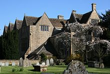 North Cadbury Court from the churchyard
North Cadbury Court is a country house built around 1580-1610, by Sir Francis Hastings,[13] who inherited the estate from his father in 1544.[14] After his wife died in 1596 Hastings sold the court with the rest of the manor to Matthew Ewens. In 1910 the court was bought by Sir Archibald Langham.[3]
Church of St Michael
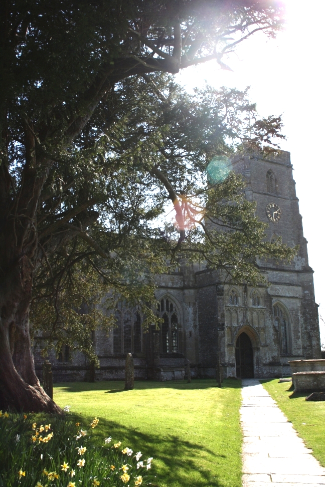
Main article: Church of St Michael, North CadburyThe Church of St. Michael the Archangel in North Cadbury dates mostly from 1417, however the tower is from a few years earlier. It has been designated by English Heritage as a grade I listed building.[15]
Sources
- Sanders, I.J. English Baronies, A Study of their Origin & Descent 1086-1327, Oxford, 1960, p.68, "North Cadbury"
- Newmarch, George Frederick & Newmarch Charles H., The Newmarch Pedigree, Verified by Public Records, Authentic Manuscripts and General and Local Histories, Cirencester, 1868, p.2. (lacks sources for assertions made)
- Wiffen, J.H. Historical Memoirs of the House of Russell from the Time of the Norman Conquest, 1883. vol.1 (Confounds the family of Russell of KR with Russell ancestors of Dukes of Bedford, but otherwise contains excellent biographical research)
References
- ^ "South Somerset population estimates for 2002". Somerset County Council. http://www.webcitation.org/5lRyCVNCk. Retrieved 27 December 2009.
- ^ "North Cadbury & Yarlington Parish Website". North Cadbury & Yarlington Parish Website. http://www.galhampton.org.uk/. Retrieved 5 December 2009.
- ^ a b c d Bush, Robin (1994). Somerset: The complete guide. Wimborne: The Dovecote Press Ltd. p. 154. ISBN 1874336261.
- ^ "Somerset Hundreds". GENUKI. http://www.genuki.org.uk/big/eng/SOM/Miscellaneous/. Retrieved 8 October 2011.
- ^ www.domesdaybook.co.uk
- ^ Sanders, I.J. English Baronies, A Study of their Origin & Descent 1086-1327, Oxford, 1960, p.68, "North Cadbury"
- ^ Newmarch, George Frederick & Newmarch Charles H., The Newmarch Pedigree, Verified by Public Records, Authentic Manuscripts and General and Local Histories, Cirencester, 1868, p.2
- ^ Wiffen, Memorials of the House of Russell, op.cit.
- ^ A Vision of Britain Through Time : Wincanton Rural District
- ^ "Sparkford Wood". English Nature. http://www.english-nature.org.uk/citation/citation_photo/1000468.pdf. Retrieved 21 August 2006.
- ^ a b "South West England: climate". Met Office. http://www.metoffice.gov.uk/climate/uk/sw/. Retrieved 14 March 2010.
- ^ "The Manor House". Images of England. http://www.imagesofengland.org.uk/details/default.aspx?id=262080. Retrieved 2 February 2008.
- ^ "North Cadbury Court". Images of England. http://www.imagesofengland.org.uk/details/default.aspx?id=262112. Retrieved 8 February 2008.
- ^ "North Cadbury Court". Newman family tree. http://www.newman-family-tree.net/Cadbury-Court.htm. Retrieved 8 February 2008.
- ^ "Church of St. Michael". Images of England. http://www.imagesofengland.org.uk/details/default.aspx?id=262104. Retrieved 8 February 2008.
External links
Categories:- Villages in South Somerset
- Civil parishes in Somerset


Wikimedia Foundation. 2010.