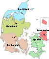
Nyborg Municipality

Nyborg Municipality
Nyborg municipality (Nyborg Kommune)
Municipalities of Denmark
Country Denmark
Region Region of Southern Denmark
Seat Nyborg
Area 278 km2 (107 sq mi)
Population 31,607 (2008)
Density 114 / km2 (295 / sq mi)
Mayor Jørn Terndrup (Venstre)
Timezone CET (UTC1)
 - summer (DST) CEST (UTC2)
The town museum Mads Lerches Gaard
The 40 metre long gatehouse Landporten in Nyborg

Nyborg municipality is a municipality (Danish, kommune) in Region of Southern Denmark on the east coast of the island of Funen in central Denmark. The municipality, including the island of Sprogø, covers an area of 278 km², and has a total population of 31,607 (2008). Its mayor is Jørn Terndrup, a member of the Venstre (Liberal Party) political party. The main town and the site of its municipal council is the city of Nyborg.

The island of Sprogø lies in the Great Belt ca. 8.5 kilometers from the shores of the town of Nyborg. The Great Belt Bridge connects the municipality to the island, and then it continues to the island of Zealand at the town of Korsør.

Holckenhavn Fjord cuts into the municipality on its eastern shore north of the town of Holckenhavn. A road (Svendborgvej) connects the municipality across the fjord.

On January 1, 2007 Nyborg municipality was, as the result of Kommunalreformen ("The Municipal Reform" of 2007), merged with Ørbæk and Ullerslev municipalities to form a new Nyborg municipality.

Attractions

  • Holckenhavn Castle (Holckenhavn Slot)
  • Mads Lerche's House (Mads Lerches Gård)
  • Nyborg & Area Museums (Nyborg & Omegns museer)
  • Nyborg Castle (Nyborg Slot)
  • Vindinge Church (Vindinge Kirke)

External links

References

Coordinates: 55°20′00″N 10°45′00″E / 55.3333°N 10.75°E / 55.3333; 10.75


Wikimedia Foundation. 2010.

Игры ⚽ Нужна курсовая?

Look at other dictionaries:

  • Nyborg — Palace …   Wikipedia

  • Nyborg, Sweden — Nyborg …   Wikipedia

  • Ullerslev Municipality — Until January 1, 2007 Ullerslev municipality was a municipality (Danish: kommune ) in the former Funen County, on the east coast of the island of Funen, in central Denmark. The municipality covered an area of 54 km², and had a total population of …   Wikipedia

  • Ørbæk Municipality — Until January 1, 2007 Ørbæk municipality was a municipality (Danish, kommune) in the former Funen County on the east coast of the island of Funen in central Denmark. The municipality covered an area of 138 km², and had a total population of… …   Wikipedia

  • Hordaland county municipality — Infobox Fylkeskommune name = Hordaland enname = hordaland isocode = 12 capital = Bergen mayor = Torill Selsvolld Nyborg executive = revenue = 3,300 employees = 4,200 schools = 46 pupils = 17,000 transit = Skyss roads = website =… …   Wikipedia

  • Odense Municipality — Coordinates: 55°23′45.48″N 10°23′18.73″E / 55.3959667°N 10.3885361°E / 55.3959667; 10.3885361 …   Wikipedia

  • Copenhagen Municipality — Coordinates: 55°40′31″N 12°34′13″E / 55.67528°N 12.57028°E / 55.67528; 12.57028 …   Wikipedia

  • Odder Municipality — Location of Odder municipality Odder municipality is a municipality in Region Midtjylland on the east coast of the Jutland peninsula in central Denmark just south of Aarhus and is a part of the greater Aarhus area. The municipality includes the… …   Wikipedia

  • Randers Municipality — (Randers Kommune) Municipalities of Denmark The old Town Hall on the square in Randers with statue of Niels Ebbesen in f …   Wikipedia

  • Korsør Municipality — Until January 1, 2007 Korsør municipality was a municipality (Danish, kommune ) in West Zealand County on the west coast of the island of Zealand ( Sjælland ) in Denmark. The municipality covered an area of 75 km², and had a total population of… …   Wikipedia

Share the article and excerpts

Direct link
Do a right-click on the link above
and select “Copy Link”