- Rickreall, Oregon
Infobox Settlement
official_name = Rickreall, Oregon
settlement_type = CDP
nickname =
motto =
imagesize =
image_caption =
image_
imagesize =
image_caption =
image_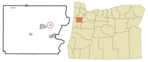
mapsize = 250px
map_caption = Location of Rickreall, Oregon
mapsize1 =
map_caption1 =subdivision_type = Country
subdivision_name =United States
subdivision_type1 = State
subdivision_name1 =Oregon
subdivision_type2 = County
subdivision_name2 = Polkgovernment_footnotes =
government_type =
leader_title =
leader_name =
leader_title1 =
leader_name1 =
established_title =
established_date =unit_pref = Imperial
area_footnotes =area_magnitude =
area_total_km2 = 0.4
area_land_km2 = 0.4
area_water_km2 = 0.0
area_total_sq_mi = 0.2
area_land_sq_mi = 0.2
area_water_sq_mi = 0.0population_as_of = 2000
population_footnotes =
population_total = 57
population_density_km2 = 129.6
population_density_sq_mi = 335.6timezone = Pacific (PST)
utc_offset = -8
timezone_DST = PDT
utc_offset_DST = -7
elevation_footnotes =
elevation_m = 64
elevation_ft = 210
latd = 44 |latm = 55 |lats = 52 |latNS = N
longd = 123 |longm = 13 |longs = 51 |longEW = Wpostal_code_type =
ZIP code
postal_code = 97371
area_code = 503
blank_name = FIPS code
blank_info = 41-61800GR|2
blank1_name = GNIS feature ID
blank1_info = 1163222GR|3
website =
footnotes =Rickreall is a
census-designated place (CDP) in Polk County,Oregon ,United States . As of the 2000 census, the CDP population was 57. It is part of the Salem Metropolitan Statistical Area. The town's name is pronounced RICK-ree-awl. The town is skirted to the south by Rickreall Creek.Geography
Rickreall is located at coor dms|44|55|52|N|123|13|51|W|city (44.931199, -123.230745)GR|1.
According to the
United States Census Bureau , the CDP has a total area of 0.2square mile s (0.4km² ), all of it land.Demographics
As of the
census GR|2 of 2000, there were 57 people, 26 households, and 17 families residing in the CDP. Thepopulation density was 335.6 people per square mile (129.5/km²). There were 26 housing units at an average density of 153.1/sq mi (59.1/km²). The racial makeup of the CDP was 98.25% White, and 1.75% from two or more races.There were 26 households out of which 19.2% had children under the age of 18 living with them, 57.7% were married couples living together, 7.7% had a female householder with no husband present, and 30.8% were non-families. 23.1% of all households were made up of individuals and 11.5% had someone living alone who was 65 years of age or older. The average household size was 2.19 and the average family size was 2.56.
In the CDP the population was spread out with 15.8% under the age of 18, 1.8% from 18 to 24, 24.6% from 25 to 44, 38.6% from 45 to 64, and 19.3% who were 65 years of age or older. The median age was 50 years. For every 100 females there were 83.9 males. For every 100 females age 18 and over, there were 71.4 males.
The median income for a household in the CDP was $27,222, and the median income for a family was $26,389. Males had a median income of $41,250 versus $21,250 for females. The
per capita income for the CDP was $12,846. None of the population and none of the families were below thepoverty line .Education
At one time there were two elementary schools in Rickreall. One was Oak Grove Elementary, and the other was Rickreall Elementary. In 2003, Rickreall Elementary was shut down by the Dallas School District, and the school building was leased to Our Jubilee Church and Academy. ["
Itemizer Observer " "Rickreall transition going smoothly" 7/28/2004; accessed 5/14/08] Students that were attending Rickreall Elementary were sent to Whitworth Elementary inDallas, Oregon . As of 2007, the church ended their lease on the Rickreall Elementary building. ["Itemizer Observer " "Jesus Our Jubilee school will vacate Rickreall building " 4/19/2006; accessed 5/14/08]Oak Grove Elementary is currently not in operation as it was closed in the fall of 2005. ["
Itemizer Observer " "Eola, Oak Grove schools face closure" 4/29/2003; accessed 5/14/08]References
External links
* [http://terraserver.microsoft.com/image.aspx?T=1&S=10&Z=10&X=2409&Y=24875&W=1 Terraserver overhead of Rickreall]
Wikimedia Foundation. 2010.