- Devola, Ohio
-
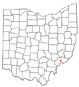
Devola, Ohio — CDP — Location of Devola, Ohio Detailed map of Devola
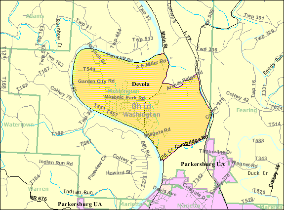
Coordinates: 39°28′13″N 81°28′22″W / 39.47028°N 81.47278°WCoordinates: 39°28′13″N 81°28′22″W / 39.47028°N 81.47278°W Country United States State Ohio County Washington Area – Total 5.4 sq mi (13.9 km2) – Land 5.1 sq mi (13.3 km2) – Water 0.2 sq mi (0.6 km2) Elevation[1] 682 ft (208 m) Population (2000) – Total 2,771 – Density 539.9/sq mi (208.5/km2) Time zone Eastern (EST) (UTC-5) – Summer (DST) EDT (UTC-4) FIPS code 39-21868[2] GNIS feature ID 1085460[1] Devola is a census-designated place (CDP) in Washington County, Ohio, United States, along the Muskingum River. It is part of the Parkersburg-Marietta-Vienna, WV-OH Metropolitan Statistical Area. The population was 2,771 at the 2000 census.
Geography
Devola is located at 39°28′13″N 81°28′22″W / 39.47028°N 81.47278°W (39.470334, -81.472759)[3].
According to the United States Census Bureau, the CDP has a total area of 5.4 square miles (14 km2), of which, 5.1 square miles (13 km2) of it is land and 0.2 square miles (0.52 km2) of it (4.10%) is water.
Demographics
As of the census[2] of 2000, there were 2,771 people, 1,065 households, and 803 families residing in the CDP. The population density was 539.9 people per square mile (208.6/km²). There were 1,136 housing units at an average density of 221.4/sq mi (85.5/km²). The racial makeup of the CDP was 97.58% White, 0.07% African American, 1.88% Asian, 0.07% from other races, and 0.40% from two or more races. Hispanic or Latino of any race were 0.11% of the population.
There were 1,065 households out of which 28.6% had children under the age of 18 living with them, 68.2% were married couples living together, 6.3% had a female householder with no husband present, and 24.6% were non-families. 22.1% of all households were made up of individuals and 12.2% had someone living alone who was 65 years of age or older. The average household size was 2.46 and the average family size was 2.88.
In the CDP the population was spread out with 22.4% under the age of 18, 6.1% from 18 to 24, 22.4% from 25 to 44, 26.9% from 45 to 64, and 22.2% who were 65 years of age or older. The median age was 44 years. For every 100 females there were 93.1 males. For every 100 females age 18 and over, there were 88.3 males.
The median income for a household in the CDP was $48,558, and the median income for a family was $58,214. Males had a median income of $39,028 versus $26,833 for females. The per capita income for the CDP was $24,751. About 3.4% of families and 4.5% of the population were below the poverty line, including 7.8% of those under age 18 and 4.8% of those age 65 or over.
References
- ^ a b "US Board on Geographic Names". United States Geological Survey. 2007-10-25. http://geonames.usgs.gov. Retrieved 2008-01-31.
- ^ a b "American FactFinder". United States Census Bureau. http://factfinder.census.gov. Retrieved 2008-01-31.
- ^ "US Gazetteer files: 2010, 2000, and 1990". United States Census Bureau. 2011-02-12. http://www.census.gov/geo/www/gazetteer/gazette.html. Retrieved 2011-04-23.
Municipalities and communities of Washington County, Ohio Cities 
Villages Beverly | Lowell | Lower Salem | Macksburg | Matamoras
Townships CDP Devola
Unincorporated
communitiesBarlow | Bartlett | Coal Run | Cutler | Fleming | Germantown | Little Hocking | Newport | Reno | Vincent | Waterford | Watertown | Whipple | Wingett Run
Categories:- Census-designated places in Ohio
- Populated places in Washington County, Ohio
- Muskingum River
- Parkersburg–Marietta–Vienna metropolitan area

Wikimedia Foundation. 2010.