- Millers Creek, North Carolina
-
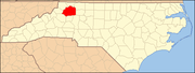
Millers Creek, North Carolina — CDP — Location of Miller Creek, North Carolina
Coordinates: 36°11′21″N 81°14′16″W / 36.18917°N 81.23778°WCoordinates: 36°11′21″N 81°14′16″W / 36.18917°N 81.23778°W Country United States State North Carolina County Wilkes Area – Total 4.5 sq mi (11.6 km2) – Land 4.5 sq mi (11.6 km2) – Water 0.0 sq mi (0.0 km2) Elevation 1,437 ft (438 m) Population (2000) – Total 2,071 – Density 460.6/sq mi (177.9/km2) Time zone Eastern (EST) (UTC-5) – Summer (DST) EDT (UTC-4) ZIP code 28651 Area code(s) 336 FIPS code 37-43160[1] GNIS feature ID 1021469[2] Millers Creek is a census-designated place (CDP) in Wilkes County, North Carolina, United States. The population was 2,071 at the 2000 census. West Wilkes High School, one of the four public high schools in Wilkes County, is located in Millers Creek.
Contents
Geography
Millers Creek is located at 36°11′21″N 81°14′16″W / 36.18917°N 81.23778°W (36.189184, -81.237650).[3]
According to the United States Census Bureau, the CDP has a total area of 4.5 square miles (12 km2), all of it land.
Demographics
As of the census[1] of 2000, there were 2,071 people, 850 households, and 619 families residing in the CDP. The population density was 460.6 people per square mile (177.7/km²). There were 900 housing units at an average density of 200.2 per square mile (77.2/km²). The racial makeup of the CDP was 98.7% White, 0.5% African American, 0.19% Native American, 0.34% Asian, 3.67% from other races, and 0.77% from two or more races. Hispanic or Latino of any race were 4.25% of the population.
There were 850 households out of which 29.2% had children under the age of 18 living with them, 58.6% were married couples living together, 11.4% had a female householder with no husband present, and 27.1% were non-families. 22.8% of all households were made up of individuals and 10.6% had someone living alone who was 65 years of age or older. The average household size was 2.44 and the average family size was 2.84.
In the CDP the population was spread out with 21.1% under the age of 18, 8.9% from 18 to 24, 29.9% from 25 to 44, 25.7% from 45 to 64, and 14.3% who were 65 years of age or older. The median age was 39 years. For every 100 females there were 101.7 males. For every 100 females age 18 and over, there were 97.1 males.
The median income for a household in the CDP was $39,844, and the median income for a family was $43,476. Males had a median income of $27,279 versus $21,774 for females. The per capita income for the CDP was $22,119. About 3.5% of families and 8.9% of the population were below the poverty line, including 10.6% of those under age 18 and 20.5% of those age 65 or over.
Notable people
Benny Parsons, a well-known NASCAR racer and winner of the 1973 NASCAR championship, was a native of Millers Creek. After retiring from racing, he became a popular racing analyst for the ESPN, NBC, and TBS television networks.
References
- ^ a b "American FactFinder". United States Census Bureau. http://factfinder.census.gov. Retrieved 2008-01-31.
- ^ "US Board on Geographic Names". United States Geological Survey. 2007-10-25. http://geonames.usgs.gov. Retrieved 2008-01-31.
- ^ "US Gazetteer files: 2010, 2000, and 1990". United States Census Bureau. 2011-02-12. http://www.census.gov/geo/www/gazetteer/gazette.html. Retrieved 2011-04-23.
Municipalities and communities of Wilkes County, North Carolina Towns Elkin‡ | North Wilkesboro | Ronda | Wilkesboro
CDPs Boomer | Cricket | Fairplains | Hays | Millers Creek | Moravian Falls | Mulberry | Pleasant Hill
Footnotes ‡This populated place also has portions in an adjacent county or counties
Categories:- Census-designated places in North Carolina
- Populated places in Wilkes County, North Carolina


Wikimedia Foundation. 2010.