- Nanafalia, Alabama
-
Nanafalia, Alabama Mathers House, the oldest house remaining in Nanafalia Location within the state of Alabama
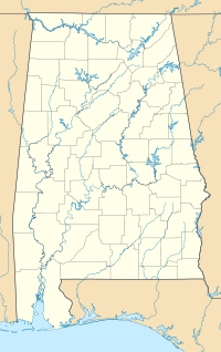
 Nanafalia, Alabama
Coordinates: 32°6′46.76″N 87°59′15.32″W / 32.1129889°N 87.9875889°W Country United States State Alabama County Marengo Elevation 213 ft (65 m) Time zone Central (CST) (UTC-6) – Summer (DST) CDT (UTC-5) ZIP code 36764 Area code(s) 334 Nanafalia is an unincorporated community in Marengo County, Alabama, United States. The community is located on a ridge above the Tombigbee River and the name derives from the Choctaw words for long hill.[1] Nanafalia had a post office at one time, but it is no longer active.[2]
Geography
Nanafalia is located at 32°06′47″N 87°59′15″W / 32.11299°N 87.98759°WCoordinates: 32°06′47″N 87°59′15″W / 32.11299°N 87.98759°W and the elevation is 213 feet (65 m).[1]
References
- ^ a b ""Nanafalia, Alabama"". "ePodunk Community Profiles". http://www.epodunk.com/cgi-bin/genInfo.php?locIndex=12103. Retrieved 2008-01-16.
- ^ U.S. Geological Survey Geographic Names Information System: Nanafalia, Alabama
Municipalities and communities of Marengo County, Alabama Cities 
Towns Dayton | Faunsdale | Myrtlewood | Providence | Sweet Water | Thomaston
Unincorporated
communitiesAimwell | Alfalfa | Beaver Creek | Clay Hill | Consul | Coxheath | Dixons Mills | Exmoor | Half Acre | Half Chance | Hampden | Hoboken | Hugo | Jefferson | Lasca | McKinley | Magnolia | Marengo | Moores Valley | Moscow | Nanafalia | Nicholsville | Octagon | Old Spring Hill | Pin Hook | Putnam | Rembert | Salt Well | Shiloh | Siddonsville | Surginer | Vangale | Vineland | Wayne
Ghost town Aigleville
Categories:- Unincorporated communities in Alabama
- Populated places in Marengo County, Alabama
- Place names in Alabama of Native American origin
- Alabama geography stubs


Wikimedia Foundation. 2010.