- Mayodan, North Carolina
-
Mayodan, North Carolina — Town — Location of Mayodan, North Carolina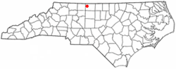
Coordinates: 36°24′51″N 79°58′15″W / 36.41417°N 79.97083°WCoordinates: 36°24′51″N 79°58′15″W / 36.41417°N 79.97083°W Country United States State North Carolina County Rockingham Area - Total 1.5 sq mi (3.9 km2) - Land 1.5 sq mi (3.9 km2) - Water 0.0 sq mi (0.0 km2) Elevation 623 ft (190 m) Population (2000) - Total 2,417 - Density 1,608.8/sq mi (621.2/km2) Time zone Eastern (EST) (UTC-5) - Summer (DST) EDT (UTC-4) ZIP code 27027 Area code(s) 336 FIPS code 37-42060[1] GNIS feature ID 1021374[2] Website www.townofmayodan.com 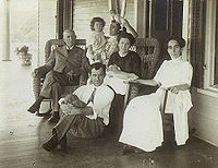 The Pannill family on the porch of their home, Mayodan, 1911
Mayodan is a town in Rockingham County, North Carolina, in the United States. It is a manufacturing site for Bridgestone Aircraft Tire and General Tobacco. Washington Mills Company, later Tultex, operated a textile mill in Mayodan until 1999.[3]
The town is named for two rivers that converge nearby, the Mayo and the Dan, and is the only town in the world with this name.
Contents
Geography
Mayodan is located at 36°24′51″N 79°58′15″W / 36.41417°N 79.97083°W (36.414089, -79.970849)[4].
According to the United States Census Bureau, the town has a total area of 1.5 square miles (3.9 km2); 1.5 square miles (3.9 km2) of the area is land and 0.66% is water.
Mayodan is located near the confluence of the Mayo and Dan Rivers.
Schools
- High Schools: Dalton L. McMichael High School
- Middle Schools: Western Rockingham Middle School
Demographics
As of the census[1] of 2000, there were 2,417 people, 1,173 households, and 651 families residing in the town. The population density was 1,608.8 people per square mile (622.1/km²). There were 1,268 housing units at an average density of 844.0 per square mile (326.4/km²). The racial makeup of the town was 85.85% White, 10.38% African American, 0.17% Native American, 0.21% Asian, 2.57% from other races, and 0.83% from two or more races. Hispanic or Latino of any race were 4.01% of the population.
There were 1,173 households out of which 21.4% have children under the age of 18 living with them; 38.6% are married couples living together; 13.3% have a female householder with no husband present; and 44.5% were non-families. 41.4% of all households were made up of individuals and 21.2% had someone living alone who was 65 years of age or older. The average household size was 2.06 and the average family size is 2.78 people.
The population's age distribution is broad: 19.3% under the age of 18, 7.4% from 18 to 24, 27.5% from 25 to 44, 23.4% from 45 to 64, and 22.4% who are 65 years of age or older. The median age is 43 years. For every 100 females there were 82.3 males. For every 100 females age 18 and over, there were 79.7 males.
The median income for a household in Mayodan is $25,980, and the median income for a family was $36,328. Males had a median income of $25,878 versus $21,250 for females. The per capita income for the town was $15,607. 16.0% of the population and 11.3% of families were below the poverty line. 20.5% of those under the age of 18 and 17.9% of those 65 and older are living below the poverty line.
References
- ^ a b "American FactFinder". United States Census Bureau. http://factfinder.census.gov. Retrieved 2008-01-31.
- ^ "US Board on Geographic Names". United States Geological Survey. 2007-10-25. http://geonames.usgs.gov. Retrieved 2008-01-31.
- ^ "Washington Mills Collection". James Library, Rockingham Community College. http://www.rockinghamcc.edu/library/mill/washingtonmills.html. Retrieved 8 May 2010.
- ^ "US Gazetteer files: 2010, 2000, and 1990". United States Census Bureau. 2011-02-12. http://www.census.gov/geo/www/gazetteer/gazette.html. Retrieved 2011-04-23.
External links
Municipalities and communities of Rockingham County, North Carolina County seat: Wentworth Cities 
Towns Madison | Mayodan | Stoneville | Wentworth
Unincorporated
communitiesCategories:- Populated places in Rockingham County, North Carolina
- Towns in North Carolina


Wikimedia Foundation. 2010.