- 2004 North Indian Ocean cyclone season
Infobox hurricane season
Basin=NIO
Year=2004
Track=2004 North Indian Ocean cyclone season summary.jpg
First storm formed=May 5 ,2004
Last storm dissipated=December 2 ,2004
Strongest storm name=02B and Agni
Strongest storm pressure=976
Strongest storm winds=65
Average wind speed=1
Total depressions=10
Total storms=5
Total hurricanes=4
Total intense=
Fatalities=
Da
Inflated=
five seasons=2002, 2003, 2004, 2005, 2006The 2004 North Indian Ocean cyclone season had no bounds, but cyclones tend to form between April and December, with peaks in May and November. These dates conventionally delimit the period of each year when most tropical cyclones form in the northernIndian Ocean . __TOC__eason Summary
In 2004, RSMC New Delhi identified one Very Severe Cyclonic Storm and three Severe Cyclonic Storms. Out of the four cyclonic storms, three developed over the Arabian Sea and only one formed over the Bay of Bengal. Joint Typhoon Warning Center identified one more tropical cyclones(4A) in Arabian sea. The notable features is that the Arabian sea was more active than the Bay of Bengal during 2004.
The Arabian sea severe cyclone “Agni” in November formed very close to the equator near latitude 1.5N. Cyclogenesis over the north Indian Ocean at such low latitudes has not occurred in the past. The coexistence of cyclonic disturbances over the Arabian sea and the Bay of Bengal as occurred in June 2004 is also not common. This had however helped the progress of the southwest monsoon across the country during the onset phase.
This was the first North Indian season that featured the naming of storms, though only two storms received names.
torms
evere Cyclonic Storm (01A)
Infobox Hurricane Small
Basin=NIO
Type1=svrcyclstorm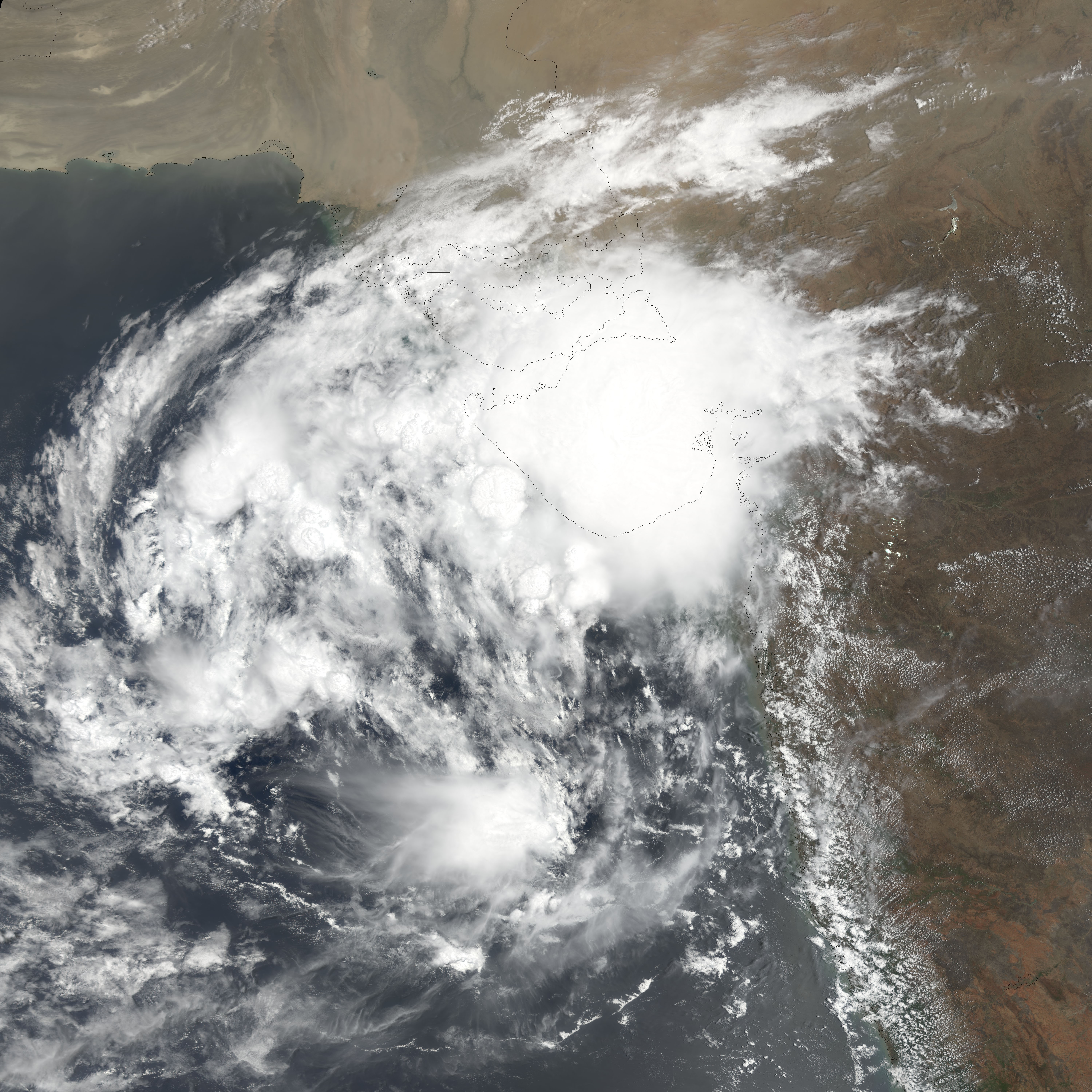
Track=Cyclone 01A 2004 track.pngMay 5
Dissipated=May 10
1-min winds=45
Pressure=991May 5 , Tropical Depression 1A developed in the Arabian Sea, 200 miles west of the Indian coast. It wandered for the next three days, slowly strengthening to its peak of 50 mph winds. The tropical storm turned northwestward, where dry air and moderate shear caused the system to dissipate on the 10th.evere Cyclonic Storm (02B)
Infobox Hurricane Small
Basin=NIO
Type1=svrcyclstorm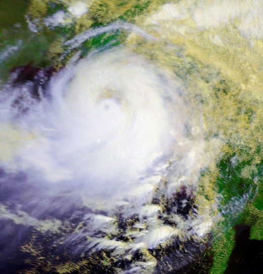
Track=Cyclone 02B 2004 track.pngMay 16
Dissipated=May 19
1-min winds=65
Pressure=976May 17 in the Bay of Bengal, 230 nautical miles south ofCalcutta . It drifted southwestward initially, followed by a turn to the northeast where it intensified to a 70 mph tropical storm. Not long after on the 19th, the tropical storm hitMyanmar , and dissipated later that day. The storm caused heavy flooding and damage, amounting to 220 casualties. [http://www.swissre.com/INTERNET/pwsfilpr.nsf/vwFilebyIDKEYLu/SROS-6MQDPM/$FILE/C_2004.pdf]Depression
A depression existed in the Arabian Sea between
June 10 andJune 13 .Deep Depression
A deep depression existed in the Bay of Bengal on
June 11 , made landfall on the thirteenth and dissipated onJune 14 .Land Depression
A depression developed over land near the India-Bangladesh border on
September 12 , remained nearly stationary for the next few days, and dissipated onSeptember 15 .evere Cyclonic Storm Onil
Infobox Hurricane Small
Basin=NIO
Type1=svrcyclstorm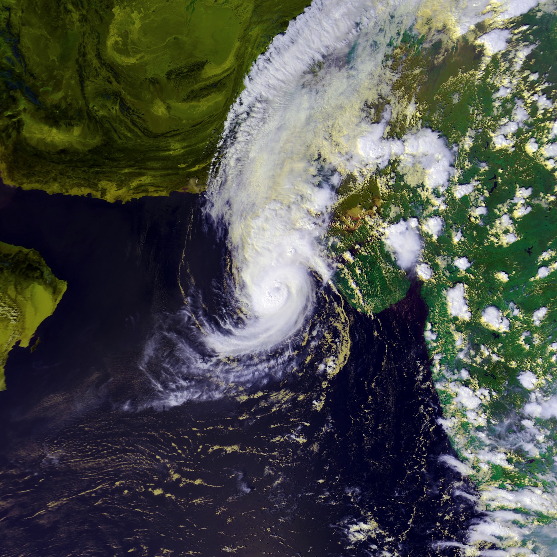
Track=Onil 2004 track.pngSeptember 30
Dissipated=October 3
1-min winds=40
Pressure=997October 1 , a tropical depression developed in the northeastern Arabian Sea. It moved northeastward, where it strengthened into a tropical storm on the 2nd. The name, "Onil" was the first cyclonic system to ever be named in history of the North Indian Ocean cyclones. Onil later reached a peak with sustained winds of 45 mph, though other forecasting agencies estimated a stronger storm. Regardless, the storm entrained dry air and rapidly weakened. Though operationally Onil was said to have made landfall on India, the low level circulation halted just before landfall, drifted southward, and dissipated on the 10th.In the post-analysis by RSMC New Delhi, the system weakened into a depression over Gujarat-Kutch coast in the evening of 3 October without crossing the coast.
Depression
A depression existed in the Bay of Bengal between
October 2 andOctober 4 before making landfall on the fourth.Land Depression
A depression developed over land near the India-Bangladesh border on
October 7 , traveled northeast over Bangladesh, and dissipated onOctober 8 .Deep Depression (04A)
Infobox Hurricane Small
Basin=NIO
Type1=deepdepression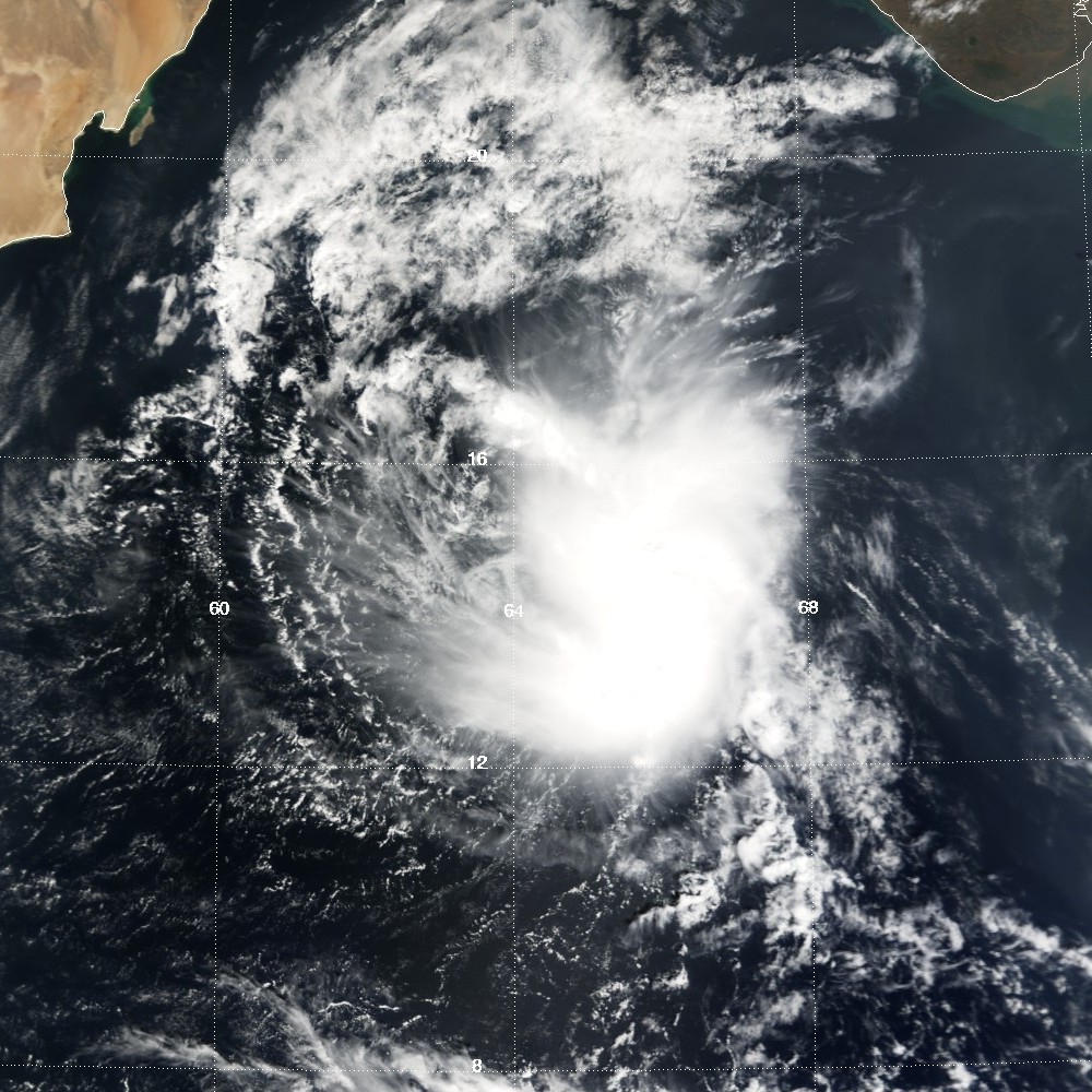
Track=Cyclone 04A 2004 track.pngNovember 2
Dissipated=November 7
1-min winds=40
Pressure=994November 4 . It moved generally westward, where it slowly weakened until dissipating on the 7th.evere Cyclonic Storm Agni
Infobox Hurricane Small
Basin=NIO
Type1=svrcyclstorm
Track=Agni 2004 track.pngNovember 29
Dissipated=December 2
1-min winds=65
Pressure=976November 19 , an area of convection developed and persisted about 500 miles east-southeast ofColombo . Under an area of moderate vertical shear, it moved west-southwestward and slowly organized. It nearly dissipated on the 24th, but redeveloped on the 26th under an area of favorable upper level winds and good diffluence aloft. OnNovember 27 , it became Tropical Depression 5A, and after moving to the west-southwest, became Tropical Storm Agni on the 28th only 50 miles from theequator (about 0.7°N). In its developmental stages, its circulation crossed the equator briefly into the southern hemisphere, while retaining its counter-clockwise spin. Under unusually favorable conditions so close to the equator, Agni strengthened and turned to the northwest. The convection concentrated, and quickly became a cyclone onNovember 29 . A pinhole eye briefly developed, but dry air and vertical wind shear weakened Agni back to a tropical storm. The effects were temporary, and Agni re-attained cyclone status on the 30th. OnDecember 1 , the shear and dry air returned, and Agni again weakened back to a tropical storm. After moving to the northwest for much of its lifetime, the storm turned to the west towards northeasternAfrica , under the influence of thesubtropical ridge to its north. Late onDecember 3 , the storm weakened to a tropical depression, and made landfall on easternSomalia on the 4th. It turned to the south, and dissipated after reaching theArabian Sea onDecember 5 .When Tropical Storm Agni reached a position of 50 miles north of the equator, it became the nearest a tropical cyclone has ever approached to the equator, less than half of
Typhoon Vamei 's previous record distance of 103 miles. However, because Agni formed more to the north and tracked southwestward, Vamei retains the record for the southernmost formation. RSMC New Delhi also admitted that cyclogenesis over the north Indian Ocean at such low latitudes has not occurred in the past. Because the storm was weak and the convection disorganized when it hit Somalia, no damage or deaths were reported from the storm. [ [http://australiasevereweather.com/cyclones/2005/summ0411.htm Monthly Global Tropical Cyclone Summary November 2004 ] ]2004 storm names
Tropical cyclone naming in the North Indian Ocean began in 2004. The following names were used.
ee also
*
List of North Indian Ocean cyclone seasons
*2004 Atlantic hurricane season
*2004 Pacific hurricane season
*2004 Pacific typhoon season
*South-West Indian Ocean cyclone seasons: 2003-04, 2004-05
*Australian region cyclone seasons: 2003-04, 2004-05
*South Pacific cyclone seasons: 2003-04, 2004-05References
* [http://australiasevereweather.com/cyclones/tc2005bt.htm Gary Padgett Tropical Cyclone Summary]
* [http://australiasevereweather.com/cyclones/tc2006bt.htm Gary Padgett Tropical Cyclone Summary Part 2]
* [http://www.wmo.ch/web/www/TCP/OperationPlans/TCP21-OP2005.pdf Tropical Cyclone Operational Plan for the Bay of Bengal and the Arabian Sea]
* [http://www.imd.gov.in/services/cyclone/impact.htm Impact of Cyclonic Storms and Suggested Mitigation Actions] (by India Meteorological Department)
* [http://ftp.wmo.int/pages/prog/www/TCP_vO/PTC%2032%20Final%20Report.pdf WMO/ESCAP Panel on Tropical Cyclones Final Report]
Wikimedia Foundation. 2010.