- U.S. Route 89 in Utah
-
U.S. Route 89

Map of US-89 (delineated in red)Route information Defined by Utah Code §72-4-114 Maintained by UDOT Length: 502.577 mi[1] (808.819 km) Existed: 1926 – present Major junctions South end:  US 89 towards Flagstaff, AZ
 US-89A in Kanab
 SR-12 near Panguitch
 I-70 near Richfield
 US-189 in Provo
 I-80 in Salt Lake City
 SR-39 in Ogden
 US-91 in Logan
North end: US-89 towards Montpelier, IDHighway system United States Numbered Highways
List • Bannered • Divided • ReplacedState highways in Utah
Interstate • US • State (Parks) • Scenic←  SR-88
SR-88US-89A →In the U.S. state of Utah, U.S. Route 89 (US-89) is a long north–south state highway spanning more than 502 miles (807.891 km) through the central part of the state. Between Provo and Brigham City, US-89 serves as a local road, paralleling Interstate 15, but the portions from Arizona north to Provo and Brigham City northeast to Wyoming serve separate corridors. The former provides access to several national parks and Arizona, and the latter connects I-15 with Logan, the state's only Metropolitan Statistical Area not on the Interstate.[2]
When US-89 was established in the state in 1926, the road initially extended north to US-91 in Spanish Fork. Following the extension of the former to the Canadian border, Interstate 15 was constructed roughly paralleling US-89 to the west and replacing US-91 south of Brigham City. During this process, US-89 was rerouted in southern Utah and northern Arizona with the old roadway becoming US-89A.
Contents
Route description
Arizona border to I-70
US-89 enters Utah from the south inside the Glen Canyon National Recreation Area, about 7 miles (11 km) north of the Glen Canyon Dam, where it crosses the Colorado River near Page, Arizona. After leaving the recreation area and passing the small town of Big Water, the highway curves west through the Grand Staircase-Escalante National Monument. US-89 stays near the monument's southern boundary,[3] crossing the East Clark Bench and The Cockscomb and passing south of the Vermilion Cliffs of the Grand Staircase. At the city of Kanab, US-89 meets the north end of US-89A, an alternate route south into Arizona, and abruptly turns north and begins climbing the staircase. Here the Mt. Carmel Scenic Byway begins; one of the Utah Scenic Byways, it stretches north to SR-12 at Bryce Canyon Junction.[4] The Vermilion Cliffs are ascended via the canyon carved by Kanab Creek. Near the White Cliffs, US-89 meets SR-9 at Mt. Carmel Junction, where travelers can turn to reach Zion National Park. The final "step" is the Pink Cliffs, where the highway follows alongside the Virgin River to the highest point on US-89 in southern Utah and the east end of SR-14, a summit at Long Valley Junction (elevation 7450 feet/2300 m).[5]
 Looking south from Sevier towards the Sevier Canyon
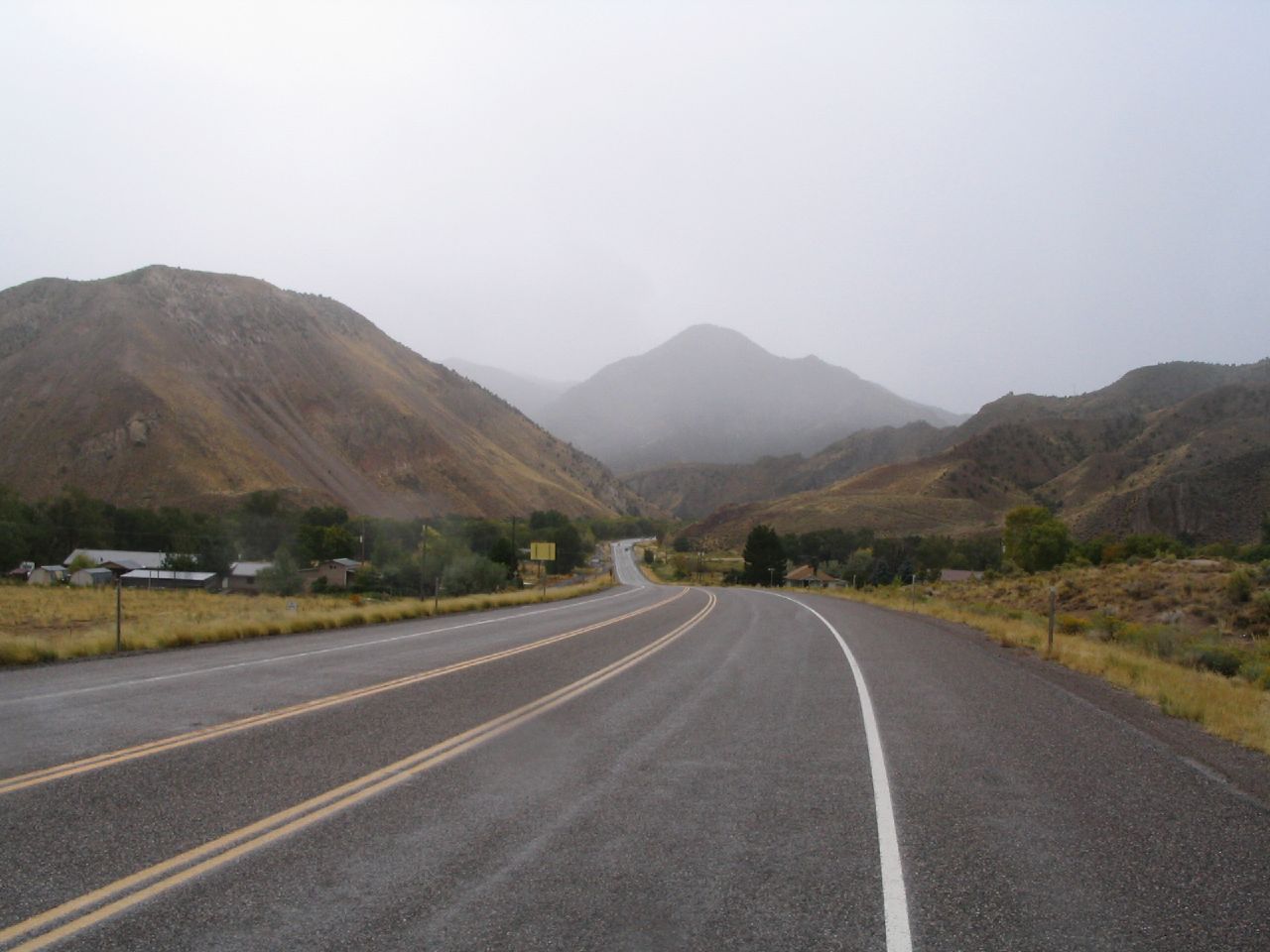
North from Long Valley Junction, US-89 descends through the valley of the Sevier River, meeting SR-12, a scenic highway that leads to Bryce Canyon National Park, at Bryce Canyon Junction, SR-143 in Panguitch, and SR-20 at Bear Valley Junction. As the highway continues north, the valley narrows significantly into the Circleville Canyon before opening out near the town of Circleville. In this part of the valley, the Sevier River is dammed to create the Piute Reservoir, and US-89 meets SR-62 near Kingston. North of Marysvale, the valley again narrows into the Sevier Canyon, which carries the river to its confluence with Clear Creek and US-89 to its overlap with Interstate 70, beginning at Sevier.[5]
I-70 to the Wasatch Front
Although US-89 follows the I-70 freeway from Sevier to Salina, the old alignment can still be driven, and is state-maintained north of Elsinore as SR-258, SR-118 (which overlaps I-70 Business through Richfield), SR-24, and US-50. Both highways stay mainly in the west half of the Sevier River's valley, with the faster I-70/US-89 bypassing the communities that the surface road passes through. Just south of Salina, I-70 curves to the east, rising alongside Salina Creek, and US-89 exits into downtown Salina, where it rejoins its pre-freeway alignment. US-50 overlaps US-89 between I-70 and Salina, following I-70 east and a separate alignment northwest from the area; the short Interstate 70 Business also uses this roadway as a business spur from I-70 to the city. North of Salina, US-89 bypasses Redmond (SR-256 follows the former route through the town) and passes through Centerfield to Gunnison, where it meets SR-28 and finally turns away from the Sevier River.[5]
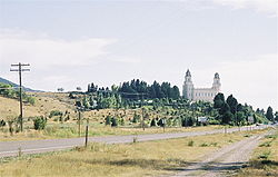
At Gunnison, US-89 turns east before curving northeast into the Sanpete Valley, formed by the San Pitch River, a tributary of the Sevier River. Along US-89 in this valley are several small cities: Manti, Ephraim, Mount Pleasant, and Fairview. Between Ephraim and Mount Pleasant, US-89 meets the south end of SR-132 at Pigeon Hollow Junction. SR-132 was formerly US-189, connecting US-89 with US-91 in Nephi. Beyond Fairview, where the scenic SR-31 turns east, US-89 climbs out of the valley, reaching a summit at Hill Top (elevation 6400 feet/2000 m). Thistle Creek parallels the next leg of the highway, descending through a canyon to the junction with US-6 near the ghost town of Thistle, flooded by a landslide in 1983. Thistle Creek and Soldier Creek, paralleled by US-89 and US-6, merge near this junction to form Spanish Fork, which the overlapped routes follow northwest through Spanish Fork Canyon into the Utah Valley at Moark Junction. US-89 splits to the north from US-6 there, skirts the west edge of Mapleton, and merges with SR-51 - the old Arrowhead Trail (US-91) - south of downtown Springville.[5]
Wasatch Front
 State Street approaching the Utah State Capitol; northbound US-89 turned left here until 2007
From Springville north to Salt Lake City, US-89 parallels—and for a distance overlaps—Interstate 15, following the old Arrowhead Trail, once the main highway from Salt Lake City to Los Angeles, through a number of downtowns. Numerous state highways connect US-89 to I-15, including SR-77 in Springville, SR-114 in Provo, SR-52 in Orem, SR-180 and SR-145 in American Fork, and SR-73 in Lehi. In Provo, US-89 meets US-189, its only branch, which heads northeast through Provo Canyon to Heber City, connecting to I-80 and bypassing Salt Lake City. North of Lehi, US-89 merges with I-15 (at exit 282), which has been built on or near the old road through a gap in the Traverse Mountains (elevation 4800 feet/1500 m) into the Salt Lake Valley. The routes split in Draper, formerly with a direct interchange north of SR-71, but US-89 traffic must now exit at SR-71 (exit 291), turn east to Factory Outlet Drive, and follow this frontage road to the location of the former split. From here all the way to downtown Salt Lake City, US-89 is marked along State Street, a major north–south street that ends at the Utah State Capitol. After passing through Sandy, Midvale, Murray, and South Salt Lake, State Street enters Salt Lake City at the intersection with SR-201 (2100 South). Until 2007, US-89 followed State Street to North Temple (100 North), two blocks from the capitol, but now it turns at 400 South, following the former alignment of SR-186 west and north on 300 West, and rejoining its pre-2007 route at North Temple. As it leaves downtown, 300 West curves northwesterly and becomes Beck Street.[5]
US-89 leaves Salt Lake City at exit 312 of I-15, where it acts as I-15's frontage roads. Just south of I-15's junction with I-215, US-89 splits to the northeast, passing through Bountiful and Woods Cross. A northerly curve onto 500 West removes the highway from Bountiful's Main Street, and it merges with I-15 at exit 317 to bypass Centerville and Farmington, where the old road (former US-91, but never US-89) is SR-106, through the narrow strip of land that separates Farmington Bay from the Wasatch Mountains. US-89 leaves I-15 at exit 324, where the Legacy Parkway also ends, and proceeds north on a freeway. This portion of US-89 is the only one to include exit numbers based on its own mileage, as opposed to the overlapping I-15 or I-70. The freeway ends after US-89 crosses SR-273, the former surface alignment of US-91 in both directions, and heads north as a four-lane road along the Wasatch foothills, to the east of Layton and Hill Air Force Base. After crossing I-84 in Uintah, US-89 enters Ogden, which it traverses via Washington Boulevard, rejoining old US-91 (now SR-26) south of downtown. Beyond Ogden, US-89 continues in a general northerly direction along the thin strip between Willard Bay and the Wasatch Mountains to Brigham City, where it finally turns east away from the I-15 corridor.[5]
Wasatch Front to Idaho border

US-89 meets the current alignment of US-91 in the southern outskirts of Brigham City, turning east for an overlap on the city's southeast bypass. (SR-13 and SR-90 are the former alignment through Brigham City.) The two routes head east up Box Elder Canyon in the southern Wellsville Mountains, finally leaving the valley of the Great Salt Lake into a small valley that contains Mantua Reservoir (elevation 5200 feet/1585 m). US-89/US-91 turns north there, bypassing the town of Mantua to the west, and continues to ascend through Dry Canyon to Sardine Summit (elevation 5900 feet/1798 m). Another small valley leads to Wellsville Canyon, where the four-lane roadway again turns east and descends into the Cache Valley. In that valley, US-89/US-91 heads northeast, bypassing Wellsville to the east, into downtown Logan. US-91 continues northerly from Logan into Idaho, but US-89 splits to the east, beginning a long climb of the Bear River Range through Logan Canyon. The Logan Canyon Scenic Byway, a Utah and National Scenic Byway, begins at Logan and follows US-89 up the canyon, past the access road to the Beaver Mountain ski area, to Garden City and on to the state line.[4][6] Bear Lake Summit (elevation 7800 ft/2377 m), at the top of the range, is the highest point on US-89 in Utah, from which it descends the east slope via horseshoe curves to Garden City on the shore of Bear Lake (elevation 5900 ft/1798 m). The final segment of US-89 to the Idaho state line follows the lake's west shore, its location constrained by the Bear River Range just to the west.[5]
History
When US-89 was created in 1926, it only went as far north as Spanish Fork, where travelers could continue to Salt Lake City via US-91.[7][8] The highway was extended north to the Canadian border near Glacier National Park in the mid-1930s,[9][10][11] though a dispute between Utah and Idaho on the one side and Wyoming on the other was not settled until 1938. The American Association of State Highway Officials decided in favor of Utah and Idaho, placing US-89 on or near US-91 between Spanish Fork and Logan, where it split northeasterly to Yellowstone National Park. (US-89 only left US-91 twice: between Farmington and Ogden, where it still travels today, and via an all-weather route from Brigham City into the Cache Valley, now SR-38 and SR-30.[12]) Wyoming's preferred routing, which left US-91 at Provo, instead became US-189.[13] Beginning in the 1950s, Interstate 15 was constructed, replacing US-91 for through traffic south of Brigham City, and leading to that route's truncation there in 1974.[14] On the other hand, US-89 follows independent corridors south of Spanish Fork and north of Logan. It has not been truncated, and mostly follows US-91's final alignment, except between Farmington and Ogden (where old US-91 is now I-15, SR-126, and SR-26).
The southern part of US-89, running northerly from Kanab, mostly follows a succession of linear valleys. The Denver and Rio Grande Western Railroad opened a branch (later the Marysvale Branch) from its main line at Thistle to Manti in 1890, and extended it (through a subsidiary, the Sevier Railway), to Salina in 1891, Belknap in 1896, and Marysvale in 1900.[15] No rail line ever reached farther south,[16] and so residents of towns such as Junction, Panguitch, Alton, Glendale, and Kanab had to travel north to the railhead at Marysvale. The old county road through Circleville Canyon was poorly constructed, with steep grades and a rough surface.[17] The State Road Commission designated the highway from Nephi east through Salt Creek Canyon and then south through these valleys to Kanab as a state road in or soon after 1910.[18] Initially the route from the summit at Long Valley Junction to Kanab went through Alton and Johnson Canyon, entering Kanab from the east. A more direct route via Long Valley was considered, serving the communities of Glendale, Orderville, and Mt. Carmel, but this would have required difficult construction over a mesa covered in loose sand to reach Kanab. In summer 1912, the commission added a branch from Long Valley Junction to Mt. Carmel, allowing these communities access to the state road system, along with a connection west from the junction to Cedar City.[17] Several years later, in December 1915, the commission added the Mt. Carmel-Kanab road over the sand hills to the system, and began construction of a sand-clay road in 1916.[19] A connection from Pigeon Hollow Junction north to Thistle was also added in 1912, following the rail line through a canyon and providing another route to Salt Lake City.[20]
In 1919, the state legislature redefined the state road system to include only a short list given in the law and any federal aid projects. The entire route from Kanab north was kept, including both approaches to Kanab and the two roads to Nephi and Thistle. In addition, a short extension from Kanab south to Arizona was added.[21] An amendment in 1923 removed most of the original route through Johnson Canyon, but added a second route to Alton from the west, effectively forming a large triangular loop through that town.[22] (The old route from Alton south to Kanab would be re-added to the state road system in 1933 as SR-136.[23]) In the early 1920s, the State Road Commission assigned numbers to several major state roads; the route from Arizona northerly through Kanab and Richfield to Nephi became State Route 11.[24][25] The numbers were officially adopted by the legislature in 1927, with both the main route and the loop through Alton being defined as SR-11; a new State Route 32 followed the branch to Thistle.[26] The Alton loop was removed from SR-11 in 1941, with the south half remaining in the system as part of SR-136.[27] Despite these designations, the majority of SR-11 and all of SR-32 were instead marked as US-89, with the remainder of SR-11 between Pigeon Hollow Junction and Nephi marked as US-189 from about 1930 until 1938.[7][8][11][28]
State Route 1, which became U.S. Route 91 in 1926, ran north–south through central and northern Utah in the 1920s. State Route 2 left SR-1 at Logan and ran east through Logan Canyon to Garden City; this had been built with federal aid as a forest road in about 1918.[29] The road north from Garden City to Idaho was added to the system in 1921,[30] and became part of State Route 3.[25] In 1927, the legislature added State Route 49, an alternate southern entrance to Ogden that left SR-1 at Farmington and merged with SR-5 (US-30S) at Uintah.[31] (Present SR-60 was numbered as a branch of SR-49 until 1935.[32]) State Route 69, stretching from US-191 (now SR-13) just north of Brigham City north and east to US-91 in Logan, became a state highway in 1931.[33] The 1930s extension of US-89 took it north from Thistle along US-50 (SR-8) to Springville, US-91 (SR-1 and SR-106, later all SR-1) to Farmington, SR-49 to Uintah, US-30S (SR-5) to Ogden, US-91 (SR-1) to Brigham City, SR-69 to Logan, SR-2 to Garden City, and SR-3 to Idaho.[12] US-89 was removed from SR-69 and overlapped with US-91 between Brigham City and Logan in the mid-1950s.[34][35]
In 1957, one year after construction began on the Glen Canyon Dam, the legislature designated a new State Route 259, heading east and southeast from SR-11 in Kanab to Arizona en route to the dam and adjacent bridge.[36] This replaced about eight miles (13 km) of SR-136 (the original state highway from the 1910s) at its south end,[37] but the remainder was a new roadway, through an area not previously served by improved roads.[35] The route past the dam was initially designated as an alternate route of US-89,[38] but when completed on February 20, 1959 it instead became US-89's mainline, as it was a better route during all weather, and the old route (SR-11 south of Kanab) became U.S. Route 89 Alternate.[39]
Major numbering changes were made in Utah's state highway system in the 1960s and 1970s, beginning with the construction of Interstate Highways and culminating in the 1977 renumbering, where state route numbers concurrent with other types were dropped entirely. However, the majority of these changes were not visible to the public, as signs continued to display US-89 and other U.S. Routes and Interstates. The following changes were made to state routes related to US-89:[40]
Route Pre-1962 Changes Post-1977 SR-1[41] Aligned with US-91 (not signed) 1962: moved to I-15 (no signage changes); specific changes are listed below Became I-15 SR-259[36] Arizona to SR-11 (US-89A) in Kanab (signed as US-89) no changes Replaced by US-89 SR-11[18] Arizona to Nephi (mostly US-89; only signed north of Pigeon Hollow Junction) 1969: cut back to SR-4 (future I-70) at Sevier (SR-11 signs were replaced with SR-132 signs north of Pigeon Hollow Junction); specific changes are listed below Arizona to Kanab SR-258[42] Loop off US-89 through Central 1969: moved west to replace SR-11 (US-89) between Elsinore and SR-120 (signs were removed from the old route) Remained as temporary US-89 SR-120[43] N/A 1969: created as a business loop for future I-70 through Richfield, replacing SR-11 (US-89) (no signage changes) Remained as temporary US-89 SR-119[44] SR-11 (US-89) east to SR-24 1969: extended southwest over SR-11 (US-89) to SR-120 (no signage changes) SR-120 east to SR-24 SR-135[45] N/A 1969: replaced SR-11 (US-89) between SR-119 and SR-24 (no signage changes) Remained as temporary US-89 SR-24[46] SR-11 (US-89) southeast and northeast to I-70 1969: extended north over SR-11 (US-89) to SR-28 in Salina (no signage changes) US-50 near Salina southeast and northeast to I-70 SR-28[47] SR-11 in Gunnison north to Levan 1969: extended south over SR-11 (US-89) and proposed connection to I-70 (no signage changes) US-89 in Gunnison north to Levan (1969 extension replaced by US-89) SR-32[20] SR-11 (US-89) at Pigeon Hollow Junction north to Thistle (signed as US-89) 1969: extended south over SR-11 (US-89) to SR-28 in Gunnison (no signage changes) Replaced by US-89 SR-132[48] Lynndyl to Nephi 1969: extended southeast over SR-11 to SR-32 (US-89) at Pigeon Hollow Junction (signs changed from SR-11 to SR-132 on extension) Lynndyl to US-89 at Pigeon Hollow Junction SR-8[49] Colorado to SR-1 (US-91) in Springville (signed as US-6, US-50, and US-89) 1962: replaced by SR-4 (I-70) near the Colorado state line (no signage changes)
1964: replaced SR-1 (US-89/91) between Springville and Lehi (no signage changes)
1969: became SR-27 south of Moark Junction (no signage changes), leaving only Moark Junction to LehiReplaced by US-89 SR-271[50] N/A 1964: replaced SR-1 (US-89/91) through Salt Lake City, from Draper to Becks (no signage changes) Replaced by US-89 SR-169[51] N/A 1962: replaced SR-1 (US-89/91) from Becks to north Bountiful (no signage changes) Replaced by US-89 SR-49[52] SR-1 north to SR-3 (I-80N) near Uintah (signed as US-89) 1968: replaced SR-3 from Uintah to Ogden (no signage changes) Replaced by US-89 SR-50[53] N/A 1969: replaced SR-1 (US-89/91) from Roy through Ogden to Hot Springs Junction (no signage changes) Replaced by US-89 north of Ogden; Roy to Ogden (ex-US-91) became SR-26 SR-84[54] SR-1 in Roy to SR-1 at Hot Springs Junction 1962: replaced SR-1 (US-89/91, US-191) from Hot Springs Junction to Riverside (no signage changes)
1969: replaced SR-1 (US-91) from Layton to Roy (no signage changes)Replaced by US-89 from Hot Springs Junction to Brigham City; Layton to Hot Springs Junction became SR-126 and Brigham City to Riverside became SR-13 SR-85[55] N/A 1962: replaced SR-1 (US-89/91) from Brigham City to Idaho (no signage changes) Replaced by US-91 (partly concurrent with US-89) SR-13[56] N/A 1962: replaced SR-2 (US-89) from Logan to Garden City (no signage changes) Replaced by US-89 SR-16[57] N/A 1962: replaced SR-3 (partly US-89) from Wyoming to Idaho (signage south of Garden City changed from SR-3 to SR-16) Wyoming to SR-30 at Sage Creek Junction (replaced by SR-30 and US-89 north of Sage Creek Junction) In particular, SR-11 was cut back to only the roadway south from Kanab, which had become US-89A in 1959.[18]
Major intersections
County Location Mile[1] # Destinations Notes Kane 0.000 Arizona state line 17.689 Cottonwood Canyon Road 54.629 Johnson Canyon Road Former SR-136 Kanab 63.832 US-89A south (100 East) – Fredonia, Jacob Lake, Grand CanyonMt. Carmel Junction 81.211  SR-9 west – Zion National Park, Hurricane
98.993 Johnson Canyon Road Former SR-136 Long Valley Junction 103.684  SR-14 west – Duck Creek, Cedar City
Garfield Bryce Canyon Junction 124.227 SR-12 east – Bryce Canyon National Park, TropicPanguitch 131.088  SR-143 (Main Street)
Bear Valley Junction 141.104  SR-20
SR-20Piute 162.382  SR-62
SR-62Junction 164.282  SR-153 (Center Street)
Sevier Sevier 190.830 Sevier Road, Clear Creek Canyon Road Former SR-4 191.740 I-70 westSouth end of I-70 overlap Joseph 194 25  SR-118 – Joseph, Monroe
Elsinore 200 31 Elsinore, Monroe (SR-258) Richfield 206 37  I-70 Bus. east (SR-120) – Richfield
209 40 I-70 Bus. west (SR-120) – RichfieldSigurd 217 48  To SR-24 (via SR-259) – Sigurd, Aurora
Salina 225.362  I-70 east / US-50 – Green River
North end of I-70 overlap; south end of US-50/I-70 Bus. overlap 227.117 US-50 west (Main Street) to SR-24 – Scipio, DeltaNorth end of US-50/I-70 Bus. overlap 228.225  SR-256
Sanpete 233.460 SR-256Gunnison 240.195  SR-137 (600 South)
241.434  SR-28 (Main Street)
247.806 SR-137Ephraim 262.180 400 South Former SR-29 262.668  SR-290 (Center Street)
262.794 SR-290 (100 North)Pigeon Hollow Junction 267.346  SR-132
271.892  SR-117
276.346 SR-117Mount Pleasant 277.868  SR-116 (Main Street)
Fairview 284.131  SR-31 (400 North)
Utah 312.784  US-6 east – Price
South end of US-6 overlap Moark Junction 322.276  US-6 west to I-15 – Spanish Fork, Provo, Salt Lake
North end of US-6 overlap Mapleton 324.711  SR-147 (1600 South)
325.719 SR-147 (Maple Street) – Mapleton City CenterSpringville 327.694  SR-51
SR-51Interchange; southbound exit and northbound entrance 328.068  SR-77 (400 South) to I-15
329.778  SR-75 (1400 North) to I-15
Provo 334.108 US-189 (University Avenue) to I-15334.855  SR-114 (Center Street) to I-15
Orem 337.878  SR-265 (University Parkway) to I-15
339.625 Center Street Former SR-78 340.167 400 North Former SR-247 340.707  SR-52 (800 North) to I-15
Pleasant Grove 344.559  SR-146 (100 East)
344.676 SR-114 (Main Street)Former SR-233 345.436 To I-15 / Pleasant Grove Boulevard, Center StreetFormer SR-233 American Fork 347.360  SR-180 (500 East) to I-15
347.971  SR-74 (100 East)
348.811  SR-145
Lehi 350.056  SR-73 (Main Street) to I-15
351.984  SR-197 (500 West)
352.996 I-15 south – ProvoSouth end of I-15 overlap 355 284  SR-92 – Highland, Alpine
Salt Lake Draper 359 288  SR-140 (14600 South)
361 289  SR-154 (Bangerter Highway)
362  I-15 north / SR-71 west (12300 South) – Salt Lake, Riverton
North end of I-15 overlap; south end of SR-71 overlap 362.150 SR-71 east (12300 South) – DraperNorth end of SR-71 overlap Sandy 364.420 10600 South 366.464  SR-209 (9000 South)
Midvale 368.750  SR-48 (7200 South)
Murray 369.493  I-215
I-215Interchange 371.216  SR-173 (5300 South)
371.793 Vine Street Former SR-173 372.491  SR-266 (4500 South)
South Salt Lake 374.270  SR-171 (3300 South)
375.559 I-80Interchange 376.062  SR-201 (2100 South)
Salt Lake City 377.762 900 South Former SR-176 378.407  SR-269 (500 South) to I-15 / I-80
378.552  SR-186 (400 South, State Street)
Former US-89 north 378.852  SR-270 south (West Temple) to I-15 / I-80
379.145 To I-15 / I-80 / 300 West, 400 SouthFormer SR-176 379.881 North Temple Former US-89 south, SR-186 west 380.641  SR-268 (600 North) to I-15
381.495 SR-186 (Victory Road) – Pioneer Memorial Museum383 2300 North Former SR-249; access across railroad has been closed 383 I-15 southSouthbound exit and northbound entrance Davis North Salt Lake 384 I-15 north – OgdenNorthbound exit and southbound entrance 384.879 Orchard Drive Former SR-255 386.272 400 East Former SR-131 386.801  SR-93 (2600 South) to I-15
Bountiful,
Woods Cross387.379  SR-68 north
Interchange; northbound exit and southbound entrance 387.773 1500 South Former SR-131 Bountiful 388.438 SR-68 (500 South) to I-15Bountiful, West Bountiful 389.123  SR-106 (400 North) to I-15 south
South end of freeway 389.531 I-15 southSouth end of I-15 overlap; southbound exit and northbound entrance Centerville 391 319 Centerville (SR-105) Farmington 394 322  SR-227 / Lagoon Drive – Farmington
Northbound exit and southbound entrance 395.586 I-15 northNorth end of I-15 overlap; southbound exit is via exit 395 394  SR-67 south (Legacy Parkway)
Southbound exit and northbound entrance 396.051 395  SR-225 (Park Lane) – Farmington
396.746 396 SR-106 (Shepard Lane)397.549 397  SR-273 – Fruit Heights, Kaysville, Farmington
Fruit Heights 398.695 North end of freeway 399.705 200 North Former SR-110 Layton 401.411  SR-109 (Oakhills Drive)
404.296 404  SR-193 west – Hill AFB, Clearfield
Interchange South Weber 405.729 405  SR-60 (South Weber Drive)
Interchange; former SR-49A Weber Uintah 406.434  I-84 – Morgan, Evanston, Cheyenne, Riverdale
Interchange South Ogden 408.379  SR-203 (Harrison Boulevard)
410.256 Adams Avenue Parkway Washington Terrace South Ogden 412.189 36th Street Former SR-230 Ogden 412.365  SR-26 (Riverdale Road)
413.052  SR-79 (30th Street)
413.927  SR-53 (24th Street)
414.361 21st Street Former SR-175 414.508 20th Street Former SR-182 415.425 SR-39 (12th Street)415.942 7th Street Former SR-183A 416.463  SR-235 (Washington Boulevard) / 2nd Street
Former SR-203 Harrisville 417.408 SR-203 (Wall Avenue)Pleasant View 420.292  SR-134 (2700 North)
422.487 Pleasant View Drive Former SR-235 Box Elder Hot Springs Junction[58] 423.300  SR-126 to I-15 / I-84 – Salt Lake
Interchange Willard 428.771  SR-315 (750 North) to I-15 / I-84
Brigham City 433.555  US-91 south (1100 South) / SR-13 (Main Street)
435  SR-90 – Brigham City
Interchange; southbound exit and northbound entrance Mantua 437 Mantua Interchange; northbound exit and southbound entrance; former SR-251 439 Main Street Former SR-251; access has been closed Cache Wellsville 449  SR-23 (Center Street)
451  SR-101 (Main Street)
Logan 455  SR-252 (1000 West)
457  SR-165 (Main Street)
458 300 South Former SR-238 458  SR-30 west (200 North)
South end of SR-30 overlap 458.970 US-91 north (Main Street)North end of US-91 overlap 460.630 1200 East Former SR-288 480.896 Tony Grove Road Former SR-238 487.023  SR-243
Rich Garden City 498.512 SR-30 east (Bear Lake Boulevard)North end of SR-30 overlap 502.577 Idaho state line References
- ^ a b Utah Department of Transportation, Highway Reference Information, accessed May 2008
- ^ U.S. Census Bureau, Metropolitan and Micropolitan Statistical Areas and Components, December 2006, accessed May 2008
- ^ Bureau of Land Management, Grand Staircase-Escalante National Monument map, accessed May 2008
- ^ a b Utah Administrative Code, Rule R926-7: Scenic Byways, as in effect on April 1, 2008, accessed May 2008
- ^ a b c d e f g Google Maps street maps and USGS topographic maps, accessed May 2008 via ACME Mapper
- ^ National Scenic Byways Program, Logan Canyon Scenic Byway, accessed May 2008
- ^ a b Bureau of Public Roads, United States System of Highways, November 11, 1926
- ^ a b American Association of State Highway Officials, United States Numbered Highways, American Highways, April 1927
- ^ H.M. Gousha Company, Road Map: Western United States (prepared exclusively for Standard Oil Company of California), 1935: note that only Wyoming's routing is shown, and the old US-189 is present
- ^ Helena Independent, February 16, 1936: "U. S. 89. Closed from Canadian line to Browning."
- ^ a b Rand McNally & Company, Texaco Road Map: Idaho, Montana, Wyoming, 1937: note that the current routing is shown to the Utah-Idaho border, but Wyoming's preferred alignment is also labeled; the old US-189 is still present
- ^ a b Rand McNally Auto Road Atlas, 1946
- ^ Soda Springs Sun, Road Routing Of U.S. 89 Settled, December 15, 1938
- ^ Utah Department of Transportation, Highway Resolutions: Route 91PDF (19.6 MB), updated November 2007, accessed May 2008: includes scans of correspondence with AASHO
- ^ R. A. LeMassena (Sundance Publications), Rio Grande ... to the Pacific!, 1974, ISBN 0-913582-09-3, pp. 93, 255
- ^ C.S. Hammond & Company, 1923 Atlas of the World and Gazetteer, p. 114: Utah
- ^ a b Second Biennial Report of the State Road Commission to the Governor of Utah for the Year 1911 and 1912, pp. 76, 78
- ^ a b c Utah Department of Transportation, Highway Resolutions: Route 11PDF (5.62 MB), updated January 2008, accessed May 2008
- ^ Fourth Biennial Report, State Road Commission, 1915 and 1916, p. 163
- ^ a b Utah Department of Transportation, Highway Resolutions: Route 32PDF (15.0 MB), updated October 2007, accessed May 2008
- ^ "State Road Commission", Chapter 57, Session Laws of Utah, 1919: "(d) From Nephi southeasterly via Salt Creek Canyon, Fountain Green, Moroni, Ephraim, Manti, Sterling, Gunnison, Centerfield, Redmond, Salina, Aurora, Vermillion, Sigurd, Venice, Richfield, Austin, Elsinore, Joseph, Sevier, Marysvale, Junction, Circleville, Orton, Panguitch, Hillsdale, Hatch to Glendale, Mt. Carmel to Kanab to Arizona line to Johnson to Alton and Hatch. From Thistle southerly via Indianola, Milburn, Fairview, Mt. Pleasant, and Spring City to intersect with the road from Nephi to Ephraim and beginning at Fairview via Connellsville to Huntington."
- ^ "Designation of State Roads", Chapter 89, Session Laws of Utah, 1923: "...Hatch to Glendale, Mt. Carmel to Kanab to Arizona line; from Whitney McDonald's ranch, at what is known as the Old School House to Gravel Springs via Levanger Lake and Alton."
- ^ "Designation of Secondary State Roads", Chapter 30, Session Laws of Utah, 1933: "(136) From Kanab northeasterly via Johnson canyon to Alton."
- ^ State Road Commission, Utah State Trunk Lines, 1923
- ^ a b Rand McNally Auto Road Atlas, 1926
- ^ "Designation of State Roads", Chapter 21, Session Laws of Utah, 1927: "11. From Nephi via Fountain Green, Pigeon Hollow Junction, Ephraim, Manti, Gunnison, Salina, Sigurd, Richfield, Sevier, Marysvale, Junction, Orton, Panguitch, Hillsdale, Long Valley Junction, Gravel Springs Junction, McDonald's Ranch, Mt. Carmel Junction and Kanab to the Utah-Arizona state line; also from Gravel Springs Junction to Alton and Alton to McDonald's Ranch." "32. From Thistle, Utah county, thence south via Fairview and Mt. Pleasant to Pigeon Hollow Junction."
- ^ "Designation of State Roads", Chapter 34, Session Laws of Utah, 1941: "Route 136. From route 11 in Kanab northeasterly via Johnson Canyon and Alton to route 11 near McDonald's Ranch."
- ^ Rand McNally Auto Road Atlas, 1931
- ^ Fifth Biennial Report, State Road Commission, 1917-1918, p. 24
- ^ "Designation of State Roads", Chapter 62, Session Laws of Utah, 1921: "(q) From the Utah-Idaho state line near Swan Creek in Rich county following the west shore of Bear Lake by way of Garden City, Laketown, Randolph, Woodruff, to the Utah-Wyoming state line at a point about ten (10) miles in a southeasterly direction from Woodruff."
- ^ "Designation of State Roads", Chapter 21, Session Laws of Utah, 1927: "49. From Riverdale Junction to mouth of Weber canyon; also from mouth of Weber canyon to North Farmington Junction."
- ^ "Designation of State Roads", Chapter 37, Session Laws of Utah, 1935: "Route 49. From Uintah Junction on route 5 to North Farmington Junction on route 1." "Route 60. From Riverdale Junction on route 1 easterly to junction with route 49.""
- ^ "Designation of State Roads", Chapter 55, Session Laws of Utah, 1931: "(69) From Brigham City northerly via Honeyville, Deweyville, Collinston, Beaver Dam Summit, and easterly to Logan."
- ^ Rand McNally Auto Road Atlas, 1953
- ^ a b Utah State Road Commission (Rand McNally), Utah Official Highway Map, 1956
- ^ a b Utah Department of Transportation, Highway Resolutions: Route 259PDF (11.8 MB), updated November 2007, accessed May 2008
- ^ Utah Department of Transportation, Highway Resolutions: Route 136PDF (869 KB), updated November 2007, accessed May 2008
- ^ New York Times, Work Starts Soon on Canyon Bridge, February 10, 1957, p. 68
- ^ New York Times, New Bridge Spans Canyon of the Colorado, February 1, 1959, p. X23
- ^ Utah Department of Transportation, Highway Resolutions: Route 89PDF (18.3 MB), updated October 2007, accessed May 2008
- ^ Utah Department of Transportation, Highway Resolutions: Route 1PDF (35.4 MB), updated September 2007, accessed May 2008
- ^ Utah Department of Transportation, Highway Resolutions: Route 258PDF (5.66 MB), updated November 2007, accessed May 2008
- ^ Utah Department of Transportation, Highway Resolutions: Route 120PDF (1.62 MB), updated November 2007, accessed May 2008
- ^ Utah Department of Transportation, Highway Resolutions: Route 119PDF (5.66 MB), updated November 2007, accessed May 2008
- ^ Utah Department of Transportation, Highway Resolutions: Route 135PDF (5.65 MB), updated November 2007, accessed May 2008
- ^ Utah Department of Transportation, Highway Resolutions: Route 24PDF (17.9 MB), updated September 2007, accessed May 2008
- ^ Utah Department of Transportation, Highway Resolutions: Route 28PDF (10.0 MB), updated October 2007, accessed May 2008
- ^ Utah Department of Transportation, Highway Resolutions: Route 132PDF (2.04 MB), updated November 2007, accessed May 2008
- ^ Utah Department of Transportation, Highway Resolutions: Route 8PDF (16.8 MB), updated September 2007, accessed May 2008
- ^ Utah Department of Transportation, Highway Resolutions: Route 271PDF (3.03 MB), updated December 2007, accessed May 2008
- ^ Utah Department of Transportation, Highway Resolutions: Route 169PDF (5.59 MB), updated November 2007, accessed May 2008
- ^ Utah Department of Transportation, Highway Resolutions: Route 49PDF (4.59 MB), updated October 2007, accessed May 2008
- ^ Utah Department of Transportation, Highway Resolutions: Route 50PDF (5.14 MB), updated October 2007, accessed May 2008
- ^ Utah Department of Transportation, Highway Resolutions: Route 84PDF (6.85 MB), updated November 2007, accessed May 2008
- ^ Utah Department of Transportation, Highway Resolutions: Route 85PDF (3.24 MB), updated November 2007, accessed May 2008
- ^ Utah Department of Transportation, Highway Resolutions: Route 13PDF (4.69 MB), updated February 2008, accessed May 2008
- ^ Utah Department of Transportation, Highway Resolutions: Route 16PDF (2.01 MB), updated September 2007, accessed May 2008
- ^ "Utah Code -- Title 72 -- Chapter 04 -- Section 118 -- Designation of State Highways Act". Utah State Legislature. http://le.utah.gov/~code/TITLE72/htm/72_04_011800.htm. Retrieved 2008-08-06.
External links
U.S. Route 89Previous state:
ArizonaUtah Next state:
IdahoCategories:- U.S. Highways in Utah
- Utah Scenic Byways
- U.S. Route 89
- Transportation in Kane County, Utah
- Transportation in Garfield County, Utah
- Transportation in Piute County, Utah
- Transportation in Sevier County, Utah
- Transportation in Sanpete County, Utah
- Transportation in Utah County, Utah
- Transportation in Salt Lake County, Utah
- Transportation in Davis County, Utah
- Transportation in Weber County, Utah
- Transportation in Box Elder County, Utah
- Transportation in Cache County, Utah
- Transportation in Rich County, Utah


Wikimedia Foundation. 2010.