- Mount Ivy, New York
-
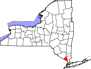
Mount Ivy, New York — CDP — Location within the state of New York
 Mount Ivy, New York
Coordinates: 41°11′31″N 74°1′56″W / 41.19194°N 74.03222°WCoordinates: 41°11′31″N 74°1′56″W / 41.19194°N 74.03222°W Country United States State New York County Rockland Area – Total 1.5 sq mi (3.8 km2) – Land 1.5 sq mi (3.8 km2) – Water 0.0 sq mi (0.0 km2) Elevation 459 ft (140 m) Population (2000) – Total 6,536 – Density 4,456.8/sq mi (1,720.8/km2) Time zone Eastern (EST) (UTC-5) – Summer (DST) EDT (UTC-4) ZIP code 10970 Area code(s) 845 FIPS code 36-48879 GNIS feature ID 0957849 Mount Ivy is a hamlet (and census-designated place) in the towns of Haverstraw and Ramapo New York, United States located north of New City; east of Pomona; south of Thiells and west of the Garnerville. The population was 6,536 at the 2000 census.
Geography
Mount Ivy is located at 41°11′31″N 74°1′56″W / 41.19194°N 74.03222°W (41.191839, -74.032162)[1].
According to the United States Census Bureau, the CDP has a total area of 1.5 square miles (3.9 km2), of which, 1.5 square miles (3.9 km2) of it is land and 0.68% is water.
Mount Ivy straddles the border of the Town of Ramapo and the Town of Haverstraw, lying primarily within southernmost Haverstraw and extending into northern Ramapo. The business center of Mount Ivy is located at the junction of U.S. Route 202 and New York State Route 45, approximately ¼ mile east of the Mount Ivy exit of the Palisades Interstate Parkway.
Demographics
As of the census[2] of 2000, there were 6,536 people, 2,693 households, and 1,728 families residing in the CDP. The population density was 4,456.8 per square mile (1,716.7/km²). There were 2,761 housing units at an average density of 1,882.7/sq mi (725.2/km²). The racial makeup of the CDP was 78.93% White, 8.48% African American, 0.43% Native American, 4.39% Asian, 0.06% Pacific Islander, 4.44% from other races, and 3.27% from two or more races. Hispanic or Latino of any race were 13.51% of the population. There were 2,693 households out of which 31.0% had children under the age of 18 living with them, 48.2% were married couples living together, 12.5% had a female householder with no husband present, and 35.8% were non-families. 29.7% of all households were made up of individuals and 6.6% had someone living alone who was 65 years of age or older. The average household size was 2.42 and the average family size was 3.04.
In the CDP the population was 23.5% under the age of 18, 7.0% from 18 to 24, 34.8% from 25 to 44, 26.1% from 45 to 64, and 8.6% who were 65 years of age or older. The median age was 36 years. For every 100 females there were 90.4 males. For every 100 females age 18 and over, there were 85.8 males. The median income for a household in the CDP was $51,935, and the median income for a family was $61,968. Males had a median income of $42,205 versus $38,071 for females. The per capita income for the CDP was $25,685. About 6.9% of families and 8.0% of the population were below the poverty line, including 10.7% of those under age 18 and 7.4% of those age 65 or over.
References
- ^ "US Gazetteer files: 2010, 2000, and 1990". United States Census Bureau. 2011-02-12. http://www.census.gov/geo/www/gazetteer/gazette.html. Retrieved 2011-04-23.
- ^ "American FactFinder". United States Census Bureau. http://factfinder.census.gov. Retrieved 2008-01-31.
Municipalities and communities of Rockland County, New York Towns Clarkstown | Haverstraw | Orangetown | Ramapo | Stony Point
Villages Airmont | Chestnut Ridge | Grand View-on-Hudson | Haverstraw | Hillburn | Kaser | Montebello | New Hempstead | New Square | Nyack | Piermont | Pomona | Sloatsburg | South Nyack | Spring Valley | Suffern | Upper Nyack | Wesley Hills | West Haverstraw
CDPs Bardonia | Blauvelt | Congers | Hillcrest | Monsey | Mount Ivy | Nanuet | New City | Orangeburg | Pearl River | Stony Point | Tappan | Thiells | Valley Cottage | Viola | West Nyack
Other
hamletsCentenary | Central Nyack | Doodletown | Garnerville | Grassy Point | Johnsontown | Jones Point | Ladentown | Middletown | Nauraushaun | Palisades | Rockland Lake | Sandyfield | Sickletown | Sparkill | St. John's in the Wilderness | Sterlington | Tallman | Tomkins Cove
Categories:- Census-designated places in New York
- Hamlets in New York
- Populated places in Rockland County, New York


Wikimedia Foundation. 2010.