- Clarkstown, New York
-
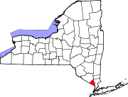
Clarkstown — Town — Location of Clarkstown within Rockland County Location within the state of New York
 Clarkstown
Coordinates: 41°7′34″N 73°58′49″W / 41.12611°N 73.98028°WCoordinates: 41°7′34″N 73°58′49″W / 41.12611°N 73.98028°W Country United States State New York County Rockland Area - Total 46.9 sq mi (121.6 km2) - Land 38.5 sq mi (99.8 km2) - Water 8.4 sq mi (21.7 km2) Elevation 105 ft (32 m) Population (2000) - Total 82,082 - Density 2,129.7/sq mi (822.3/km2) Time zone Eastern (EST) (UTC-5) - Summer (DST) EDT (UTC-4) ZIP code 10956 (New City) Area code(s) 845 FIPS code 36-15968 GNIS feature ID 0978832 Website http://town.clarkstown.ny.us Clarkstown is a town in Rockland County, New York, United States. The town is on the eastern border of the county, located north of the town of Orangetown; east of the town of Ramapo; South of the town of Haverstraw and west of the Hudson River. As of the 2000 census, the town had a total population of 82,082. The community of New City in the town is the seat of town government and of the Clarkstown Police Department, county sherriff's police office, and correctional facility. New City makes up about 41.47% of the town's population.
In 2008 Clarkstown became one of 600 municipalities nationwide to sign the United States Mayor's Climate Protection Agreement to reduce carbon dioxide emissions to 7 percent below the 1990 levels by 2012.
Contents
History
The town of Clarkstown was created in 1791 in Orange County, before Rockland County was formed.
In 2008 CNNMoney.com named Clarkstown the 71st best small "city" to live in America.
In 2010 CNNMoney.com named Clarkstown the 41st best small "city" to live in America, which was the highest such ranking in New York.[1]
Geography
The Hudson River defines the eastern border of the town, which is opposite the town of Mount Pleasant in Westchester County.
According to the United States Census Bureau, the town has a total area of 46.9 square miles (121 km2), of which 38.5 square miles (100 km2) is land and 8.4 square miles (22 km2) (17.87%) is water.
The New York State Thruway (Interstate 87) intersects the Palisades Parkway and the Garden State Parkway Connector in the town.
Demographics
As of the census[2] of 2000, there were 82,082 people, 27,697 households, and 21,991 families residing in the town. The population density was 2,129.7 people per square mile (822.3/km²). There were 28,220 housing units at an average density of 732.2 per square mile (282.7/km²). The racial makeup of the town was 79.97% White, 7.87% African American, 0.13% Native American, 7.90% Asian, 0.10% Pacific Islander, 1.99% from other races, and 2.03% from two or more races. Hispanic or Latino of any race were 6.92% of the population.
There were 27,697 households out of which 36.9% had children under the age of 18 living with them, 67.4% were married couples living together, 9.1% had a female householder with no husband present, and 20.6% were non-families. 16.9% of all households were made up of individuals and 6.5% had someone living alone who was 65 years of age or older. The average household size was 2.90 and the average family size was 3.27.
In the town the population was spread out with 24.7% under the age of 18, 6.6% from 18 to 24, 28.3% from 25 to 44, 28.1% from 45 to 64, and 12.3% who were 65 years of age or older. The median age was 39 years. For every 100 females there were 94.3 males. For every 100 females age 18 and over, there were 90.3 males.
According to a 2007 estimate, the median income for a household in the town was $92,121, and the median income for a family was $104,909.[1] Males had a median income of $57,773 versus $40,805 for females. The per capita income for the town was $34,430. About 2.5% of families and 3.8% of the population were below the poverty line, including 4.5% of those under age 18 and 3.4% of those age 65 or over.
Clarkstown is the most densely populated town in Rockland County and is home to New City which is the county's seat. It also has more business districts in it than any other town in Rockland, including Palisades Center, which is among the largest malls in the world.
Elected Representation
The Town of Clarkstown has as its chief executive a Town Supervisor. The current Town Supervisor is Alexander Gromack. Clarkstown is represented in the United States House of Representatives by Congressman Eliot Engel and by Congresswoman Nita Lowey. It is represented in New York State government by Senator David Carlucci and Assemblyman Kenneth Zebrowski.
Communities and locations in Clarkstown, NY
- Bardonia – A hamlet east of Spring Valley.
- Brownsell Corners – A hamlet in the north part of the town.
- Centenary – A hamlet near the north town line.
- Central Nyack – A hamlet on the south town line.
- Congers – A hamlet in the eastern part of the town.
- DeForest Lake – A long lake with a north-south orientation.
- High Tor State Park – A state park along the north town line.
- Germonds – A location south of New City.
- Hook Mountain State Park – A state park in the east part of the town.
- Lake Lucille – A location in the north part of the town.
- Mount Ivy – A hamlet on the north town line.
- Nanuet – A hamlet.
- New City – A hamlet that is the county seat.
- New City Condominiums – A neighborhood near the center of New City
- New City Park – A community in South New City.
- Nyack – A village, the north part of which is at the south town line.
- Nyack Beach State Park – A state park near the Hudson River.
- Oakbrook – A hamlet east of Spring Valley.
- Rockland Lake – A hamlet located west of a lake of the same name.
- Rockland Lake State Park – A state park in the eastern part of the town.
- Spring Valley – A village, the east portion of which is within the town.
- Upper Nyack – A village north of Nyack.
- Valley Cottage – A hamlet in the eastern part of the town.
- West Nyack – A hamlet west of Nyack village.
CQ Press Crime ranking
 Clarkstown Police Car
In 2005, it was named by Morgan Quitno the second safest city in the United States whose population is greater than 75,000 as well as then second safest overall from over 369 cities. This was the fifth year in a row in which Clarkstown made it within the top five and top ten respectively in these categories.
In 2007, Clarkstown, once again named the second safest city in the United States in The 14th annual "2007 – 2008 City Crime Rankings" published by CQ Press – formally known as Morgan Quitno, a unit of Congressional Quarterly Inc. It was based on the FBI's September 24, 2007 crime statistics report which looked at 378 municipal areas with at least 75,000 people based on per-capita rates for homicide, rape, robbery, aggravated assault, burglary and auto theft.
In 2008, Clarkstown, named the six safest city in the United States in The 15th annual "2008 – 2009 City Crime Rankings" published by CQ Press.
In 2009, Clarkstown, named the seventh safest city in the United States in The 16th annual "2009 – 2010 City Crime Rankings" published by CQ Press.
In 2010, Clarkstown, named the fifth safest city in the United States in The 17th annual "2010 – 2011 City Crime Rankings" published by CQ Press.[3]
However, these rankings are highly controversial, because of their source. In October 2007 The American Society of Criminology, The United States Conference of Mayors, and The Federal Bureau of Investigation requested that the publisher reconsider the promotion of the book – specifically, "their inaccurate and inflammatory press release labeling cities as 'safest' and 'most dangerous'" – because the rankings are "baseless and damaging." [2]
Clarkstown Going Green
Clarkstown has not only taken steps towards "going green" by conducting energy audits, purchasing Energy Star office equipment and using green cleaning products in town facilities, steps also included;
- 2005 – Purchasing 10% of the energy used by town government from wind and solar sources.
- 2006 – Passing a tree preservation law.
- 2007 – Purchasing Hybrid vehicles and smaller cars.
- 2008 – Installing energy-efficient lighting (LED) at its parks and recreation building with sensors that automatically turn off lights when no motion is detected.
US Supreme Court Case
In 1994, Clarkstown was involved in litigation that challenged a town ordinance that required all waste picked up in the town to be sorted for recyclables at a specific privately-operated facility. The case made it to the United States Supreme Court in C&A Carbone, Inc. v. Town of Clarkstown, New York, in which the ordinance was held unconstitutional.
References
- ^ "Amherst in top 50 of 'Best Places to Live'". BuffaloNews.com. July 16, 2010. http://www.buffalonews.com/incoming/article74813.ece.
- ^ "American FactFinder". United States Census Bureau. http://factfinder.census.gov. Retrieved 2008-01-31.
- ^ http://os.cqpress.com/citycrime/2010/City_crime_rate_2010-2011_lowtohigh.pdf
External links
Municipalities and communities of Rockland County, New York Towns Clarkstown | Haverstraw | Orangetown | Ramapo | Stony Point
Villages Airmont | Chestnut Ridge | Grand View-on-Hudson | Haverstraw | Hillburn | Kaser | Montebello | New Hempstead | New Square | Nyack | Piermont | Pomona | Sloatsburg | South Nyack | Spring Valley | Suffern | Upper Nyack | Wesley Hills | West Haverstraw
CDPs Bardonia | Blauvelt | Congers | Hillcrest | Monsey | Mount Ivy | Nanuet | New City | Orangeburg | Pearl River | Stony Point | Tappan | Thiells | Valley Cottage | Viola | West Nyack
Other
hamletsCentenary | Central Nyack | Doodletown | Garnerville | Grassy Point | Johnsontown | Jones Point | Ladentown | Middletown | Nauraushaun | Palisades | Rockland Lake | Sandyfield | Sickletown | Sparkill | St. John's in the Wilderness | Sterlington | Tallman | Tomkins Cove
Categories:- Towns in New York
- Populated places in Rockland County, New York


Wikimedia Foundation. 2010.