- City of Heidelberg
-
This article is about a former local government area in Victoria. For the German city, see Heidelberg.
City of Heidelberg
Victoria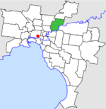
Location in MelbournePopulation: 62,800 (1992)[1] Established: 1840 Area: 34.08 km² (13.2 sq mi) Council Seat: Ivanhoe Region: Melbourne County: Bourke LGAs around City of Heidelberg: Whittlesea Diamond Valley Eltham Preston City of Heidelberg Doncaster & Templestowe Northcote Kew Camberwell  Heidelberg Town Hall
The City of Heidelberg was a Local Government Area located about 10 kilometres (6 mi) northeast of Melbourne, the state capital of Victoria, Australia. The city covered an area of 34.08 square kilometres (13.16 sq mi), and existed from 1840 until 1994.
Contents
History
Heidelberg was first incorporated as a Trust in 1840 - making it one of the earliest local government formations in Australia. On 12 October 1860 it became a District with a Roads Board. On 27 January 1871 it became a Shire and on 11 April 1934 it was proclaimed a City. In the 1960s it lost significant sections of its territory when on 1 October 1962 the neighbouring City of Northcote annexed its South Ward, and on 30 September 1964 the Shire of Diamond Valley was created out of its mostly rural North Ward.[2]
On 15 December 1994, along with nearly all other councils in Victoria, the City of Heidelberg was abolished and was merged with parts of Diamond Valley and Eltham into the new City of Banyule. A small area near La Trobe University was added to the City of Darebin.[3]
Council meetings were held at Heidelberg Town Hall in Upper Heidelberg Road, Ivanhoe. It is still used for the same purpose by the City of Banyule.
Wards
The City of Heidelberg was subdivided into five wards, each electing three councillors:
- Banyule Ward
- Eaglemont Ward
- Heidelberg West Ward
- Ivanhoe Ward
- Macleod Ward[2]
Suburbs
- Eaglemont
- Heidelberg
- Heidelberg Heights
- Heidelberg West
- Ivanhoe
- Ivanhoe East
- Macleod (split with Shire of Diamond Valley)
- Rosanna
- Viewbank
- Yallambie
Population
Year Population 1954 60,007 1958 77,000*+ 1961 59,795 1966 63,810 1971 68,013 1976 66,108 1981 64,757 1986 62,717 1991 60,468 * Estimate in the 1958 Victorian Year Book.
+ Includes the two sections severed in 1962-1964.References
- ^ Australian Bureau of Statistics, Victoria Office (1994). Victorian Year Book. p. 49. ISSN 0067-1223.
- ^ a b Victorian Municipal Directory. Brunswick: Arnall & Jackson. 1992. pp. 397–398. Accessed at State Library of Victoria, La Trobe Reading Room.
- ^ Australian Bureau of Statistics (1 August 1995). Victorian local government amalgamations 1994-1995: Changes to the Australian Standard Geographical Classification. Commonwealth of Australia. pp. 4–5. ISBN 0-642-23117-6. http://www.ausstats.abs.gov.au/ausstats/free.nsf/0/76E601D6DB55E88ACA25722500049195/$File/12570_1994-95.pdf. Retrieved 2007-12-16.
Former Local Government Areas in Melbourne, Victoria Altona · Berwick · Box Hill · Brighton · Broadmeadows · Brunswick · Bulla (S) · Camberwell · Caulfield · Chelsea · Coburg · Collingwood · Cranbourne · Croydon · Diamond Valley (S) · Doncaster & Templestowe · Dandenong · Eltham (S) · Essendon · Fitzroy · Flinders (S) · Footscray · Frankston · Hastings (S) · Hawthorn · Healesville (S) · Heidelberg · Keilor · Kew · Lillydale (S) · Malvern · Moorabbin · Mordialloc · Mornington (S) · Northcote · Nunawading · Oakleigh · Pakenham (S) · Port Melbourne · Prahran · Preston · Richmond · Ringwood · Sandringham · Sherbrooke (S) · South Melbourne · Springvale · St Kilda · Sunshine · Upper Yarra (S) · Waverley · Werribee · Williamstown
Categories:- Former Local Government Areas of Victoria (Australia)


Wikimedia Foundation. 2010.