- Mount Takao
-
Mount Takao 高尾山 
Elevation 599 m (1,965 ft) Location Hachiōji, Tokyo, Honshū, Japan 
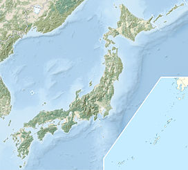
Coordinates 35°37′31″N 139°14′37″E / 35.62528°N 139.24361°ECoordinates: 35°37′31″N 139°14′37″E / 35.62528°N 139.24361°E Climbing Easiest route Chairlift or Funicular & Hiking Mount Takao (高尾山 Takao-san) is a mountain in the city of Hachiōji, Tokyo, Japan. It is protected within Meiji no Mori Takao Quasi-National Park.
Standing 599 metres (1,965 ft) tall and located within an hour of downtown Tokyo, it is a popular hiking spot, with eight hiking courses and more than 2.5 million annual visitors. The Tama Forest Science Garden is also located at the mountain's base.
Mount Takao is closely associated with tengu, minor kami from Japanese folklore, and the daitengu Naigubu. A Buddhist temple, Takaosan Yakuōin Yūkiji, is located on the mountain.
Contents
Climbing Mount Takao
Visitors to Mount Takao can choose to start climbing from the base, or take a funicular or ropeway ride halfway up the mountain. The Takao Mountain Railroad operates both of these services. The system nominally has four stations—two each for the funicular and the ropeway. However, the distance between the pairs of stations is only a few dozen meters (at the base of the mountain) and approximately 150 meters (at the top of the services, which are themselves about a 30 minute scenic uphill walk from the top of Mount Takao itself), so they can essentially both be thought of as coming from and going to the same place.
Some visitors to Mount Takao bypass the Takao Mountain Railroad services entirely. Trail 1 from the base of the mountain is a somewhat arduous climb, but it is paved and leads past the top stations of both the ropeway and the funicular on the way to the summit. Trail 6 and the "Inariyama Trail" are unpaved trails that start from the base of the mountain and go all the way to the summit, but they do not pass the ropeway and funicular top stations. Some visitors to Takao ride up the mountain and then walk back down.
One end of the Tōkai Nature Trail is at Mount Takao, at the Takaosan-guchi Station. The other end is at Minoh, near Osaka.
Wildlife
Despite the mountain's proximity to the metropolis of Tokyo, Mount Takao is rich in wildlife, with more than 1,200 species of plants and a wide variety of native animals and insects. This diversity is currently under threat from the construction of the Ken-O Expressway, which will involve the drilling of two 10 m tunnels through the heart of the mountain.
Access
- Takao Station on the JR East Chūō Line
- Takaosan-guchi Station on the Keio Takao Line
Gallery
External links
- Official website (English)
- Official website (Japanese)
- "Citizens' Association to Protect Wildlife of Mt.Takao" website (Japanese only)
- Takao photos
- [1]
Categories:- Mountains of Tokyo
- Geography of Tokyo
- Visitor attractions in Tokyo
- Western Tokyo
- Tokyo geography stubs
Wikimedia Foundation. 2010.


