- Dover Plains, New York
-
Dover Plains Hamlet and CDP  East view along Mill Street
Country USA State New York Region Hudson Valley County Dutchess Town Dover Elevation 400 ft (122 m) Coordinates 41°44′27″N 73°34′35″W / 41.74083°N 73.57639°W Area 1.2 sq mi (3 km2) Population 1,996 (2000) Density 1,639.8 / sq mi (633 / km2) Timezone Eastern (EST) (UTC-5) - summer (DST) EDT (UTC-4) ZIP Code 12522 Area code 845 FIPS code 20841 GNIS feature ID 0948613 
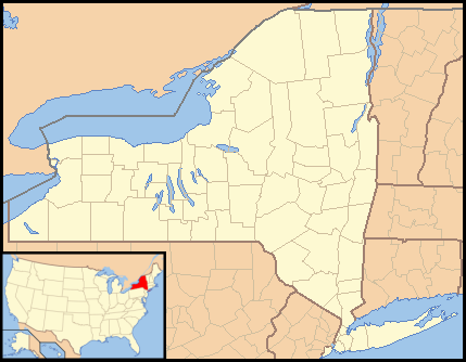
 Location of Dover Plains within New York
Dover Plains is a hamlet (and census-designated place) in Dutchess County, New York, United States. The population was 1,996 at the 2000 census. It is part of the Poughkeepsie–Newburgh–Middletown Metropolitan Statistical Area. Dover Plains is in the northeast part of the Town of Dover on NY 22.
Metro-North Railroad has a Harlem Line station here, bringing commuters to New York City. This station was the line's northern terminus for many years, until the line was expanded four miles north to Wassaic in the early 2000s.[citation needed]
Congresswoman Nan Hayworth (NY-R) represents the 19th District in the United States House of Representatives.
Contents
Geography
Dover Plains is located at 41°44′43″N 73°34′47″W / 41.74528°N 73.57972°W (41.745294, -73.579831)[1].
According to the United States Census Bureau, the CDP has a total area of 1.2 square miles (3.1 km2), of which, 1.2 square miles (3.1 km2) of it is land and 0.81% is water.
Demographics
As of the census[2] of 2000, there were 1996 people, 834 households, and 503 families residing in the CDP. The population density was 1,639.8 per square mile (631.7/km²). There were 892 housing units at an average density of 732.8/sq mi (282.3/km²). The racial makeup of the CDP was 93.79% White, 2.40% African American, 0.30% Native American, 1.25% Asian, 0.10% Pacific Islander, 0.40% from other races, and 1.75% from two or more races. Hispanic or Latino of any race were 4.61% of the population.
There were 834 households out of which 28.5% had children under the age of 18 living with them, 44.5% were married couples living together, 11.2% had a female householder with no husband present, and 39.6% were non-families. 34.9% of all households were made up of individuals and 17.0% had someone living alone who was 65 years of age or older. The average household size was 2.35 and the average family size was 3.02.
In the CDP the population was spread out with 23.0% under the age of 18, 6.9% from 18 to 24, 27.3% from 25 to 44, 22.1% from 45 to 64, and 20.7% who were 65 years of age or older. The median age was 41 years. For every 100 females there were 98.8 males. For every 100 females age 18 and over, there were 95.3 males.
The median income for a household in the CDP was $31,979, and the median income for a family was $45,586. Males had a median income of $36,442 versus $26,776 for females. The per capita income for the CDP was $20,676. About 8.6% of families and 13.4% of the population were below the poverty line, including 11.9% of those under age 18 and 15.1% of those age 65 or over.
 Downtown near train station
References
- ^ "US Gazetteer files: 2010, 2000, and 1990". United States Census Bureau. 2011-02-12. http://www.census.gov/geo/www/gazetteer/gazette.html. Retrieved 2011-04-23.
- ^ "American FactFinder". United States Census Bureau. http://factfinder.census.gov. Retrieved 2008-01-31.
External links
Municipalities and communities of Dutchess County, New York Cities Beacon | Poughkeepsie

Towns Amenia | Beekman | Clinton | Dover | East Fishkill | Fishkill | Hyde Park | LaGrange | Milan | North East | Pawling | Pine Plains | Pleasant Valley | Poughkeepsie | Red Hook | Rhinebeck | Stanford | Union Vale | Wappinger | Washington
Villages CDPs Amenia | Arlington | Brinckerhoff | Crown Heights | Dover Plains | Fairview | Haviland | Hillside Lake | Hopewell Junction | Myers Corner | Pine Plains | Pleasant Valley | Red Oaks Mill | Spackenkill | Staatsburg
Other
hamletsAnnandale-on-Hudson | Barrytown | Boston Corner‡ | Chelsea | Linden Acres | Mabbettsville | New Hamburg | Pleasant Plains | Quaker Hill | Rhinecliff | Salt Point | Shekomeko | Sylvan Lake | Van Keurens | Verbank | Wassaic
Footnotes ‡This populated place also has portions in an adjacent county or counties
Categories:- Census-designated places in New York
- Hamlets in New York
- Poughkeepsie–Newburgh–Middletown metropolitan area
- Populated places in Dutchess County, New York


Wikimedia Foundation. 2010.