- Bemus Point, New York
Infobox Settlement
settlement_type = Village
official_name = Bemus Point, New York
motto = Get to the Point… Bemus Point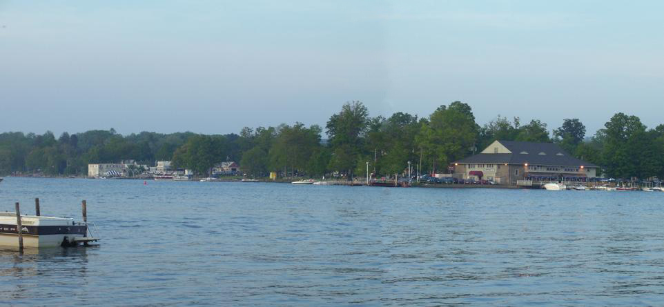
imagesize = 220px
image_caption = From right to left: The Village Casino, Stow Ferry landing, The Italian Fisherman and floating stage)
image_
|pushpin_
pushpin_label_position =
pushpin_map_caption =Location within the state of New York
pushpin_mapsize =
mapsize =
map_caption =
mapsize1 =
map_caption1 =
subdivision_type = Country
subdivision_name =United States
subdivision_type1 = State
subdivision_name1 =New York
subdivision_type2 = County
subdivision_name2 = Chautauqua
government_type =
leader_title =Mayor
leader_name = Bryan P. Dahlberg (R)
established_date =
area_magnitude =
area_total_sq_mi = 0.4
area_total_km2 = 1.1
area_land_sq_mi = 0.4
area_land_km2 = 1.1
area_water_sq_mi = 0.0
area_water_km2 = 0.0
area_urban_sq_mi =
area_urban_km2 =
area_metro_sq_mi =
area_metro_km2 =
population_as_of = 2000
population_note =
population_total = 340
population_metro =
population_urban =
population_density_km2 = 305.3
population_density_sq_mi = 782.9
latd = 42 |latm = 9 |lats = 46 |latNS = N
longd = 79 |longm = 23 |longs = 28 |longEW = W
elevation_m = 403
elevation_ft = 1322
timezone = Eastern (EST)
utc_offset = -5
timezone_DST = EDT
utc_offset_DST = -4
postal_code_type =ZIP code
postal_code = 14712
area_code = 716
blank_name = FIPS code
blank_info = 36-05848
blank1_name = GNIS feature ID
blank1_info = 0943649
footnotes =
website =Bemus Point is a
village in Chautauqua County,New York ,United States . The population was 340 at the 2000 census. Bemus Point is also home of the floating stage with many performers during the summer.The Village of Bemus Point, within the Town of Ellery, is located along the eastern shore of
Chautauqua Lake .Geography
Bemus Point is located at coor dms|42|9|46|N|79|23|28|W|city (42.162886, -79.391230)GR|1.
According to the
United States Census Bureau , the village has a total area of 0.4square mile s (1.1km² ), all of it land.The village is immediately north of the location where Interstate 86 crosses
Chautauqua Lake .Community
Bemus point is home to many restaurants including the village Casino, the Italian Fisherman, and the Surf club. Bemus point also has a 9 hole golf course.
History
The area currently known as Bemus Point was first settled by
William Bemus in 1806. Bemus had purchased land on both sides ofChautauqua Lake from the Land Company in 1805 at a cost of $1.50. He moved his family to the east side of the lake (in the area now known as Bemus Point) on March 9, 1806. The Bemus family lived in a log cabin approximately 500-660 feet northeast of the current ferry landing site. [http://www.bemuspt.com/About/Default.asp History of Bemus Point] ]The ferry located in Bemus Point on watson road was founded in 1811 by Thomas Bemus. On watson road there are many historic houses including the Strok's, Kuntz, and Groths which have been there for over 100 years. Thomas lived on the west side of the lake directly across from Bemus Point, in the area now known as Stow. The original ferry was a raft built by Thomas, and had to be poled across the lake. [http://www.bemuspt.com/About/Default.asp History of Bemus Point] ] Today, a cable-drawn ferry exists in its place and is operated by the Chautauqua Lake Historic Vessels Company.
Throughout the 1800’s, Bemus Point gained popularity as a tourist destination, which promoted its growth and development. By the early 1900’s, a dance hall known as the Casino, which still exists under the same name, became a well-known venue for entertainment, particularly big band music. [http://www.bemuspt.com/About/Default.asp History of Bemus Point] ]
In the summer, Bemus Point hosts its 'Bemus Bay Pops' concert which involves many local musicians and is also host to the "Chautauqua Idol", similar to
American Idol . Bemus Point is so much fun and full of tourists. The ice cream is amazing and the memories will last a lifetime. Don't get too excited about the ferry because it only runs on the weekends. Also, gasoline is pricy. There is a slight chance that you could spend twelve hundred dollars on gas. The village casino has some great deep fried food and the fisherman has good wine. Shaggy's has nice televisions and pool tables. Come to the point, Bemus Point!The Village of Bemus Point was incorporated in 1911.
United States Secretary of State Bainbridge Colby died here.Demographics
As of the
census GR|2 of 2000, there were 340 people, 170 households, and 95 families residing in the village. Thepopulation density was 782.8 people per square mile (305.3/km²). There were 218 housing units at an average density of 501.9/sq mi (195.7/km²). The racial makeup of the village was 97.65% White, 0.88% Native American, 0.59% Asian, 0.29% from other races, and 0.59% from two or more races. Hispanic or Latino of any race were 0.88% of the population.There were 170 households out of which 18.8% had children under the age of 18 living with them, 44.1% were married couples living together, 9.4% had a female householder with no husband present, and 44.1% were non-families. 38.8% of all households were made up of individuals and 24.7% had someone living alone who was 65 years of age or older. The average household size was 2.00 and the average family size was 2.65.
In the village the population was spread out with 17.6% under the age of 18, 4.7% from 18 to 24, 23.5% from 25 to 44, 26.5% from 45 to 64, and 27.6% who were 65 years of age or older. The median age was 47 years. For every 100 females there were 85.8 males. For every 100 females age 18 and over, there were 79.5 males.
The median income for a household in the village was $33,333, and the median income for a family was $46,250. Males had a median income of $37,708 versus $25,625 for females. The
per capita income for the village was $19,943. About 3.9% of families and 7.6% of the population were below thepoverty line , including 10.8% of those under age 18 and 9.5% of those age 65 or over.chools
The Bemus Point Central School District (BPCSD) includes
Bemus Point Elementary School andMaple Grove Junior Senior High School or MGHS.The current principal of Bemus Point Elementary is Scott P. Sawyer who was once a cheerleader and the current principal of MGHS is Edward Turkasz Jr.www.bemusptcsd.org
References
External links
* [http://www.bemuspt.com Bemus Point Official Website]
* [http://www.bemuspoint.com Bemus Point webpage]
* [http://www.co.chautauqua.ny.us/municipal/bemuspoint.htm Bemus Point village government]
* [http://www.mghs.org/ MGHS School Website]

Wikimedia Foundation. 2010.