- Peralta, New Mexico
Infobox Settlement
official_name = Peralta, New Mexico
settlement_type = CDP
nickname =
motto =
imagesize =
image_caption =
image_
imagesize =
image_caption =
image_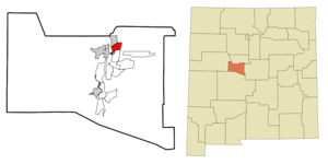
mapsize = 250px
map_caption = Location of Peralta, New Mexico
mapsize1 =
map_caption1 =subdivision_type = Country
subdivision_name =United States
subdivision_type1 = State
subdivision_name1 =New Mexico
subdivision_type2 = County
subdivision_name2 = Valencia
government_footnotes =
government_type =
leader_title =
leader_name =
leader_title1 =
leader_name1 =
established_title =
established_date =unit_pref = Imperial
area_footnotes =area_magnitude =
area_total_km2 = 11.4
area_land_km2 = 11.4
area_water_km2 = 0.0
area_total_sq_mi = 4.4
area_land_sq_mi = 4.4
area_water_sq_mi = 0.0population_as_of = 2000
population_footnotes =
population_total = 3750
population_density_km2 = 328.7
population_density_sq_mi = 851.4timezone = Mountain (MST)
utc_offset = -7
timezone_DST = MDT
utc_offset_DST = -6
elevation_footnotes =
elevation_m = 1482
elevation_ft = 4862
latd = 34 |latm = 49 |lats = 35 |latNS = N
longd = 106 |longm = 41 |longs = 20 |longEW = Wpostal_code_type =
ZIP code s
postal_code = 87042, 87068
area_code = 505
blank_name = FIPS code
blank_info = 35-56180
blank1_name = GNIS feature ID
blank1_info = 0923646
website =
footnotes =Peralta is a town in Valencia County,
New Mexico ,United States . Prior to its incorporation on July 1, 2007 [ [http://www.loslunasnm.gov/index.asp?NID=278 Peralta, NM] – Valencia County Chamber of Commerce.] , it was acensus-designated place (CDP). The CDP population was 3,750 at the 2000 census.Peralta is part of the Albuquerque Metropolitan Statistical Area.
Geography
Peralta is located at coor dms|34|49|35|N|106|41|20|W|city (34.826464, -106.688916)GR|1.
According to the
United States Census Bureau , the CDP had a total area of 4.4square mile s (11.4km² ), all of it land.Demographics
As of the
census GR|2 of 2000, there were 3,750 people, 1,314 households, and 1,034 families residing in the CDP. Thepopulation density was 851.4 people per square mile (329.1/km²). There were 1,413 housing units at an average density of 320.8/sq mi (124.0/km²). The racial makeup of the CDP was 66.88% White, 0.75% African American, 2.27% Native American, 0.32% Asian, 24.24% from other races, and 5.55% from two or more races. Hispanic or Latino of any race were 51.28% of the population.There were 1,314 households out of which 37.4% had children under the age of 18 living with them, 62.1% were married couples living together, 10.9% had a female householder with no husband present, and 21.3% were non-families. 16.3% of all households were made up of individuals and 5.5% had someone living alone who was 65 years of age or older. The average household size was 2.85 and the average family size was 3.19.
In the CDP the population was spread out with 28.9% under the age of 18, 7.1% from 18 to 24, 28.9% from 25 to 44, 24.1% from 45 to 64, and 11.0% who were 65 years of age or older. The median age was 36 years. For every 100 females there were 95.9 males. For every 100 females age 18 and over, there were 95.2 males.
The median income for a household in the CDP was $38,039, and the median income for a family was $39,605. Males had a median income of $31,916 versus $26,442 for females. The
per capita income for the CDP was $15,511. About 10.6% of families and 11.5% of the population were below thepoverty line , including 15.3% of those under age 18 and 13.6% of those age 65 or over.Education
The community's public schools are operated by
Los Lunas Schools .References
External links
Wikimedia Foundation. 2010.