- Flora Vista, New Mexico
Infobox Settlement
official_name = Flora Vista, New Mexico
settlement_type = CDP
nickname =
motto =
imagesize =
image_caption =
image_
imagesize =
image_caption =
image_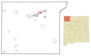
mapsize = 250px
map_caption = Location of Flora Vista, New Mexico
mapsize1 =
map_caption1 =subdivision_type = Country
subdivision_name =United States
subdivision_type1 = State
subdivision_name1 =New Mexico
subdivision_type2 = County
subdivision_name2 = San Juan
government_footnotes =
government_type =
leader_title =
leader_name =
leader_title1 =
leader_name1 =
established_title =
established_date =unit_pref = Imperial
area_footnotes =area_magnitude =
area_total_km2 = 5.4
area_land_km2 = 5.3
area_water_km2 = 0.1
area_total_sq_mi = 2.1
area_land_sq_mi = 2.0
area_water_sq_mi = 0.0population_as_of = 2000
population_footnotes =
population_total = 1383
population_density_km2 = 262.5
population_density_sq_mi = 679.8timezone = Mountain (MST)
utc_offset = -7
timezone_DST = MDT
utc_offset_DST = -6
elevation_footnotes =
elevation_m = 1679
elevation_ft = 5509
latd = 36 |latm = 48 |lats = 8 |latNS = N
longd = 108 |longm = 4 |longs = 57 |longEW = Wpostal_code_type =
ZIP code
postal_code = 87415
area_code = 505
blank_name = FIPS code
blank_info = 35-26360
blank1_name = GNIS feature ID
blank1_info = 0889098
website =
footnotes =Flora Vista is a
census-designated place (CDP) in San Juan County,New Mexico ,United States . The population was 1,383 at the 2000 census. It is part of the FarmingtonMetropolitan Statistical Area .Geography
Flora Vista is located at coor dms|36|48|8|N|108|4|57|W|city (36.802152, -108.082603)GR|1.
According to the
United States Census Bureau , the CDP has a total area of 2.1square mile s (5.4km² ), of which, 2.0 square miles (5.3 km²) of it is land and 0.04 square miles (0.1 km²) of it (1.93%) is water.Demographics
As of the
census GR|2 of 2000, there were 1,383 people, 504 households, and 406 families residing in the CDP. Thepopulation density was 679.8 people per square mile (263.0/km²). There were 537 housing units at an average density of 264.0/sq mi (102.1/km²). The racial makeup of the CDP was 87.13% White, 0.29% African American, 3.33% Native American, 0.14% Asian, 5.21% from other races, and 3.90% from two or more races. Hispanic or Latino of any race were 17.79% of the population.There were 504 households out of which 33.5% had children under the age of 18 living with them, 68.3% were married couples living together, 8.3% had a female householder with no husband present, and 19.4% were non-families. 15.1% of all households were made up of individuals and 5.4% had someone living alone who was 65 years of age or older. The average household size was 2.74 and the average family size was 3.03.
In the CDP the population was spread out with 26.4% under the age of 18, 7.8% from 18 to 24, 23.7% from 25 to 44, 28.6% from 45 to 64, and 13.4% who were 65 years of age or older. The median age was 40 years. For every 100 females there were 102.2 males. For every 100 females age 18 and over, there were 102.0 males.
The median income for a household in the CDP was $46,157, and the median income for a family was $46,071. Males had a median income of $40,481 versus $20,125 for females. The
per capita income for the CDP was $20,189. About 8.1% of families and 12.1% of the population were below thepoverty line , including 14.6% of those under age 18 and 9.8% of those age 65 or over.Education
Flora Vista is served by two public school districts – Aztec and Farmington.
References
External links
Wikimedia Foundation. 2010.