- New Harmony Historic District
-
New Harmony Historic District
 Harmony Society buildings in New Harmony Historic District, Indiana
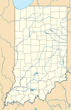

Location: Main St. between Granary and Church Sts., New Harmony, Indiana Coordinates: 38°7′48″N 87°56′8″W / 38.13°N 87.93556°WCoordinates: 38°7′48″N 87°56′8″W / 38.13°N 87.93556°W Built: 1815 Architectural style: Greek Revival, Gothic Governing body: State NRHP Reference#: 66000006[1] Significant dates Added to NRHP: October 15, 1966
May 3, 2000 (increase)Designated NHLD: July 23, 1965[2] The New Harmony Historic District in New Harmony, Indiana, was placed on the National Register of Historic Places in 1966, with a boundary increase in 2000. The area includes sites within the Historic New Harmony State Historic Site. Twelve buildings from the early 19th century, and twenty from the mid-19th century, are within the area.
The original boundary was Main Street between Granary and Church Streets, but had been increased to include between North and Steam Mill Streets, and between Third and Arthur Streets.[3]
It includes New Harmony's Atheneum, which is the visitor center for touring the historic district, and Maple Hill Cemetery. 25 houses and eight sites were built by the Harmony Society.[4] Buildings that are separately on the National Register include: Amon Clarence Thomas House, Mattias Scholle House, Ludwig Epple House, and George Bentel House.
The site includes 59 contributing and 99 noncontributing structures.[5]
References
- ^ "National Register Information System". National Register of Historic Places. National Park Service. 2009-03-13. http://nrhp.focus.nps.gov/natreg/docs/All_Data.html.
- ^ "New Harmony Historic District". National Historic Landmarks Program. National Park Service. http://tps.cr.nps.gov/nhl/detail.cfm?ResourceId=10&ResourceType=District. Retrieved 2009-06-05.
- ^ National Register of Historical Places - INDIANA (IN), Posey County
- ^ Historic New Harmony
- ^ Hurdis, Frank D., Jr. (May 2002). "National Historic Landmark Nomination: New Harmony Historic District". National Park Service. http://pdfhost.focus.nps.gov/docs/NHLS/Text/66000006.pdf. and Accompanying photos
External links
- Historic New Harmony - official site
- Information and description
U.S. National Register of Historic Places Topics Lists by states Alabama • Alaska • Arizona • Arkansas • California • Colorado • Connecticut • Delaware • Florida • Georgia • Hawaii • Idaho • Illinois • Indiana • Iowa • Kansas • Kentucky • Louisiana • Maine • Maryland • Massachusetts • Michigan • Minnesota • Mississippi • Missouri • Montana • Nebraska • Nevada • New Hampshire • New Jersey • New Mexico • New York • North Carolina • North Dakota • Ohio • Oklahoma • Oregon • Pennsylvania • Rhode Island • South Carolina • South Dakota • Tennessee • Texas • Utah • Vermont • Virginia • Washington • West Virginia • Wisconsin • WyomingLists by territories Lists by associated states Other  Category:National Register of Historic Places •
  Portal:National Register of Historic PlacesCategories:
- Historic districts in Indiana
- National Historic Landmarks in Indiana
- Historic house museums in Indiana
- Open air museums in Indiana
- Museums in Posey County, Indiana
- New Harmony, Indiana
- National Register of Historic Places in Posey County, Indiana
- Religious museums in the United States
- Indiana Registered Historic Place stubs


Wikimedia Foundation. 2010.