- Timberon, New Mexico
Infobox Settlement
official_name = Timberon, New Mexico
settlement_type = CDP
nickname =
motto =
imagesize =
image_caption =
image_
imagesize =
image_caption =
image_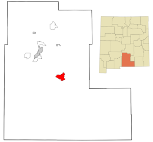
mapsize = 250px
map_caption = Location of Timberon, New Mexico
mapsize1 =
map_caption1 =subdivision_type = Country
subdivision_name =United States
subdivision_type1 = State
subdivision_name1 =New Mexico
subdivision_type2 = County
subdivision_name2 = Otero
government_footnotes =
government_type =
leader_title =
leader_name =
leader_title1 =
leader_name1 =
established_title =
established_date =unit_pref = Imperial
area_footnotes =area_magnitude =
area_total_km2 = 52.3
area_land_km2 = 52.3
area_water_km2 = 0.0
area_total_sq_mi = 20.2
area_land_sq_mi = 20.2
area_water_sq_mi = 0.0population_as_of = 2000
population_footnotes =
population_total = 309
population_density_km2 = 5.9
population_density_sq_mi = 15.3timezone = Mountain (MST)
utc_offset = -7
timezone_DST = MDT
utc_offset_DST = -6
elevation_footnotes =
elevation_m = 2112
elevation_ft = 6929
latd = 32 |latm = 37 |lats = 54 |latNS = N
longd = 105 |longm = 41 |longs = 32 |longEW = Wpostal_code_type =
ZIP code
postal_code = 88350
area_code = 505
blank_name = FIPS code
blank_info = 35-77950
blank1_name = GNIS feature ID
blank1_info = 0912792
website =
footnotes =Timberon is a
census-designated place (CDP) in Otero County,New Mexico and is within the Sacramento Mountains at the southern edge of theLincoln National Forest , directly north of the Fort Bliss Military Reservation. The population was 309 at the 2000 census.Timberon has a 9-hole golf course, as well as a lodge, a pool, a church, and a volunteer fire department. The residents consider it a retirement and resort community.
Geography
Timberon is located at coor dms|32|37|54|N|105|41|32|W|city (32.631675, -105.692254)GR|1. Elevation is 7150 feet.
According to the
United States Census Bureau , the CDP has a total area of 20.2square mile s (52.3km² ), all of it land.Demographics
As of the
census GR|2 of 2000, there were 309 people, 145 households, and 98 families residing in the CDP. Thepopulation density was 15.3 people per square mile (5.9/km²). There were 458 housing units at an average density of 22.7/sq mi (8.7/km²). The racial makeup of the CDP was 91.59% White, 0.32% Native American, 0.32% Asian, 4.21% from other races, and 3.56% from two or more races. Hispanic or Latino of any race were 12.62% of the population.There were 145 households out of which 14.5% had children under the age of 18 living with them, 63.4% were married couples living together, 2.1% had a female householder with no husband present, and 32.4% were non-families. 29.7% of all households were made up of individuals and 14.5% had someone living alone who was 65 years of age or older. The average household size was 2.13 and the average family size was 2.52.
In the CDP the population was spread out with 16.2% under the age of 18, 3.6% from 18 to 24, 15.2% from 25 to 44, 36.6% from 45 to 64, and 28.5% who were 65 years of age or older. The median age was 54 years. For every 100 females there were 114.6 males. For every 100 females age 18 and over, there were 100.8 males.
The median income for a household in the CDP was $24,519, and the median income for a family was $25,804. Males had a median income of $13,000 versus $25,278 for females. The
per capita income for the CDP was $11,743. About 2.9% of families and 9.5% of the population were below thepoverty line , including none of those under the age of eighteen and 4.9% of those sixty five or over.ee also
*
Lincoln National Forest References
External links
* [http://www.timberon.com/ The Timberon Mountaineer]
* [http://www.timberon.info/ Timberon info pages from the Mountain Times]
Wikimedia Foundation. 2010.