- Virden, New Mexico
Infobox Settlement
official_name = Virden, New Mexico
settlement_type = Village
nickname =
motto =
imagesize =
image_caption =
image_
imagesize =
image_caption =
image_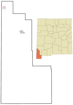
mapsize = 250px
map_caption = Location of Virden, New Mexico
mapsize1 =
map_caption1 =subdivision_type = Country
subdivision_name =United States
subdivision_type1 = State
subdivision_name1 =New Mexico
subdivision_type2 = County
subdivision_name2 = Hidalgo
government_footnotes =
government_type =
leader_title =
leader_name =
leader_title1 =
leader_name1 =
established_title =
established_date =unit_pref = Imperial
area_footnotes =area_magnitude =
area_total_km2 = 0.6
area_land_km2 = 0.6
area_water_km2 = 0.0
area_total_sq_mi = 0.2
area_land_sq_mi = 0.2
area_water_sq_mi = 0.0population_as_of = 2000
population_footnotes =
population_total = 143
population_density_km2 = 247.1
population_density_sq_mi = 640.1timezone = Mountain (MST)
utc_offset = -7
timezone_DST = MDT
utc_offset_DST = -6
elevation_footnotes =
elevation_m = 1147
elevation_ft = 3763
latd = 32 |latm = 41 |lats = 19 |latNS = N
longd = 109 |longm = 0 |longs = 9 |longEW = Wpostal_code_type =
postal_code =
area_code = 505
blank_name = FIPS code
blank_info = 35-83200
blank1_name = GNIS feature ID
blank1_info = 0920732
website =
footnotes =Virden is a village in Hidalgo County,
New Mexico ,United States . The population was 143 at the 2000 census. The nearby community of Summit, essentially belongs to Virden, and is included in the population. Growth and new construction is almost non-existent, but together with the Arizona sister-village of Duncan, the consolidated area might experience minimal population and infrastructural growth in the next decade.Geography
Virden is located at coor dms|32|41|19|N|109|0|9|W|city (32.688626, -109.002585)GR|1.
According to the
United States Census Bureau , the village has a total area of 0.2square mile s (0.6km² ), all of it land.Demographics
As of the
census GR|2 of 2000, there were 143 people, 48 households, and 38 families residing in the village. Thepopulation density was 640.1 people per square mile (251.0/km²). There were 63 housing units at an average density of 282.0/sq mi (110.6/km²). The racial makeup of the village was 95.10% White, 1.40% African American, 1.40% from other races, and 2.10% from two or more races. Hispanic or Latino of any race were 13.29% of the population.There were 48 households out of which 39.6% had children under the age of 18 living with them, 77.1% were married couples living together, 2.1% had a female householder with no husband present, and 20.8% were non-families. 20.8% of all households were made up of individuals and 8.3% had someone living alone who was 65 years of age or older. The average household size was 2.98 and the average family size was 3.50.
In the village the population was spread out with 33.6% under the age of 18, 8.4% from 18 to 24, 18.2% from 25 to 44, 25.2% from 45 to 64, and 14.7% who were 65 years of age or older. The median age was 32 years. For every 100 females there were 113.4 males. For every 100 females age 18 and over, there were 115.9 males.
The median income for a household in the village was $29,375, and the median income for a family was $46,250. Males had a median income of $33,750 versus $0 for females. The
per capita income for the village was $23,184. There were 2.6% of families and 14.1% of the population living below thepoverty line , including 26.1% of under eighteens and 6.7% of those over 64.References
External links
Wikimedia Foundation. 2010.