- Somersworth, New Hampshire
Infobox Settlement
official_name = City of Somersworth
settlement_type =City
nickname =
motto =
imagesize =
image_caption =
image_
mapsize = 250px
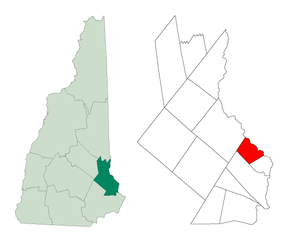
map_caption = Location inStrafford County ,New Hampshire
mapsize1 =
map_caption1 =
subdivision_type = Country
subdivision_type1 = State
subdivision_type2 = County
subdivision_name =United States
subdivision_name1 =New Hampshire
subdivision_name2 = Strafford
government_type =
leader_title = City Manager
leader_title1 =Mayor
leader_title2 = City Council
leader_name = Robert M. Belmore
leader_name1 = Michael Micucci
leader_name2 = Martin Pepin
Dan Watson
Dale Spainhower
Jonathan McCallion
Denis Messier
Jim Wiggin
Dana Hilliard
Brian Tapscott
Sherie Dinger
established_title = Settled
established_title2 = Incorporated (town)
established_title3 = Incorporated (city)
established_date = before 1700
established_date2 = 1754
established_date3 =
area_magnitude =
area_total_sq_mi = 10.0
area_total_km2 = 25.9
area_land_sq_mi = 9.8
area_land_km2 = 25.3
area_water_sq_mi = 0.2
area_water_km2 = 0.6
area_urban_sq_mi =
area_urban_km2 =
area_metro_sq_mi =
area_metro_km2 =
population_as_of = 2007
population_note =
population_total = 11,860
population_metro =
population_urban =
population_density_km2 = 468.8
population_density_sq_mi = 1,210.2
timezone = EST
utc_offset = -5
timezone_DST = EDT
utc_offset_DST = -4
latd = 43 |latm = 15 |lats = 45 |latNS = N
longd = 70 |longm = 51 |longs = 51 |longEW = W
elevation_m = 62
elevation_ft = 204
website = [http://www.somersworth.com/ www.somersworth.com]
postal_code_type =ZIP code
postal_code = 03878
area_code = 603
blank_name = FIPS code
blank_info = 33-69940
blank1_name = GNIS feature ID
blank1_info = 0870007
footnotes =Somersworth is a city in Strafford County,
New Hampshire ,United States . The population was 11,477 at the 2000 census. Somersworth has the smallest area and third-lowest population of New Hampshire's 13 cities.History
Somersworth, originally called Sligo after
Sligo inIreland , was settled before 1700 as a part of Dover. It was organized in 1729 as the parish of Summersworth, meaning summer town, because during that season the ministers would preach here. It was set off and incorporated in 1754 by Colonial GovernorBenning Wentworth , and until 1849 included Rollinsford. A clerical error at incorporation contracted the name to Somersworth. It would be incorporated as a city in 1893, before which it was also known as Great Falls.Situated where the
Salmon Falls River drops 100 feet over a mile, Somersworth early became amill town , beginning withgristmill s andsawmills . In 1822, the brothers Isaac and Jacob Wendell of Boston purchased for $5,000 a gristmill with its water rights at the Great Falls. They established the Great Falls Manufacturing Company, atextile business that expanded to include three mills for spinning thread andweaving cotton andwoolen fabrics, specializing in "drillings, shirtings and sheetings." Throughout the 19th century, other expansive brick mill buildings, including a Bleachery and Dye Works, were erected beside the river. A gate house at thedam directed water as needed, regulating the flow either into the river or a companycanal , which itself had gates sending it under the mill.Water power turned the wheels and belts that operated mill machinery. Therailroad arrived in the early 1840s, before which goods were carted to Dover.At first millworkers came from surrounding farms, including those in
Berwick, Maine directly across the bridge. Many were women. But as the need for labor grew,immigrant s arrived fromIreland , and laterQuebec . Bricktenement row house s were rented by the company to employee families, many of whose members worked in the mills beside their parents before passage ofchild labor laws. For relaxation, workers found entertainment at the Opera House or at Central Park, anamusement park beside Willand Pond. In the early 1870s, the Portsmouth, Great Falls & Conway Railroad began excursions to the White Mountains. The Electric Street Railway came in 1890, allowing trolley rides to York Beach, Maine.But the
New England textile industry went into decline in the 20th century. Water power was replaced with newer forms of energy, and cotton could be manufactured where it grew, saving transportation costs. Labor was also cheaper in the South, which did not have New Hampshire's inventory tax that levied commodities likecoal and cotton at the plants. TheGreat Depression sent many regional textile firms intobankruptcy , when some local facilities were adapted forshoemaking . The Great Falls Manufacturing Company's big mill was renovated for other uses in the 1980s, although the bleachery suffered a devastating fire in November 2003, which required assistance from 23fire department s from New Hampshire andMaine . TheGeneral Electric Company operates a factory that manufactures state of the art electric meters for the energy business.Somersworth's heyday was during the mill periods. Though much of its architectural character has been overlooked due to the prominence of the larger neighboring cities of Dover and Rochester, Somersworth has several buildings that feature hints of
Victorian architecture . The city is today largely abedroom community for other cities and thePortsmouth Naval Shipyard . The upper end of High Street, however, continues to develop as a retail center with severalbig-box chain store s.Notable inhabitants
*
Fred H. Brown , governor & senator
*John Sullivan ,Revolutionary War generalGeography
Somersworth is located at coor dms|43|15|14|N|70|52|32|W|city (43.253783, -70.875499).GR|1
According to the
United States Census Bureau , the city has a total area of convert|10.0|sqmi|lk=on|1, of which convert|9.8|sqmi|abbr=on|1 is land and convert|0.2|sqmi|abbr=on|1 is water, comprising 2.30% of the city. Somersworth is drained by the Salmon Falls River. The highest point in Somersworth is Prospect Hill rising just west of the city center, on which the city reservoir is built. The hill's elevation is approximately convert|310|ft abovesea level .Demographics
As of the
census GR|2 of 2000, there were 11,477 people, 4,687 households, and 3,079 families residing in the city. Thepopulation density was 1,173.4 people per square mile (453.1/km²). There were 4,841 housing units at an average density of 494.9/sq mi (191.1/km²). The racial makeup of the city was 96.17% White, 0.58% African American, 0.19% Native American, 0.96% Asian, 0.01% Pacific Islander, 0.59% from other races, and 1.51% from two or more races. Hispanic or Latino of any race were 1.61% of the population.There were 4,687 households out of which 33.7% had children under the age of 18 living with them, 47.5% were married couples living together, 13.8% had a female householder with no husband present, and 34.3% were non-families. 26.9% of all households were made up of individuals and 9.5% had someone living alone who was 65 years of age or older. The average household size was 2.44 and the average family size was 2.95.
In the city the population was spread out with 26.3% under the age of 18, 8.1% from 18 to 24, 33.1% from 25 to 44, 20.6% from 45 to 64, and 12.0% who were 65 years of age or older. The median age was 35 years. For every 100 females there were 92.7 males. For every 100 females age 18 and over, there were 89.4 males.
The median income for a household in the city was $42,739, and the median income for a family was $47,933. Males had a median income of $36,585 versus $25,804 for females. The
per capita income for the city was $19,592. About 6.3% of families and 8.8% of the population were below thepoverty line , including 10.9% of those under age 18 and 9.0% of those age 65 or over.Education
The Somersworth School District consists of
Somersworth High School (grades 9-12), Somersworth Middle School (grades 5-8), and two elementary schools, Hilltop School and Maple Wood Elementary School.Somersworth's first high school (pictured above) opened in 1850 and was located at 17 Grand Street. Hilltop School, built at the same location in 1927, replaced the original high school. Later it would be converted to an elementary school.
In 1999, after numerous fire code violations were identified with the Hilltop School by the New Hampshire State Fire Marshal, the City of Somersworth was granted waivers for a period of three years to address the state's concerns. Despite the failure of the school district to address the numerous code violations during the probation period, the waivers continued to be extended past their originally intended three year period. In August 2007, the upper floors of the school were closed by the New Hampshire State Fire Marshall after the city neglected to fix code violations they were warned about in November 2006.
The closure of the upper floors came just weeks before neighborhood students were scheduled to return from summer vacation. This resulted in the start of school being delayed by over two weeks for Hilltop students. Three portable classrooms were brought in for "2 years" as it stands in 2007. Currently, students are occupying the bottom two floors along with the three portable classrooms.
In the spring of 2007, the Somersworth School Board voted to build a new school to replace Hilltop. As of early November 2007, the city council had yet to approve funding as debate continues over whether to build a new elementary school, or to renovate the historic neighborhood school and keep it open.
ites of interest
* Summersworth Historical Society Museum [http://www.goseacoast.com/detail.ihtml?lid=280&catID=17]
References
External links
* [http://www.somersworth.com City website]
* [http://www.somersworthchamber.com/ Somersworth Chamber of Commerce]
* [http://www.somersworthmainstreet.org Somersworth Main Street] - Somersworth, NH is a part of the [http://www.nhcdfa.org/mainstreet.html New Hampshire Main Street program] .
* [http://www.nh.gov/nhes/elmi/htmlprofiles/somersworth.html New Hampshire Economic and Labor Market Information Bureau Profile]
Wikimedia Foundation. 2010.