- New Ipswich, New Hampshire
-
New Ipswich, New Hampshire — Town — 
SealLocation in Hillsborough County, New Hampshire
Coordinates: 42°44′53″N 71°51′15″W / 42.74806°N 71.85417°WCoordinates: 42°44′53″N 71°51′15″W / 42.74806°N 71.85417°W Country United States State New Hampshire County Hillsborough Incorporated 1762 Government - Board of Selectmen George Lawrence
James Coffey
Bentti O. HoiskaArea - Total 33.1 sq mi (85.6 km2) - Land 32.8 sq mi (84.8 km2) - Water 0.3 sq mi (0.8 km2) 0.97% Elevation 1,106 ft (337 m) Population (2010) - Total 5,099 - Density 154/sq mi (59.5/km2) Time zone Eastern (UTC-5) - Summer (DST) Eastern (UTC-4) ZIP code 03071 Area code(s) 603 FIPS code 33-51940 GNIS feature ID 0873681 Website http://www.townofnewipswich.org/ New Ipswich is a town in Hillsborough County, New Hampshire, United States. The population was 5,099 at the 2010 census.[1] New Ipswich, situated on the Massachusetts border, includes the villages of Bank, Davis, Gibson Four Corners, Highbridge, New Ipswich Center, Smithville, and Wilder, though these village designations no longer hold the importance they did in the past. The Wapack Trail passes through the community.
Contents
History
 Barr Mansion in 1900
New Ipswich was granted in 1735 to 60 inhabitants of Ipswich, Massachusetts, from whence the name is derived, by Colonial Governor Jonathan Belcher and the General Court (Assembly) of Massachusetts. As was customary, tall white pine trees were reserved for use as masts by the Royal Navy. Settlement began in 1738, when Abijah Foster arrived with his wife and infant daughter. In 1762, Governor Benning Wentworth incorporated the town as "Ipswich", and then in 1766 as "New Ipswich". New Ipswich Academy, later renamed Appleton Academy after benefactor Samuel Appleton, was chartered in 1789,[2] the second oldest in New Hampshire after Phillips Exeter Academy in Exeter. It would also serve as high school for the nearby communities of Mason and Greenville. Appleton Academy closed in 1968. In 1969, construction of Mascenic Regional High School was completed in New Ipswich.
 Baptist Church c. 1912
The Souhegan River provided water power for mills, and in 1801, the first woolen mill in the state was established at New Ipswich, followed in 1804 by the first cotton mill. Other early factories produced glass, potash and linseed oil. Cabinet making craftsmen produced elegant furniture. The town's affluence would be expressed in fine architecture, an example of which is the Barrett House, used as a setting for the 1979 Merchant Ivory film of The Europeans by Henry James. Bypassed by the railroad, the early mill town was preserved.
In the past half century, a notable influx of peoples of Finnish descent, particularly of the Apostolic Lutheran Church of America, have settled in New Ipswich. Additionally, migrants from nearby Massachusetts make up a large percentage of new residents.
Notable inhabitants
- Jesse Appleton, theologian & educator
- Nathan Appleton, merchant & politician, born in New Ipswich[3]
- Samuel Appleton, merchant & philanthropist
- Benjamin Champney, artist
- Jonas Chickering, piano manufacturer
- Augustus Addison Gould, scientist
Geography
According to the United States Census Bureau, the town has a total area of 33.1 square miles (86 km2), of which 32.8 sq mi (85 km2) is land and 0.3 sq mi (0.78 km2) is water, comprising 0.97% of the town. New Ipswich is drained by the Souhegan River. New Ipswich Mountain, part of the Wapack Range, is the highest point in the town, with an elevation of 1,881 feet (573 m) above sea level. Much of the town is made up of the wooded foothills of the Wapack Range. Secondary growth forests have reclaimed the vast majority of the pasture lands that dominated New Ipswich and much of New England at the beginning of the 20th century.
New Ipswich is bordered by Rindge to the west, Sharon and Temple to the north, Greenville and Mason to the east, and Ashburnham, Massachusetts and Ashby, Massachusetts to the south.
Demographics
 Main Street in 1907
As of the census[4] of 2000, there were 4,289 people, 1,350 households, and 1,089 families residing in the town. The population density was 131.0 people per square mile (50.6/km²). There were 1,449 housing units at an average density of 44.2 per square mile (17.1/km²). The racial makeup of the town was 98.55% White, 0.19% African American, 0.12% Native American, 0.37% Asian, 0.14% from other races, and 0.63% from two or more races. Hispanic or Latino of any race were 0.79% of the population. 19.7% were of Finnish, 13.2% French, 13.0% English, 10.4% Irish, 9.7% French Canadian, 6.5% German and 5.6% American ancestry according to Census 2000.
There were 1,350 households out of which 45.6% had children under the age of 18 living with them, 69.6% were married couples living together, 7.2% had a female householder with no husband present, and 19.3% were non-families. 15.2% of all households were made up of individuals and 5.6% had someone living alone who was 65 years of age or older. The average household size was 3.16 and the average family size was 3.55.
 Appleton Academy c. 1910
In the town the population was spread out with 34.5% under the age of 18, 7.7% from 18 to 24, 29.8% from 25 to 44, 20.4% from 45 to 64, and 7.5% who were 65 years of age or older. The median age was 32 years. For every 100 females there were 104.8 males. For every 100 females age 18 and over, there were 101.7 males.
The median income for a household in the town was $53,939, and the median income for a family was $57,865. Males had a median income of $40,887 versus $26,724 for females. The per capita income for the town was $20,210. About 4.3% of families and 7.1% of the population were below the poverty line, including 10.5% of those under age 18 and 10.1% of those age 65 or over.
New Ipswich has one of the highest population percentages of residents under the age of 18 in New Hampshire.[5]
Sites of interest
- Barrett House (c. 1800)
References
- ^ United States Census Bureau, American FactFinder, 2010 Census figures. Retrieved March 23, 2011.
- ^ New Ipswich, New Hampshire at nh.gov. Retrieved February 21, 2009.
- ^ Who Was Who in America, Historical Volume, 1607-1896. Marquis Who's Who. 1963.
- ^ "American FactFinder". United States Census Bureau. http://factfinder.census.gov. Retrieved 2008-01-31.
- ^ New Hampshire Economic and Labor Market Information Bureau Profile
External links
Municipalities and communities of Hillsborough County, New Hampshire County seats: Manchester and Nashua Cities 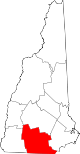
Towns Amherst | Antrim | Bedford | Bennington | Brookline | Deering | Francestown | Goffstown | Greenfield | Greenville | Hancock | Hillsborough | Hollis | Hudson | Litchfield | Lyndeborough | Mason | Merrimack | Milford | Mont Vernon | New Boston | New Ipswich | Pelham | Peterborough | Sharon | Temple | Weare | Wilton | Windsor
Villages East Merrimack | Grasmere | Pinardville
Categories:- Towns in Hillsborough County, New Hampshire
- Populated places established in 1762


Wikimedia Foundation. 2010.