- Morrill, Nebraska
-
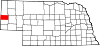
Morrill, Nebraska — Village — Location of Morrill, Nebraska
Coordinates: 41°57′54″N 103°55′33″W / 41.965°N 103.92583°WCoordinates: 41°57′54″N 103°55′33″W / 41.965°N 103.92583°W Country United States State Nebraska County Scotts Bluff Area – Total 0.6 sq mi (1.5 km2) – Land 0.6 sq mi (1.5 km2) – Water 0.0 sq mi (0.0 km2) Elevation 3,990 ft (1,216 m) Population (2000) – Total 957 – Density 1,610.2/sq mi (621.7/km2) Time zone Mountain (MST) (UTC-7) – Summer (DST) MDT (UTC-6) ZIP code 69358 Area code(s) 308 FIPS code 31-32830[1] GNIS feature ID 0831427[2] Morrill is a village located in the extreme west panhandle of Scotts Bluff County, Nebraska, United States. It is part of the Scottsbluff, Nebraska Micropolitan Statistical Area. The population was 957 at the 2000 census.
Contents
Geography
Morrill is located at 41°57′54″N 103°55′33″W / 41.965°N 103.92583°W (41.964919, -103.925711)[3].
According to the United States Census Bureau, the village has a total area of 0.6 square miles (1.6 km2), all of it land.
History
In 1886 the first settlers found a fertile valley at the mouth of the Sheep Creek draw and staked their claims. They came from Fort Collins, Colo., in search of a new home. They called their new home Collins, which was located nearly a mile north of present Morrill.
In 1900 the railroad determined the relocation of what is now Morrill. The new town was named for Charles Henry Morrill, president of the Lincoln Land Company.[citation needed] As president he laid out a tract of land for a town. In 1901 a post office was opened and the Village of Morrill was incorporated in April 1907. Some of the original buildings are still occupied today with thriving businesses. Electricity came to Morrill about 1912.
Demographics
As of the census[1] of 2000, there were 957 people, 416 households, and 264 families residing in the village. The population density was 1,610.2 people per square mile (626.3/km²). There were 445 housing units at an average density of 748.7 per square mile (291.2/km²). The racial makeup of the village was 91.75% White, 0.10% African American, 1.46% Native American, 0.52% Asian, 5.64% from other races, and 0.52% from two or more races. Hispanic or Latino of any race were 13.69% of the population.
There were 416 households out of which 24.5% had children under the age of 18 living with them, 54.8% were married couples living together, 5.8% had a female householder with no husband present, and 36.3% were non-families. 33.2% of all households were made up of individuals and 15.1% had someone living alone who was 65 years of age or older. The average household size was 2.30 and the average family size was 2.94.
In the village the population was spread out with 22.5% under the age of 18, 6.0% from 18 to 24, 23.3% from 25 to 44, 27.2% from 45 to 64, and 21.1% who were 65 years of age or older. The median age was 44 years. For every 100 females there were 89.1 males. For every 100 females age 18 and over, there were 90.3 males.
The median income for a household in the village was $31,450, and the median income for a family was $37,639. Males had a median income of $31,750 versus $19,500 for females. The per capita income for the village was $20,191. About 4.4% of families and 7.6% of the population were below the poverty line, including 9.3% of those under age 18 and 9.9% of those age 65 or over.
Historic Site
Horse Creek Treaty Marker Site Four miles west of Morrill on Highway 26, you'll come to a historical marker. This marker will tell you about the 1851 Horse Creek Treaty, officially known as the Treaty of Fort Laramie (1851), and the largest gathering of Native Americans in history. More than 10,000 Plains Indians representing 10 tribes gathered in a council with United States government officials near the North Platte River and Horse Creek to sign the treaty in a desire to live at peace with the whites.
References
- ^ a b "American FactFinder". United States Census Bureau. http://factfinder.census.gov. Retrieved 2008-01-31.
- ^ "US Board on Geographic Names". United States Geological Survey. 2007-10-25. http://geonames.usgs.gov. Retrieved 2008-01-31.
- ^ "US Gazetteer files: 2010, 2000, and 1990". United States Census Bureau. 2011-02-12. http://www.census.gov/geo/www/gazetteer/gazette.html. Retrieved 2011-04-23.
Municipalities and communities of Scotts Bluff County, Nebraska Cities Gering | Minatare | Mitchell | Scottsbluff
Villages Categories:- Villages in Nebraska
- Populated places in Scotts Bluff County, Nebraska
- Scottsbluff micropolitan area

Wikimedia Foundation. 2010.