- Swains Island
-
Not to be confused with Swain's Island, Newfoundland and Labrador.
Swains Island Disputed island
Other names: Olosega Island, Olohega Island, Quiros Island, Gente Hermosa Island, Jennings Island
Swains Island Geography 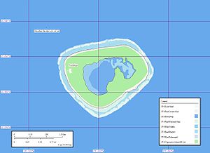
Location Pacific Ocean Coordinates 11°03′20″S 171°04′40″W / 11.05556°S 171.07778°WCoordinates: 11°03′20″S 171°04′40″W / 11.05556°S 171.07778°W Archipelago Tokelau Total islands 2 (one very minor) Major islands Swains Island Area 372.6 acres (150.8 ha) Administered by  United States
Territory  American Samoa
Claimed by  New Zealand
Territory  Tokelau United States
Territory American SamoaDemographics Population 37 (as of 2005) Swains Island (
 /ˈsweɪnz/; Samoan: Olosega) is an atoll in the Tokelau chain. Culturally a part of Tokelau, it is an unincorporated unorganized territory of the United States administered by American Samoa. Swains Island has also been known at various times as Olosenga Island, Olohega Island, Quiros Island, Gente Hermosa Island, and Jennings Island. Owned by the Jennings family and used as a copra plantation, Swains Island has a population of 37 Tokelauans, who harvest the island's coconuts.
Contents
Geography and demographics
Swains Island has a total area of 460.9 acres (186.5 ha), of which 373 acres (150.8 ha) is land. The central lagoon accounts for the balance of 88 acres (35.8 ha). There is a small islet of 914 square yards (764 m2) in the eastern part of the lagoon.
The atoll is somewhat unusual, featuring an unbroken circle of land enclosing a freshwater lagoon cut off from the sea. Recent U.S. Coast Guard visitors to Swains described its lagoon as "brackish" and a source for the plentiful numbers of mosquitoes which plague the island.[1] In April 2007, a member of an amateur radio expedition confirmed that the lagoon water was fit only for bathing and washing, and that fresh water seemed to be in rather short supply on the island at the time.[2] According to a United States Department of the Interior description of Swains Island, drinking water on Swains is derived entirely from rainfall collected in two large mahogany tanks near the island's copra shed.[3]
 Swains Island Lagoon
 Road on Swains Island
As of 2005[update], the population of Swains Island was 37, all located in the village of Taulaga on the island's west side. According to the Interior Department report, Talauga prior to 2005 consisted of a grassy malae (an open space similar to an American "village green"), twenty or so fale (Tokelauan-style houses), and a large red copra shed that doubled as the town hall and water-collection system. A communications building, school, and church rounded out Taulaga's buildings. Only the church remained standing after Cyclone Percy in 2005, though other structures have since been rebuilt.[4]
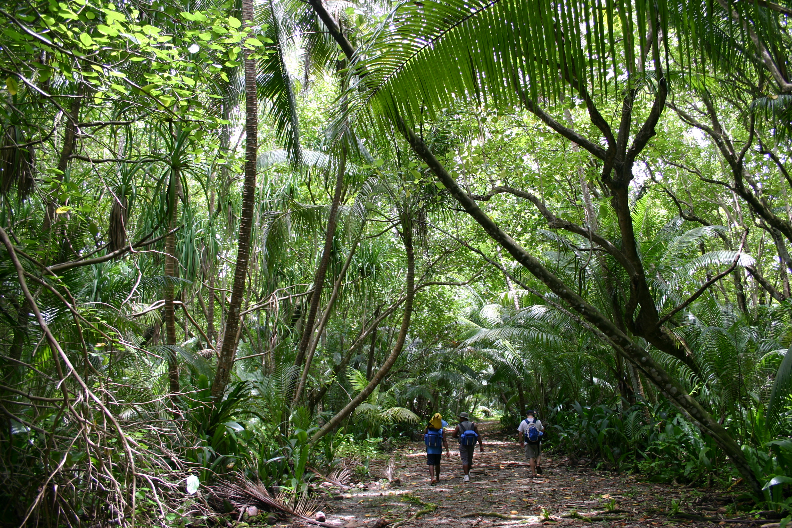
The village of Etena in the southeast, once home to the expansive "residency" of Swains' unique dynasty of "proprietors", is now abandoned. This "residency", as it was called, consisted of a rustic four-bedroom house built in the 1800s to accommodate the Jennings family, owners of the island. A visitor to Swains Island in the 1920s described the mansion as being "dilapidated, though stately", noting that parts of it were not being used even at that time.[5] A road once ran around the island rim, but it seems to have been reduced in recent years to an overgrown jungle trail.[6]
Swains Islanders mainly speak Tokelauan, although English is the principal administrative language of American Samoa.
History
Discovery
Pedro Fernandes de Queirós, a Portuguese navigator sailing for Spain, is believed to have been the first European explorer to have discovered Swains Island on 2 March 1606. He named it Isla de la Gente Hermosa, which means "island of the beautiful people" in Spanish.
Later, there was an expedition from Fakaofo to the island. The male inhabitants of the island either fled or were killed by the invaders, while the women were taken back to Fakaofo. The subsequent infertility of the island, attributed to a curse placed on it by its last chief, led to the failure of the Fakaofoan settlement there.[7]
Captain William L. Hudson of the American ship Peacock visited the atoll in 1841, at the request of Commodore Charles Wilkes, but was unable to land due to stormy weather. Finding the island was not at the position reported by de Queirós, Hudson concluded that the whaling captain W.C. Swains who had alerted them to the island had discovered it, and he renamed it "Swains Island".[7]
The Jennings family
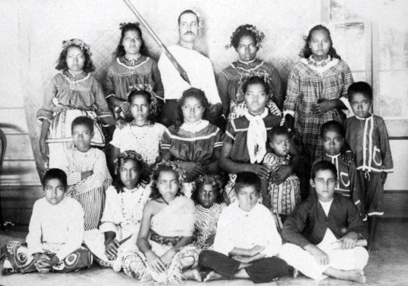
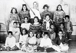 Group of young people and children from Swains Island, late 1886. Photographed by Thomas Andrew.
Fakaofoans returned to the island soon after Hudson's visit, and were joined by three Frenchmen, who then left to sell the coconut oil they had accumulated.[8] In 1856, an American, Eli Hutchinson Jennings (14 November 1814 - 4 December 1878), joined a community on Swains with his Samoan wife, Malia. Jennings claimed to have received title to the atoll from a British Captain Turnbull, who claimed ownership of the island by discovery and named it after himself. According to one account, the sale price for Swains was fifteen shillings per acre (37 shillings per hectare), and a bottle of gin.[4] One of the Frenchmen later returned, but did not care to share the island with Jennings and left.[9]
On 13 October 1856, Swains became a semi-independent proprietary settlement of the Jennings family (although under the U.S. flag), a status it would retain for approximately seventy years. It was also claimed for the U.S. by the United States Guano Company in 1860, under the Guano Islands Act.[9]
Jennings established a coconut plantation, which flourished under his son, Eli, Jr. Eli Jennings, Sr. was also instrumental in helping Peruvian "blackbird" slave ships depopulate the other three Tokelau atolls — see H.E. Maude's Slavers in Paradise (A.N.U., Canberra, 1981).
American sovereignty confirmed
In 1907, the Resident Commissioner of the British Gilbert and Ellice Islands (then a British protectorate; since 1979 the sovereign nations of Kiribati and Tuvalu) claimed that Swains belonged to the United Kingdom, demanding payment of a tax of US$85. Jennings paid, but he brought the matter before the U.S. State Department, and his money was ultimately refunded. The British government furthermore conceded that Swains was an American possession.
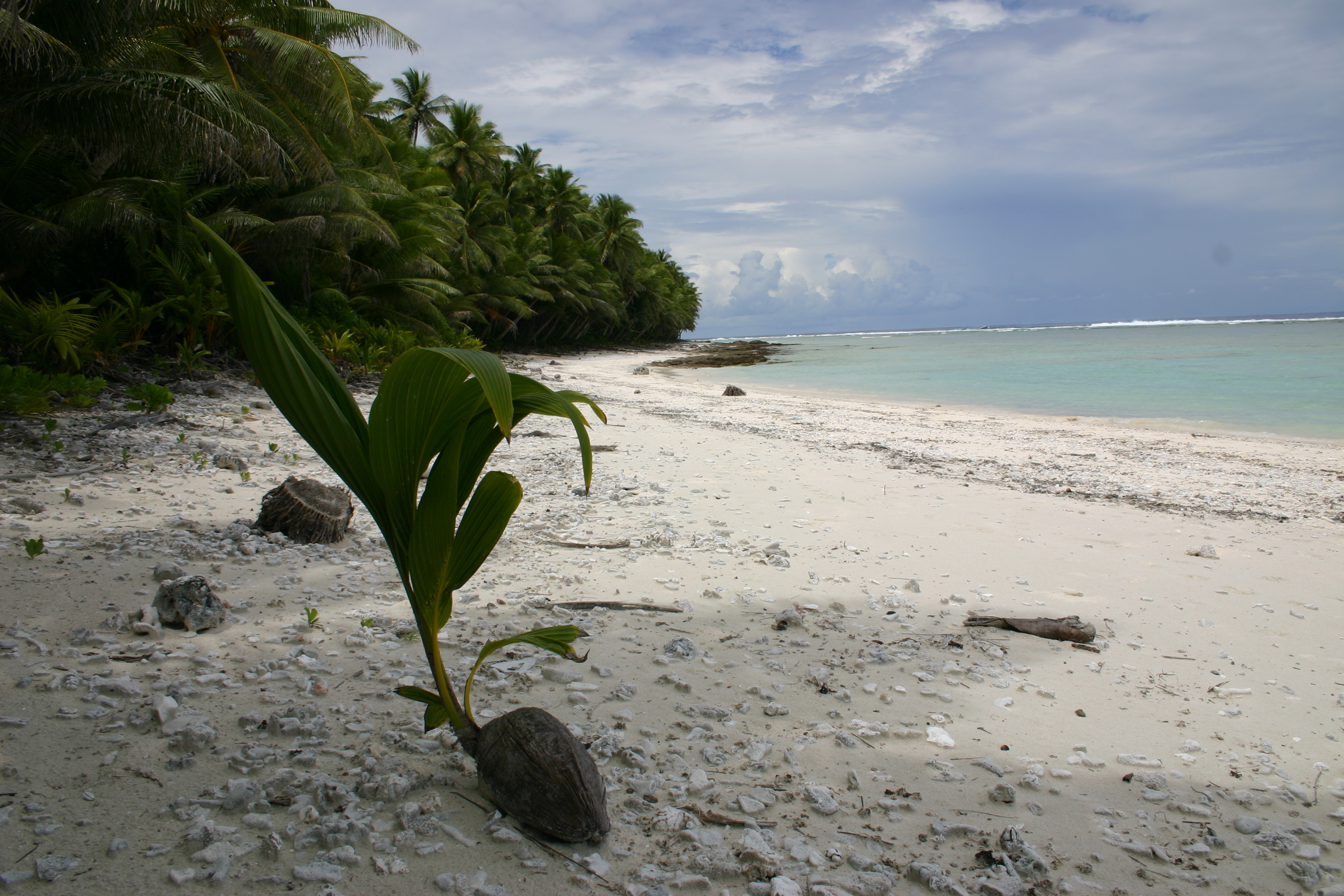
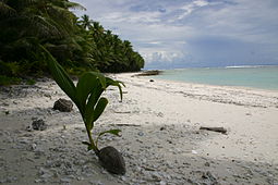 Swains Island Beach
The ownership of the island came into question after Eli Jr.'s death in 1920 and that of his wife in 1921. The United States decided to give the right of administration jointly to Eli's daughter Ann and son Alexander, while making it officially part of American Samoa by annexation on 4 March 1925. Alexander Jennings, the son of Eli Jennings, Jr., became managing owner of the island. The population at this time was around 100.
In 1953, labor troubles arose on Swains when Tokeluan-hired workers decided to claim "squatters' rights" to the atoll, by virtue of having lived on it year-round. After Alexander Jennings evicted 56 workers and their families from the island, the governor of American Samoa intervened. By executive order, the governor acknowledged Jennings' proprietary rights to Swains Island, while instituting a system of labor contracts and a local governmental structure to protect the rights of his employees.[3] The islanders were also guaranteed a representative in the territorial legislature.
Recent sovereignty and trade issues
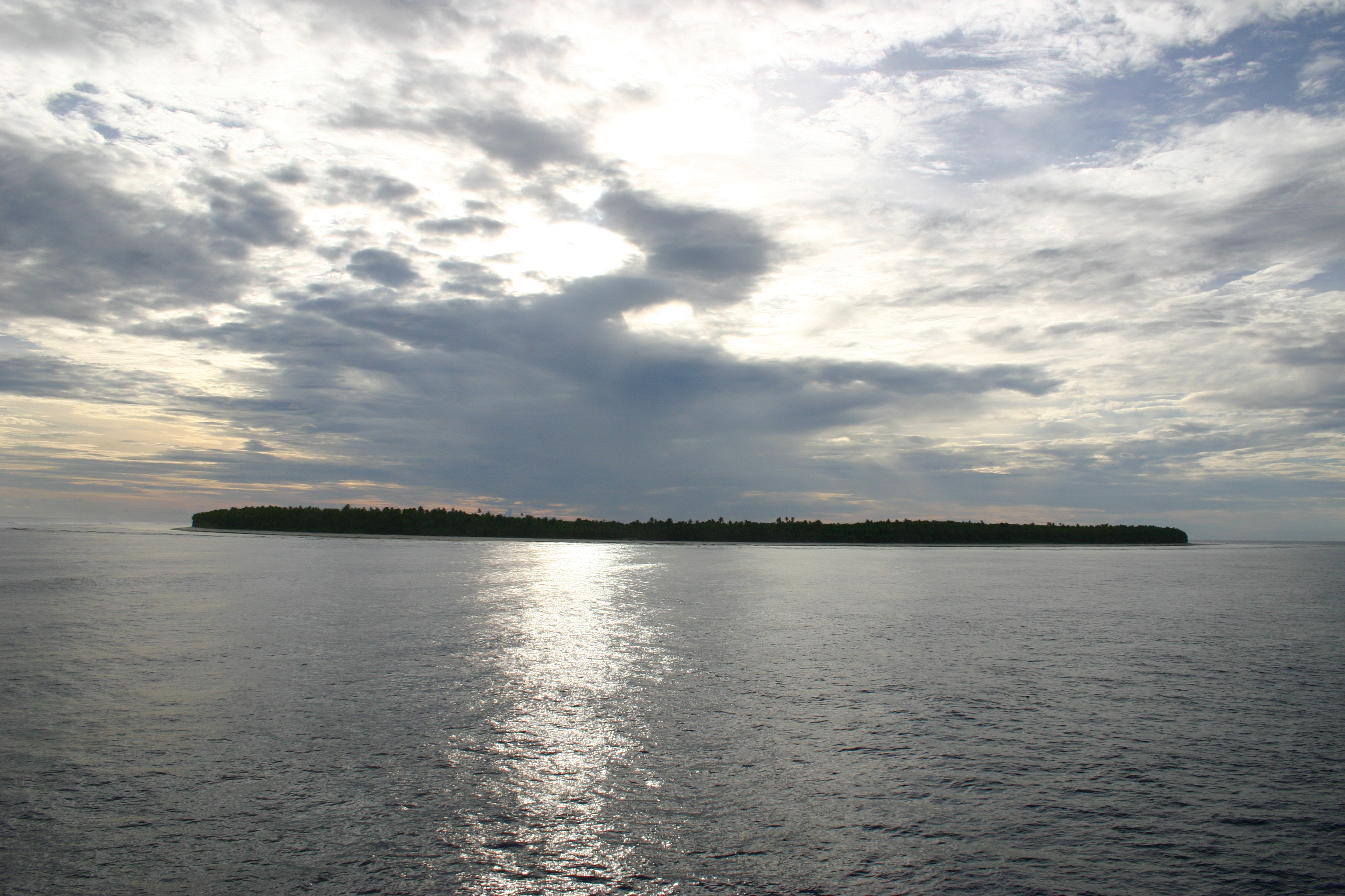
 Swains Island lies between the Samoan islands and Tokelau (upper center)
On 25 March 1981, New Zealand, of which Tokelau is a dependency, confirmed U.S. sovereignty over Swains Island in the Treaty of Tokehega, under which the United States surrendered its territorial claims to the other islands of Tokelau. In the draft constitution that was the subject of the Tokelau self-determination referendum, 2006, however, Swains Island is claimed as part of Tokelau.[10] As of March 2007, American Samoa has not yet taken an official position, but the Governor of American Samoa Togiola Tulafono has said he believes that his government should do everything it can to retain control of the island.[11]
In 2007 Tokelau's regional parliament, the General Fono, considered the adoption of a new flag for their nation which showed a map depicting Swains Island, as a fourth star in addition to three others, at a proportional distance to that of the others (see Flag of Tokelau#2007 proposal). Ultimately a compromise was adopted whereby the four stars were retained, but with the arrangement and proportionality suggestive of the Southern Cross.[citation needed]
During a recent visit to Tokelau, Alexander Jennings, representative of Swains Island to the American Samoa legislature, indicated a desire for better trade links between Swains and its neighbor.[12] The head of government of Tokelau, Kulesa Nasau, was reported[by whom?] to be "interested," and further talks were anticipated.
Cyclone Percy 2005
In February 2005, Cyclone Percy struck the island, causing widespread damage and virtually destroying the village of Taulaga, as well as the old Jennings estate at Etena. Only seven people were on the island at the time.[13] Coast Guard airdrops ensured that the islanders were not left without food, water and other necessities. A Coast Guard visit in March 2007 listed 12 to 15 inhabitants, and showed that the island's trees had largely survived Percy's wrath.[1]
Power and radio issues
Due to its remoteness, Swains Island is considered a separate amateur radio "entity" and several visits have been made by ham operators. The 2007 amateur radio "DXpedition", with the call sign N8S, made more than 117,000 contacts worldwide. This set a new world record for an expedition using generator power and tents for living accommodations. While three other expeditions have produced greater total numbers of contacts, they have all been headquartered in hotels and used commercial power sources.[14]
Island government
According to the Interior Department survey cited above, Swains Island is governed by the American Samoa "government representative", a village council, a pulenu'u (civic head of the village), and a leoleo (policeman). Swains' officials have the same rights, duties, and qualifications as in all of the other villages of American Samoa. Neither the proprietor of Swains Island nor any employee of his may serve as government representative.
The government representative has the following duties:
- to act as the Governor's representative on Swains Island
- to mediate between employees and their employer
- to enforce those laws of the United States and of American Samoa which apply on Swains Island
- to enforce village regulations
- to keep the Governor advised of the state of affairs on Swains Island, particularly on the islanders' health, education, safety, and welfare
- to ensure that the Swains Islanders continue to enjoy the rights, privileges and immunities accorded to them by the laws of the United States and of American Samoa
- to ensure that the proprietary rights of the owner are respected
The government representative has the following rights, powers and obligations:
- to make arrests
- to quell breaches of the peace
- to call meetings of the village council to consider special subjects
- to take such actions as may be reasonably necessary to implement and render effective his duties
Swains' village council consists of all men of sound mind over the age of twenty-four. According to the federal census in 1980, five men fell into this category.
Swains Island sends one non-voting delegate to the American Samoan territorial legislature. In March 2007, this office was held by Alexander Jennings.
The Jennings dynasty
Styling themselves "leaders", or "proprietors", members of the Jennings family ruled Swains Island virtually independent of any outside authority from 1856 to 1925. After 1925, while retaining proprietory ownership of the island, they were subject to the jurisdiction of the U.S. territory of American Samoa.
Jennings who ruled as semi-independent "proprietors":
- 13 October 1856 - 4 December 1878: Eli Hutchinson Jennings, Sr. (1814 - 1878)
- 4 December 1878 - 25 October 1891: Malia Jennings, his Samoan widow (d. 1891)
- 25 October 1891 - 24 October 1920: Eli Hutchinson Jennings, Jr., (1863-1920) son of Eli, Sr. and Malia (1863-1920) Referred to by Robert Louis Stevenson as "King Jennings" during a visit to the island.
- 24 October 1920 - August 1921: Ann Eliza Jennings Carruthers (1897 - 1921) Jointly with sibling, Alexander Hutchinson Jennings; both children of Eli Jr.
- 24 October 1920: - 4 March 1925: Alexander Hutchinson Jennings
Jennings who ruled under direct American jurisdiction:
- 4 March 1925 - Unknown date in 1940s: Alexander Hutchinson Jennings
- Unknown Dates between 1940 - 1954: Alexander E. Jennings
- 1954 to Present: Local government instituted by American Samoa. However, the island is still owned by the Jennings extended family.
References
- ^ a b KUKUI
- ^ Doug Faunt's Journal
- ^ a b http://www.doi.gov/oia/Islandpages/swainsis.htm
- ^ a b A queen mother's last wishes - The Honolulu Advertiser - Hawaii's Newspaper
- ^ Story
- ^ http://www.uscg.mil/d14/units/kukui/Swains/jungle%20trail.JPG
- ^ a b [1]
- ^ A Brief History of Swains Island in American Samoa
- ^ a b Page 213 in Jimmy M. Skaggs (1994), The Great Guano Rush: Entrepreneurs and American Overseas Expansion. ISBN 978-0312103163.
- ^ "Tokelau calls for return of island". One News. 15 February 2006. http://tvnz.co.nz/view/page/411749/661086. Retrieved 15 November 2011.
- ^ "American Samoa governor ready to resist Tokelau’s claim to Swains Island". Radio New Zealand International. 26 March 2007. http://www.rnzi.com/pages/news.php?op=read&id=31024. Retrieved 15 November 2011.
- ^ American Samoas Swains Island seeks trade deal with Tokelau. | PAC - Pacific Islands Broadcasting Association (March , 2007)
- ^ APCEDI Asia-Pacific Disaster Alerts: APCEDI ALERT 10F #8, 2005: CYCLONE PERCY BATTERS SWAINS ISLAND; CAUSES WIDESPREAD DAMAGE TO TOKELAU
- ^ N8S Home Page
External links
- US Coast Guard Cutter KUKUI Website Contains several excellent photos of the island.
- ur0mc.com Website of Roman Tkachenko, ham radio operator from Ukraine. Includes more fine photos of Swains Island.
- US Dept. of Interior history and description of Swains Island Introduction to Swains Island geography and history.
- "Memorable events on Swains" 2005 Story from the Samoa News about a 1920s visit to Swains Island.
- "A queen mother's last wish" Article in the Honolulu Advertiser about the death of Eliza Jennings Thompson, "queen mother" of Swains Island.
- American Samoa, its districts and unorganized islands, United States Census Bureau
- Alert for Cyclone Percy Gives 2005 population.
- History of Swains Island
- WorldStatesmen- American Samoa
- Tokelau looks to independence
Polynesia Polynesian triangle Polynesian outliers Anuta · Emae · Futuna · Kapingamarangi · Loyalty Islands · Mele · Nuguria · Nukumanu · Nukuoro · Ontong Java · Ouvéa · Pileni · Rennell · Sikaiana · Takuu · TikopiaPolynesian-influenced  Territory of American Samoa
Topics Government - Politics
- Former Governors
- Former Lieutenant Governors
- Elections
- Current Governor
Districts Villages - Aasu
- Afao
- Afono
- Agugulu
- Alao
- Alega
- Alofau
- Amaluia
- 'Amanave
- Amaua
- Amouli
- Anua
- 'Aoa
- Aoloau
- Asili
- Atu'u
- Aua
- 'Au'asi
- Aumi
- Aunu'u
- Auto
- Avaio
- Faga'alu
- Faga'itua
- Fagali'i
- Fagamalo
- Faganeanea
- Fagasa
- Fagatogo
- Failolo
- Faleasao
- Faleniu
- Fatumafuti
- Futiga
- 'Ili'ili
- Lauli'i
- Leloaloa
- Leone
- Leusoali'i
- Luma
- Maia
- Malaeimi
- Malaeloa/Aitulagi
- Malaeloa/Ituau
- Maloata
- Mapusagafou
- Masausi
- Masefau
- Matu'u
- Mesepa
- Nu'uuli
- Nua
- Ofu
- Olosega
- Onenoa
- Pagai
- Pago Pago
- Pava'ia'i
- Poloa
- Sa'ilele
- Se'etaga
- Si'ufaga
- Sili
- Taulaga
- Tafuna
- Taputimu
- Tula
- Utulei
- Utumea East
- Utumea West
- Vailoatai
- Vaitogi
- Vatia
Islands - Tutuila
- Aunu'u
- Ta'ū
- Ofu‑Olosega
- Rose Atoll
- Swains Island
Categories:- Islands of American Samoa
- Disputed islands
- Disputed islands of Oceania
- International territorial disputes of the United States
- Atolls of the Pacific Ocean
- Territorial disputes of New Zealand


Wikimedia Foundation. 2010.