- Magnet, Nebraska
-
Magnet, Nebraska — Village — Downtown Magnet: Main Street, looking east Location of Magnet, Nebraska
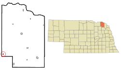
Coordinates: 42°27′19″N 97°28′15″W / 42.45528°N 97.47083°WCoordinates: 42°27′19″N 97°28′15″W / 42.45528°N 97.47083°W Country United States State Nebraska County Cedar Area – Total 0.1 sq mi (0.4 km2) – Land 0.1 sq mi (0.4 km2) – Water 0.0 sq mi (0.0 km2) Elevation 1,827 ft (557 m) Population (2000) – Total 79 – Density 547.7/sq mi (211.5/km2) Time zone Central (CST) (UTC-6) – Summer (DST) CDT (UTC-5) ZIP code 68749 Area code(s) 402 FIPS code 31-30310[1] GNIS feature ID 0831001[2] Magnet is a village in Cedar County, Nebraska, United States. The population was 79 at the 2000 census.
Contents
Geography
Magnet is located at 42°27′19″N 97°28′15″W / 42.45528°N 97.47083°W (42.455401, -97.470798)[3].
According to the United States Census Bureau, the village has a total area of 0.1 square miles (0.26 km2), all of it land.
Demographics
As of the census[1] of 2000, there were 79 people, 37 households, and 20 families residing in the village. The population density was 547.7 people per square mile (217.9/km²). There were 39 housing units at an average density of 270.4 per square mile (107.6/km²). The racial makeup of the village was 94.94% White, 3.80% Native American, and 1.27% from two or more races.
There were 37 households out of which 13.5% had children under the age of 18 living with them, 43.2% were married couples living together, 5.4% had a female householder with no husband present, and 45.9% were non-families. 35.1% households were made up of individuals and 16.2% had someone living alone who was 65 years of age or older. The average household size was 2.14 and the average family size was 2.80.
In the village the population was spread out with 16.5% under the age of 18, 7.6% from 18 to 24, 34.2% from 25 to 44, 21.5% from 45 to 64, and 20.3% who were 65 years of age or older. The median age was 39 years. For every 100 females there were 113.5 males. For every 100 females age 18 and over, there were 127.6 males.
The median income for a household in the village was $36,250, and the median income for a family was $36,250. Males had a median income of $24,000 versus $21,667 for females. The per capita income for the village was $15,357. There were no families and 1.3% of the population living below the poverty line, including no under eighteens and 10.0% of those over 64.
History
July 1993 Magnet celebrated its 100th birthday. Magnet was one of the busiest little towns that sprang up along the railroad to serve the needs of surroundings farms and ranches. Magnet was named by B. E. Smith, who platted the town, to attract more settlers to the region.
Town motto and disasters
Magnet's motto: "Magnet: The town too tough to die!" came from a variety of disasters that have struck the town over the course of its history. In February 1925 a fire burned one block of Main Street. The first tornado of two to strike Magnet happened on June 18, 1937. It tore through the town, destroying many businesses and homes. Thousands of people came to survey the damage on the Sunday following the storm. Over the summer of 1937 the town was cleaned up and through the help of neighboring towns, buildings and farms were restored.
The second tornado struck Magnet on May 6, 1975 at 2:45pm. The devastating tornado ripped through the town, destroying 2 homes and many more were heavily damaged. The Carhart Lumber truck from Randolph soon came into town with a load of plywood sheets. These were used to cover broken windows and damaged roofs so in case it rained it wouldn’t damage anything else. There were no lights and water in the town, so the fire department from the neighboring town of Wausa brought in emergency generator units. Men from the power company worked all night to get lights back into the main part of town. They worked for over a week to replace broken poles and wires. Drinking water was brought in milk creamer cans. People from all over the neighboring towns came during the summer to help with the clean-up.
Railroad
The Chicago, St. Paul, Minneapolis, and Omaha Railroad went from Randolph to Magnet, then on to Bloomfield. Travelers who came to Magnet in 1894 had only a platform and an old box car to unload on when they arrived. During 1905-06, everything came by mail, groceries, farm goods, etc. In 1948-49 there was a very bad winter, at that time there was no train for 6 weeks. In the 1950s the train only came through 3 times a week. The tracks were eventually torn up in 1965.
Jail House
The jailhouse was built around 1902. Bars on the windows were set to keep the prisoners in. Before it was moved it was an old voting booth. In the 1960s the building was moved and added on to serve as the county shed. It was one of the buildings that was destroyed by the tornado in 1975.
References
- ^ a b "American FactFinder". United States Census Bureau. http://factfinder.census.gov. Retrieved 2008-01-31.
- ^ "US Board on Geographic Names". United States Geological Survey. 2007-10-25. http://geonames.usgs.gov. Retrieved 2008-01-31.
- ^ "US Gazetteer files: 2010, 2000, and 1990". United States Census Bureau. 2011-02-12. http://www.census.gov/geo/www/gazetteer/gazette.html. Retrieved 2011-04-23.
Municipalities and communities of Cedar County, Nebraska Cities Hartington | Laurel | Randolph

Villages Categories:- Populated places in Cedar County, Nebraska
- Villages in Nebraska


Wikimedia Foundation. 2010.